Gallery

The Julian Gallagher Collection.

These remarkable photographs, recording Ossett today and yesterday, are by Julian Gallagher. They tell powerfully of what the  Ossett Fallen left behind when they went to war and they remind us of our today  thanks to their sacrifice.

Dale Street 

A Dewsbury to Ossett pre war tram traverses Dale Street on its way to Ossett Market Place.

Market Place Tram

A pre war tram moves along Bank Street towards Queen Street post 1906

Wesley Street

Looking towards Ossett with the New Wesleyan Chapel on the left and a newer Ossett on the right.

Market Place with David Dewhurst Nettleton

David Dewhirst Nettleton, Corn Merchant,  outside his shop with his daughter  on his delivery cart.

Palladium

Ossett’s only ever cinema built in 1913 saw two world wars. It closed in 1961

The Green

Ossett Green from near today’s zebra crossing. The compilation shows the railway bridge in the background and on the right, centre stage, the Ossett Green Congregational Church (built 1883) and, on its right, the earlier church (built 1864) of the same name latterly used as school rooms. Both were demolished.

Old Ossett Photographs

Back Lane.

Former entrance from Wesley Street.

Photograph courtesy of Richard Spurr

Back Lane.

Looking towards Wesley Street.

Photograph courtesy of Richard Spurr

Bank Street old cottages.

Photograph courtesy of Richard Spurr

First Baptist Church.

South Ossett built 1868.

Photograph courtesy of Richard Spurr

Holy Trinity Church

Floodlit view May 1936.

Photograph courtesy of Richard Spurr

Ossett Congregational Church

The Green built 1883 with former church (built 1864) just beyond. Final service 1973 and demolished.

Photograph courtesy of Richard Spurr

Primitive Methodist Church

Queen Street built 1863. Now apartments.

Photograph courtesy of Richard Spurr

Church stone laying at King’s Way Methodist

Wesley Street.

Photograph courtesy of Richard Spurr

New Wesleyan Chapel

Wesley Street built 1867  demolished 1971.

Photograph courtesy of Richard Spurr

Flushdyke

The railway bridge before demolition

Photograph courtesy of Richard Spurr

Flushdyke

Demolition of the railway bridge.

Photograph courtesy of Richard Spurr

Goring Park Avenue

Off Teall Street, South Ossett  aka Little Harrogate. 

Photograph courtesy of Richard Spurr

Queens Drive

Opened 1926. Prefab dwellings post WWII.

Photograph courtesy of Richard Spurr

Railway level crossing

Broadowler.

Photograph courtesy of Richard Spurr

Ossett’s replacement Station

Built 1889 – Demolished 1967.

Photograph courtesy of Richard Spurr

Queue for tickets in 1964


Photograph courtesy of Richard Spurr

Town Hall Coronation Celebrations

For the 12th  May 1937 coronation of George VI following the abdication of his brother Edward VIII on 11th December 1936.

Photograph courtesy of Richard Spurr

Town Hall crowds

Thought to be 12,000, for the opening of the Town Hall in 1908.

Photograph courtesy of Richard Spurr

THE FIRST OSSETT TRAM

Ossett Market Place on 15th August 1904 showing the first tram from Wakefield to Ossett rumbling along the recently built Station Road after its 3 ½ mile journey. The Yorkshire (West Riding) Electric Tramways Co. operated the routes from Ossett to and from Wakefield. It was joined later by a formal opening on 11th November 1908, by the Dewsbury & Ossett Tramways company which ran to Dewsbury on a 2 ½ mile journey via Church Street and the “car shed” aka the tram depot.

The final tram to leave Ossett to Agbrigg, Wakefield was on 24th July 1932 and the Ossett – Dewsbury link had its final day  a little later on Sunday 19th October 1933.

Isolation Hospital

Despite objections from local residents who feared that nearby properties would be devalued a new Hospital was built in 1895 to replace an earlier structure built in 1882.  The Hospital, designed by Ossett architect William Arthur Kendall, stood on two acres of land and  had space for twenty beds. The first case of smallpox to be treated at the isolation hospital was admitted in July 1896. The building still exists, converted into dwellings with enviable views across the Calder valley to the lower Pennines.

Shaw Peace Printing Works

The Treaty of Paris, signed on 30 May 1814, ended the war between Napoleonic France and a coalition of six countries including the United Kingdom. The inscription above the main entrance reads “Church of England Sunday School. In Commemoration of Peace. A.D. 1814” .Following Napoleon’s escape from Elba it was an uneasy peace ended only by the Battle of Waterloo in 1815. The inscription is now set on the Ventnor Way (formerly Back Lane) wall of the Kings Way Methodist and URC Church, Wesley Street.

Built in 1814 at the end of the Old Church Street the Anglican Sunday and day school founded by Reverend Kilvington served central Ossett until the opening of Holy Trinity school in 1875. It was subsequently occupied as the Shaw Peace printing works before the building was demolished.

Station Road

Station Road was the Ossett place to be in the late 19th and early 20th century. Not surprisingly its name gives the clue. It was, of course, the road to the station but it was also a road about which deals could be done. These were deals between local councillors, railway directors and Ossett businessmen like Joseph Brook, Charles Wheatley and Thomas Burton eager to join in the development opportunities offered by the coming of a new railway station and a new road, a direct thoroughfare, joining central and part of south Ossett.

Station Road owed its existence to an arrangement between the Ossett Local Board and the Great Northern Railway (GNR) Company. In late 1884 the Board convinced GNR that Ossett Town should have a new railway station in place of the 1865 station which was deemed to be past its best. In 1885 Mr. Oliver Nettleton had suggested the necessity for a new road to the chief engineer of GNR who agreed to build a new station but only on the understanding that Ossett build a new road. The deal was done.

The entrance (to the new station) will be by an inclined plane leading direct on to the platform from a street, the latter to be carried over the end of the station by a bridge 270 feet long and 30 feet wide. The local Board has agreed to make the street – one extremity of which will be in the Market-place, and the other at Park-square with a total length of about 1050 yards – furnishing a direct approach to the station not only from the centre of the town but from the South Ossett and Horbury side. The scheme renders other useful improvements possible, and the carrying out of it may be regarded as an event of permanent importance in the history of the town.

It had been proposed to extend the road beyond Park Square along Sowood Lane and to the Horbury boundary but this was not to be.

Seven years later the Ossett Observer  reported ‘Good stone buildings have arisen along both sides (of Station Road) , and such is the impetus given to the adoption of a more ornamental style of architecture in the erection of new business premises that the appearance of the centre of the borough is altogether changed for the better…..’

Construction began in 1887 and was completed by 1889; the new station was partially opened in mid July of the same year. As it happens the road also provided for the introduction in 1904 of the Ossett – Wakefield tram route via Horbury.

The development potential was huge as witnessed on Station Road even today by the survival of the many late Victorian dwellings, commercial and business premises built between the mid 1880’s and late 1890’s. Many of these fine buildings were designed by Ossett Architect William Arthur Kendall.

The first photograph in this section is looking along Station Road towards the Market Place Ivy House is on left and was owned in 1890 by Thomas Brook. On the right is the Digges La Touche Surgery and General Practice. A tram traverses the south side of Station Road indicating that the photograph must have been taken no earlier than 1904.

The second photograph looks towards the Market Place and shows Cussons’ Post Office & Chemist’s Shop (1894) on the left with the Liberal Club (1893) and the Mechanics Institute (1890) on the right. All were designed by W.A. Kendall.

The third photograph looking in the same direction is 1904 or later and shows The Borough Works (1890) on the left with a Wakefield-Ossett tram close to the Liberal Club at the junction of Prospect Road and Station Road.

Springstone House

A grade II listed house probably dating from about 1830 when it was occupied by solicitor John Sanderson Archer. From about 1854 Ossett surgeon William Wood Wiseman and his family lived here until his death in 1885 when it passed to his son, John Greaves Wiseman also a surgeon. Sold in 1904 to contractor Francis H. W. Denholm who extended the building. In more recent time the house has been used for business purposes and it is currently occupied by Carclo PLC.

South Ossett Church

South Ossett Christ Church consecrated in October 1851 was originally designed to be capable of accommodating 608 persons. More than 400 of the sittings in the church were deemed as “free forever for the use of the poor” at the time when the more well-off parishioners paid for the best seats in the church.The church design is a cruciform shape in the Gothic style of the 13th century. Christ Church is considered one of the most beautiful country churches in the neighbourhood.

The two acre site was donated by Joseph Thornes of Green House, Ossett Green, for a church, a churchyard and a vicarage.  The land comprised a rough field with a small straw thatched cottage occupied by the elderly Martha Giggall whose fireplace stood where the church pulpit stands today. Martha was offered a healthy sum and moved elsewhere.

The Gables, Station Road

Built in 1897 this grand late Victorian terrace of six dwellings (but probably initially designed to be a terrace of five) stands on the east side of Station Road on land purchased in 1896 by Ossett architect William Arthur Kendall (1857-1937). Mr. Kendall, who sadly lost his wife in1898, designed and owned the terrace, whose postal addresses were 115-125 Station Road; he lived in number 115 which is closest to Ossett.

The sixth house, number 115, his home for almost forty years, appears originally to have been built or intended as a detached house. The footprint of the terrace on the 1905 Ossett Ordnance Survey map records the sixth dwelling joined to the other five. This suggests that shortly after the design and build stage of the terrace, number 115 was joined to its neighbour at 117. Evidence of this is that numbers 115 and 117 had an original external “front door” facing one another; these doorways cannot now be seen externally because the extension built between the houses utilises the doorways internally. 

In September 2021 an Ossett Heritage Blue Plaque was mounted on number 115, bearing the names of  William Arthur Kendall and his nephew and ward, Charles Kendall (formerly Hanson) a  Lieutenant awarded the Military Cross for gallantry in The Great War. Charles Kendall was also an architect and co-designed the Ossett War Memorial, now in the Market Place. You can see more about the Blue Plaque at this link https://ossettheritage.co.uk/local-history/plaques/blue-plaques/

The first photograph looks towards Horbury; the Gables is on the left in the near distance. Tram lines can be seen on Station Road indicting that the photograph must have been taken in 1904 or later.

The second photograph looking towards Ossett shows The Gables in closer relief. The five dwelling terrace can be seen more clearly as can the sixth house, William A. Kendall’s home. In this photograph it appears to stand proud and be of a slightly different construct to the “true” terrace.

The Goit-Healey

A black and white postcard of The Goit, Healey, Ossett. The mill stream of Healey Old Mills, whose waterwheel was first built in 1787, continued to provide power into the mid twentieth century. The Goit took water from the Calder. The waterwheel had its opening widened in 1791, to provide greater power. Postcard and description courtesy of WMDC Libraries and Information Services

Ossett Town Hall

The Grade II listed Town Hall is one of Ossett’s most iconic buildings. Built in 1908, the Town Hall served as a civic centre, magistrates court and offices for Ossett Borough Council until 1974 when Ossett became part of Wakefield Metropolitan District Council. The public hall has served as a concert hall, dance hall, venue for school speech days and indoor market area.

Following much consideration and debate the Borough Council decided that Ossett’s Town Hall should be built in the Market Place, despite strong local opposition to the idea. In 1904 a suitable site, the old Ossett Grammar  School, was acquired as they found a new home called Park House, off Storrs Hill. The architects for the new Town Hall was Batley architects Walter Hanstock and Sons who won the contract to design the new building.

On the 27th February 1906, in a heavy snowstorm, Ossett’s mayor Alderman John Hampshire Nettleton laid the foundation stone for the new Town Hall.

The Public Hall was actually finished first and opened earlier than the rest of the Town Hall in November 1907 for a choral concert. An external door facing Dale Street has a 1907 date marker on the lintel.

Photograph 1 from Bank Street with the old Grammar School in the background.

Photograph 2  The Town Hall in 1908 decked out with buntings, flags and other decorations in readiness for the opening ceremony with over 12,000 local people gathered in the Market Place for the grand opening of the new Town Hall.

Photograph 3 On Tuesday 2nd June 1908 the new Town Hall was officially opened by the Mayor Councillor J.T. Marsden. The celebrations were lengthy and lasted late into the evening, in spite of heavy rain.

Runtlings Lane

Picture c. 1935. Runtlings Lane was part of an ancient main pack horse route which ran across the Calder River from Thornhill and beyond the Pennines to the west and via Back Lane through Ossett and on to Gawthorpe and  Woodkirk on the way to Leeds Cloth Market to the east. Runtlings, Runtynge or other derivations can be tracked back to the 16th century where it was a descriptive term meaning a place of an old tree and a meadow.

In more recent times it was home to WWI Conscientious Objector Joshua Fox Taylor and,  close by, the home of  Ossett Fallen, Gerald Townend who lost his life in the same conflict. His sister, Ida, was a nurse and both were children of one time Ossett Mayor, Walter Townend (1900-1902)

Red Lion Pub

Situated on Dewsbury Road (Streeside) this is an old inn with a Ghost, – of a traveller or a highwayman who hung himself in one of the bedrooms, who is said to appear from time to time.That aside the Inn located was located on the Wakefield to Halifax Turnpike Road passing through nearby Dewsbury with its markets. The earliest owner and licensee  of the Red Lion was recorded in 1821 as Joseph Shepherd, no doubt a member of the family who occupied Shepherds Hill at the Wakefield end of Flushdyke.

Ossett Palladium

In Ossett Market Place , a site was obtained by the Newton Picture Palace Company and Ossett’s first and only cinema was built; the 846 seat Palladium Cinema opened its doors on December 22nd 1913.The first film to be shown was the 1911, 18 minute long, silent movie “Greater Love Hath No Man”. Prices of admission were 2d, 4d and 6d.

With regret, The Palladium closed its doors on the 29th April 1961. The last film shown was “The Miracle”, made in 1959, and starring a youthful Roger Moore with Carroll Baker as the leading lady.

The Market Place Bank Street

Photograph 1 is taken from high in Ossett Town Hall and shows the  Market Place and Bank Street  in 1980 before the Ossett War Memorial was moved there in 2001. The town centre landscape as shown here follows the Town Centre Re-Development Plan proposed in the early 1970’s with some parts of the plan intended to break up the vastness of the Market Place. Not everyone liked the  1970’s concept just as some dislike the current design with its vastness. Others though welcome  the vastness because it provides the opportunity of local community activities which are attractive, popular   and the envy of many other towns.

Photograph 2 (Sketch) The Market. Eli Marsden Wilson’s etching, which captures the Wesley Street corner of the Market Place on a market day, was exhibited at the Royal Academy in 1905. To the left of the sketch is the Ossett branch of the London and Midland Banking Company, opened in 1892 , while in the centre is Nettleton and Mitchell’s grocery and stationary shop. Wilson, who trained at Wakefield  College of Art and the Royal College of Art, was familiar with the scene as he came from an Ossett family.

Photograph 3 On the 11th of November 2018, exactly 100 years after the Armistice was signed to signal the end of World War One, the names of the 402 Ossett men and women who gave their lives in WW1 and WW2 were unveiled on granite setts laid around the base of the Ossett War Memorial in the Market Place, Ossett.

The names of the Ossett Fallen from the two World Wars have never been available publicly and the Ossett War Memorial has never included the names of these brave men and women. Thanks to a grant from Wakefield Metropolitan District Council and the work of a small project team led by Alan Howe, the names are now available to be remembered by Ossett people when the engraved granite setts were unveiled on the 11th of the 11th 2018.

View of Ossett from Flushdyke

The picture was taken from the lane leading to Ossett from Flushdyke, across the fields. The largest chimney in the foreground is Denton’s or Ings Mill and the building nearest was, until recently, Victoria Bathrooms. The other chimneys are thought to be those of Ward’s Bottomfield Mill and Scratchard’s Mill, off Wakefield Road, opposite Springstone Avenue.

The lane with the stone wall on the left was known as Blue Clay Lane and Holy Trinity Church stands in the left background.

Ings Mill located in Dale Street was built in the second half of the 19th century, probably around 1870 for the Ossett Mitchell family, later there were early 20th century structural alterations. In 1881, the failure of the woollen cloth making business, operated by Seth Mitchell, at Ings Mill was reported in the local press. In December 1881, the situation was made worse when fifty or sixty power loom weavers at Ings Mill went out on strike because of a reduction in their wages. However, a week later the dispute was settled when the weavers returned to work.

The mill was occupied in 1882 by J.J. Mitchell and in the same year, Mitchell & Co., Ings Mill, Ossett were fined for employing three women who worked through their dinner hour against the regulations laid down in the Factories Act. Ings Mill was extended in 1887 with new buildings and J.J. Mitchell also took over Healey Old Mills. Mitchell & Co. were still in business in 1901 and were listed as woollen cloth manufacturers.

Bank Street

Picture 1 Bank Street in the mid/late 1920’s .

Picture 2 Bank Street in the early 1900’s with the old Grammar School in the background before it was demolished in  1903 in readiness for the Town Hall to be built in 1908; Providence Mill can be seen gushing smoke on the right.

Picture 3 Bank Street pictured during or just after the 1914-1918 Great War; the Town Hall stands proudly in the background.

Picture 4 Bank Street believed to be in the late 1950’s/ early 1960’s looking towards the Town Hall built in 1908, having survived two world wars.

Ossett Bus

An Ossett bound  red bus in Dewsbury Bus Station in the 1950’s 1960’s with its almost full load of passengers refreshed from a visit to the Bon Bon cafe.

The Green

A photograph taken at the junction of The Green and Healey Road, latterly Healey Lane. A railway bridge stands  in the background with the Ossett Green Congregational Church in prime position at the junction with Southdale Road. The Congregationalists built their first chapel on The Green in the 1730’s and this photograph captures the third of their churches built in 1883. The last service was held on Easter Sunday 1973 and the building was later demolished. Sowood House Surgery stands out of picture on the right.

Old Ossett Grammar School

The charity or free school was founded in 1737 and stood where Dale Street joined the Market Place. It was rebuilt in 1834 and contained a schoolroom and adjoining master’s house. By 1881 when Stephen Kendall, headmaster for almost twenty years, left, a new head teacher Michael Frankland became master. By this time it was known as The Grammar School. It was demolished in 1903 to make way for the Town Hall and the school found a new home at park House, Storrs Hill where it still survives today (2021)

Old Ossett Church Market Place

On June 13th 1409 the Chapel of the Holy Trinity in Ossett in the Parish of Dewsbury was granted episcopal licence. Little is known of this early chapel except that in 1729 there were plans to add a gallery and that it was situated at the end of Old Church Street in Ossett Market Place close to where the Town Hall was built in 1908.

In 1799, Edward Kilvington became Perpetual Curate of Ossett Chapel and in July 1805 he was granted licence to enlarge it. By October 1805 there had been a change of mind and a contract was let “to demolish the old Chapel or Church at Ossett as far as the onset (foundations) near the ground”. Reverend Kilvington’s new church, pictured here, was built upon those foundations and opened in early January 1807. By this time Ossett’s population had almost doubled from its level in 1807 when Kilvington built his new, relatively small, church in the town centre.

In June 1866 authority was granted for the old chapel to be demolished and the materials were to be sold in 34 lots. The site was cleared in the late 1860s adding to the open space in the town centre.

On July 14th 1865, the new church, Holy Trinity on Church Street (latterly Field Lane) was consecrated by the Bishop of Ripon, in whose diocese Ossett then lay.

An Ossett Funeral

The vehicle in the centre of the picture is the Ossett quarantine ambulance, which was used for transporting people with infectious diseases like smallpox to the Isolation Hospital. On this occasion Ossett  gathers in the rain to pay its respects to a member of the community who has been a victim of such a disease.

Flushdyke Station

The Bradford, Wakefield and Leeds Railway Company opened a branch line from Wrenthorpe to Flushdyke in 1862. It crossed Ossett Streetside by a bridge, now demolished, before reaching Flushdyke Station, close by two mills, Brook’s Mill and Whitley Spring Mill. The Flushdyke Station was located on and to the left of the bridge and access to the station platforms was by a long flight of stairs from the other side. The Flushdyke Station was closed in 1941.

Church Street & Dale Street

Picture 1. Aerial view of Ossett Holy Trinity Church and Church Street, latterly Field Lane.  In November 1861 a new burial ground for Ossett had been licenced and Joseph Wilson was the first burial in December. The Old Church in the Market Place location was too small and it was decided that a larger church would be built near the new burial ground. The Church was consecrated in mid July 1865and the Bishop of Ripon was later to call this church “that miniature cathedral”.

Picture 2 A picture, believed to be from about 1912, of an open-topped tram travelling up Dale Street towards the Town Hall. The tram was operating on the Dewsbury line which opened in 1908 and it will have travelled from Dewsbury or from the “Car Sheds” (aka tram depot) on Church Street before turning right on to Dale Street on its way to Ossett Market Place.

Picture 3 Post card showing the recreation ground in Church Street in the mid 1950’s; much of the site is now an Ossett Trinity  rugby pitch

Pickard Fountain

The Pickard Memorial Fountain is pictured in c. 1905 backed by buildings which are still there today (2021). With water troughs for horses and dogs, it was provided in 1893 by Miss Hannah Pickard, a member of an Ossett textile family who lived at Green Mount, a Victorian house at the junction of The Green and Southdale Road. After years of neglect the Memorial Fountain was moved to Green Park in the 1950’s but sadly it received no less neglect there and has been lost to the Ossett community.

 Miss Pickard, a great benefactor, left bequests for very many good causes, including scholarships at Ossett Grammar School and  £500 for the Borough Council to secure the design, build and erection of the Pickard Memorial Fountain. The designer of the Fountain was Ossett architect William Arthur Kendall.

WEST WELLS FARM

West Wells Farm, which was in Bank Street. An etching by Eli Marsden Wilson, dated about 1920. Through the gap in the buildings can be seen the ancient barn, which is now a taxi and take-away firm, and, behind,  the chimneys of the late 15th century, timber framed hall known as Ashfield House.

80’s Ossett from Above

Ossett Town Hall early 1980’s

The Vicarage, Dale Street  early 1980’s

The United Methodist Chapel built 1857 now apartments.  Dale Street junction with Church Street & Prospect Road early 1980’s

The Commercial Public House (now apartments). Dale Street /Wakefield Road Flushdyke junction early 1980’s

Ossett Bus Station early 1980’s

Elder House, Roundwood, Teall Street early 1980’s now demolished & private dwellings

Queens Drive (opened 1926) & Teall Court (early 1970’s). Haggs Hill mid 18th Century Cottages.

Sowood Farm built/rebuilt 1689

St. Ignatius Church, School & Parish Centre Storrs Hill

Ossett Sketches

SKETCHES FROM COCKBURN’S OSSETT ALMANACS OF THE 1880’s AND 1890’s

Published by Ossett and District Historical Society, 1987

Frank C.J. Cockburn, who made most of these drawings of Ossett scenes and buildings during the last two decades of the 19th Century, was a son of the first Stephen Cockburn who purchased the Ossett Observer from Beckett Brothers in 1873. They first appeared reproduced as woodcuts, in the “Ossett Almanacs” published annually by Cockburn’s until the early 1900’s. A number of drawings of churches, including Ossett, South Ossett and Thornhill, were used for years afterwards on the title pages of church magazines, which Cockburn’s printed. Frank Cockburn emigrated early this century to New Zealand where he became principal of the Art College in Nelson, New Zealand, where descendants still live. His eldest brother Stephen was second editor-proprietor of the Observer and was succeeded on his death in 1903 by the late Mr. S.E. Cockburn, the last owner of the Observer before it was acquired in 1956 by the “Wakefield Express” series. Another brother, Herbert, emigrated to Ontario, Canada, where he started a local weekly paper. He was a bachelor and had no descendants.

By S.F. Armitage  – Ossett 1987

Charter Day 30 June 1890

Dewsbury’s plans to extend its borough boundaries into Ossett and Soothill prompted the Ossett Local Board to apply for the Privy Council for a charter of incorporation. The charter was granted on 30th June 1890 and on 16th August 1890 it arrived at Ossett Station and was carried into the town at the head of a procession. The town’s first mayor was Edward Clay, a rag and mungo merchant.

Westfield Colliery Runtlings

Westfield Colliery which stood alongside the Great Northern Railway, was owned by Joshua Wilby. After his death in 1881, the colliery was purchased by Henry Westwood and Company. A small concern, it employed 30 colliers (coal getters) in 1893.

Royds Mill built 1820’s destroyed by Fire September 1887

Royds Mill was destroyed by fire in September 1887.It was owned by George Hanson and Henry Wormald woollen rag and  mungo merchants, who let part of the premises to two firms of cloth manufacturers. The Mill was often spoken as “the cotton mill” as when it had been opened in the 1820’s, it had been used for cotton spinning and weaving. Hanson and Wormald rebuilt the mill with one storey sheds replacing the four story buildings.

Temperance Mill Church Street burned down 1889

Francis Lumb Fothergill’s Temperance Mill was burned down in July 1889. Most of the mill had been let to mungo manufacturers, although the ground floor was occupied by J. Redgwick a rag machine maker. The mill stood opposite Holy Trinity Church school. Redgwick built a new machine shop adjacent to Broadroyd House on the Fairfield Estate early in this century.

Northfield Mill Church street fire October 1888

Northfield Mill was gutted by fire in October 1888. Abraham Pollard, head of John Speight and sons, mungo manufacturers, had purchased the mill earlier in the year for £4650. It was quickly rebuilt and started work again in 1889. John Speight and Sons was one of the oldest Ossett firms in the mungo trade.

Calder at Healey

The Lancashire and Yorkshire Railway crossed the River Calder at Healey. The nearby Calder Vale Mills belonged to Fawcett Firth and Jessop, a firm of wool extractors. The appearance of this area changed with the modernisation and expansion of the marshalling yards at Healey.

Calder Valley from Storrs Hill & Isolation Hospital

With its fine view over the Calder Valley, Storrs Hill was a favourite spot for Sunday afternoon strolls. It was also the site of the town’s isolation hospital which was built in 1882 as a result of a smallpox epidemic.

Holy Trinity Church Church Street built 1862-1865

Holy Trinity was built between 1862 and 1865 to replace the church of 1807 which stood in the market place. The cost of the new building was £8000, a large part of which was donated by Joseph Ingham, a member of a local family who was British Consul at Palermo. W.H. Crossland was the architect.

Congregational Church The Green 1883-1973

The Congregationists built their chapel on The Green in the 1730’s. The third and finest Church on the site was opened in 1883. The architect was J.P. Pritchett of Darlington. The last service was held in this church on Easter Sunday 1973 and the building was later demolished.

Wesleyan Chapel Wesley Street opened 1868

The imposing Wesleyan Chapel which was opened in 1868 was the work of the architects Bulmer & Holtom of Wakefield and Dewsbury and built by Tolsons of Ossett. The old Chapel, to its left, dating from 1825 became a Sunday and day school. The original meeting house on this site was opened in 1781. The shop on the right was owned by Emily Hetherington who sold pint mugs of soup for the pupils’ dinner.

Co-operative Stores Dale Street built 1874

The central stores of the Ossett Industrial Co-operative Society were built in 1874 to the plans of J.Kirk and Sons* The Co-operative Society ws started by the people for the people, so buildings of character were erected to improve the appearance of the district. The red and white pole projecting on the right was the sign of a barber’s shop, where men went for a shave and hair cut.

*Beyond them an extension was opened ten years later. Commenting in 1901 on the influence of the Society Councillor Walter Townend , the Mayor of Ossett, claimed that ‘When the Society was first commenced , the people of Ossett knew comparatively little of frugality, but since then there had been a great transformation, and in most co-operators homes they would find furniture that would grace a gentleman’s dining room or drawing room.’

Temperance Hall Illingworth Street 1888 Design by W.A. Kendall

The Temperance Hall was opened in 1888. Designed by W.A. Kendall it was described in the Ossett Observer as ‘in the seventeenth century style modernised.’ At this period drunkenness was a problem. The Temperance Hall was erected to provide alternative entertainment. It had a billiard hall and films were shown prior to the opening of the Palladium picture house.

Wakefield And Barnsley Union Bank Bank Street opened 1870

The Wakefield architect W. Watson designed the new premises of the Wakefield and Barnsley Union Bank, which were opened in 1870. By the end of the century, the wooden shop at the side of the bank was occupied by Oliver (‘Olly’) Oakes, tripe dresser.

London & Midland Bank Market Place opened 1892

The London and Midland Bank opened a branch in Ossett in 1887 in temporary premises. Their new building was opened in 1892 and was described as a ‘bold and handsome design’ by the Ossett Observer.

Grammar School Market Place built 1737 demolished 1903

The charity school which was founded in 1737, stood where Dale Street entered the Market Place. When it was rebuilt in 1834 it contained a schoolroom and adjoining master’s house. By 1881, when Michael Frankland became master, it was known as the Grammar School. The building was demolished in 1903 to make way for the Town Hall and the school eventually found a new home at Park House Storrs Hill.

The Market Place with Pickard Memorial Fountain

The Pickard Memorial Fountain stood near the centre of the Market Place. The road to the left was Little Town End and the tall chimney belonged to Joseph and Thomas Brook’s Providence Mill. The large building to the right of the chimney is the Conservative Club. The shop named Riley is now the National Westminster Bank.

Pickard Memorial Fountain Market Place 1893 design W.A.Kendall

When Hannah Pickard, a member of an Ossett textile manufacturing family died in 1891  she left bequests totalling £34950. Ossett corporation received £500 to provide a drinking fountain and water trough for cattle and dogs. W. A. Kendall was selected to design the fountain which was completed in 1893.

Station Road from Market Place

Station Road was begun in 1887 to join the Market Place to Park Square. Seven years later the Ossett Observer  could report ‘Good stone buildings have arisen along both sides , and such is the impetus given to the adoption of a more ornamental style of architecture in the erection of new business premises that the appearance of the centre of the borough is altogether changed for the better…..’

Mechanics’ Institute And Technical School Station Road opened 1890

The Ossett architect W.A Kendall was responsible for the design of the new premises for the Mechanics’ Institute and Technical School which were opened in 1890. In September of that year the school had four science, two art and two textile staff. Their classes totalled 119 and were drawn not only from Ossett but also from surrounding towns and villages.

Ossett Station opened 1889

The Great Northern Railway opened its new station to the west of the old station’s site in 1889. Not all residents thought that it was an improvement. Eli Townend a member of the Local Board of health condemned it as ‘the most paltry thing that any railway company or engineer could have put up’

Post Office & Chemist’s Shop Station Road

The town’s sub-postmaster J.W.Cussons who was also a chemist, opened a new shop at the junction of Station and Prospect Roads in 1894. His architect was W.A Kendall. When Cussons left Ossett in 1900 to become a manufacturing chemist making Imperial Leather, he sold the building to the Yorkshire Penny Bank and the business to S.N Pickard.* Not until 1925 did the bank occupy the whole of the premises.

*At that time his staff of nine postmen were delivering 13,000 letters a year and collecting 11,500.

Liberal Club Station Road opened 1893

The Liberal Club was founded in 1874 and its new clubhouse was opened in 1893. Funds for the building were raised through Ossett Liberal Club Building Company Limited which had a capital of £1500 in £1 shares. W.A. Kendall of Ossett was the architect.

Flushdyke Station Wrenthorpe to Flushdyke opened 1862

The Bradford, Wakefield and Leeds Railway company opened a branch line from Wrenthorpe to Flushdyke in 1862. It crossed Ossett Streetside by a bridge before reaching Flushdyke station . Opposite the station were two mills, Brook’s Mill and Whitley Spring Mill.

The Old Station Ossett

The Bradford, Wakefield and Leeds Railway Company extended their line from Flushdyke through Ossett to Batley . Ossett station, designed by J. Frazer of Leeds was completed in 1865 * From the Market Place it was reached via new Street. Part of the building on the left continued in use until 5th September 1964 as the goods warehouse when the line was closed as a result of the Beeching Report

*Built of brick, it was described as a Gothic structure.

The Borough Works Station Road

Cockburn’s, printers and publishers of the Ossett Observer opened their new premises at the junction of Station Road and Prospect Road in 1891. Ossett had become a borough in the previous year and so it was natural to name the new building ‘The Borough Works’.

Station Road Bridge . Station Road work began 1887.

The Bradford, Wakefield and Leeds was absorbed by the Great Northern Railway Company. When the company decided to build a new station in Ossett, the Local Board agreed to construct an access road if the Great Northern provided the bridge. Work on the new street, Station Road, was started in 1887 and it was carried across the railway by an iron bridge 250 feet long.

Unfortunately, although the Local Board’s road was 36 feet wide the Great Northern’s bridge was only built to carry a road 30 feet wide.

Brammers Ossett & Flushdyke Sketches 

Sketches of Past Times Flushdyke & Ossett

Douglas Morton Brammer (1937-2017)

“You get to my age and you have all these memories about places that are long gone. People would ask what we were talking about and I’d look for photographs but there weren’t any. So I thought the only way to show people the Flushdyke and Ossett I remembered was to paint it. I tried to visualise certain buildings and places. Workhouse Yard was one place I felt ought to be recorded because of its antiquity and history. My father who was born at Spring Mill and who had lived in Workhouse Yard had no photographs, although he was an avid collector of images of the places that he had visited.

I sketched Workhouse Yard from memory and all the other extinct buildings followed. I know that I am not accurate in many things I’ve drawn but it is how I remember it”

Douglas Morton Brammer 2009


Foreword

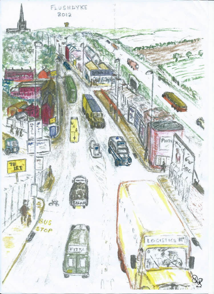
As is explained elsewhere, my brother drew these sketches primarily for his own purposes. He was a very sociable person but modest when it came to his own abilities. The sketches of Flushdyke and later of Ossett were drawn over many years whenever something triggered a memory and he wanted to recreate the moment visually as well as in his mind.

Having shared many of these experiences with him over our early lives, I was very interested and asked him for copies of his work for myself. I put these away and did not share them until about ten years later when I showed them to one of my sons and his wife. Their reactions gave me the confidence to then show them to Alan Howe with whom I had recently become acquainted through our interest in local history. He put a wider value on the images as someone who knew from maps and a few photographs what had once existed but was now long-gone.

The rest is history, as they say, and a lot of hard work by Alan is bringing them to a wider audience and hopefully, giving them a longer life than they might have had. My last comment is prompted by the knowledge that our father had several sketch books of his own which we looked at as children but which disappeared many years ago. Therefore I offer my sincere thanks to Alan, another very modest man, for giving my brother’s work a life.

Margaret Wilby July 2017

Introduction

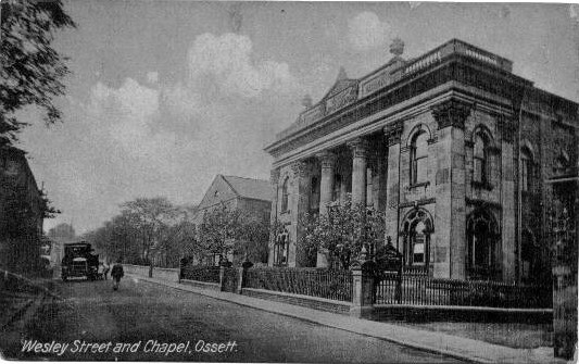
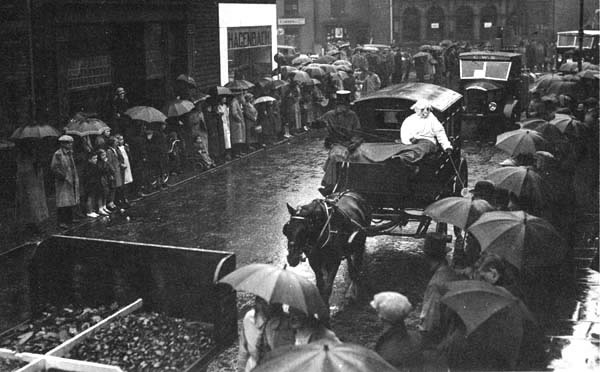
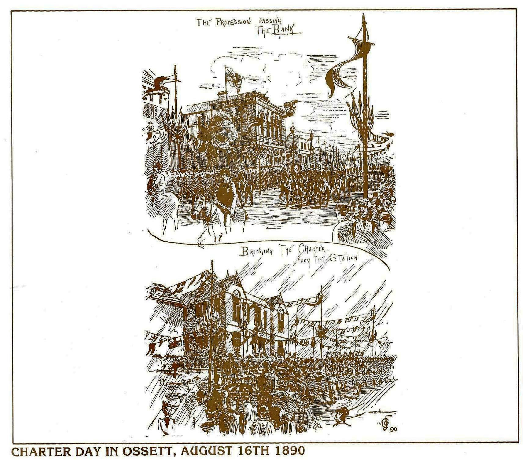
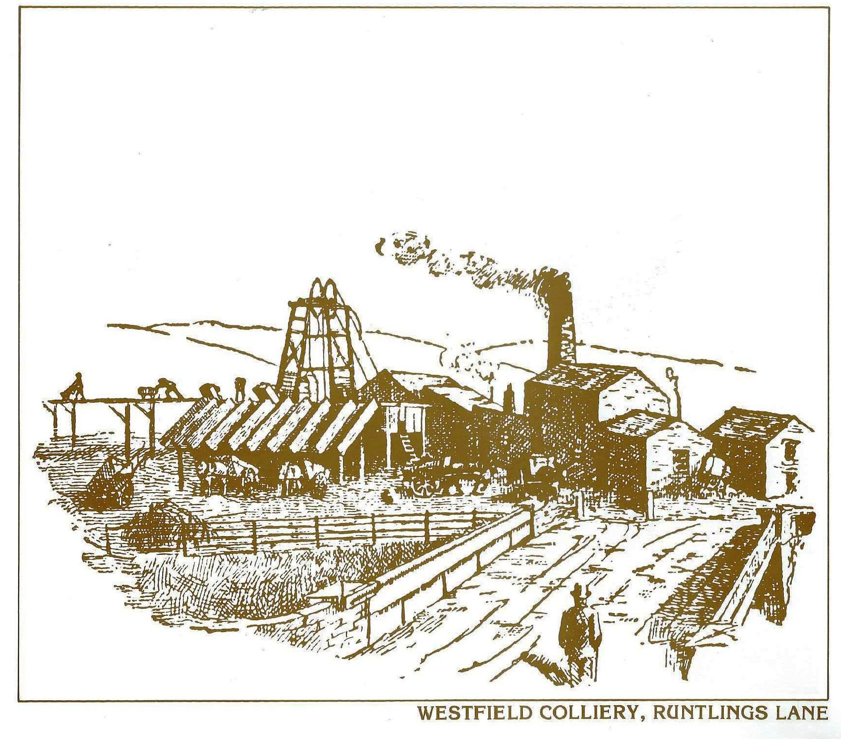
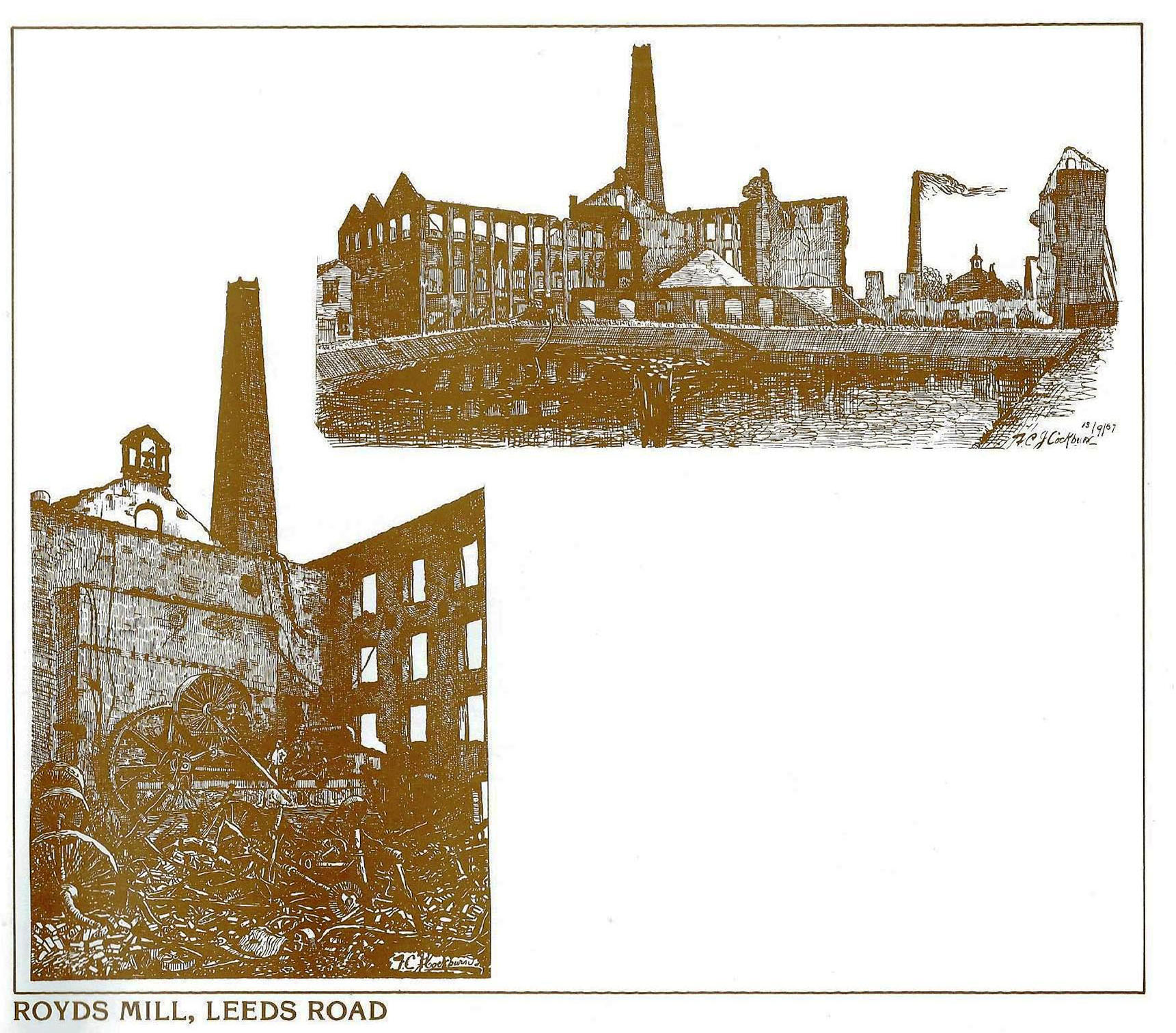
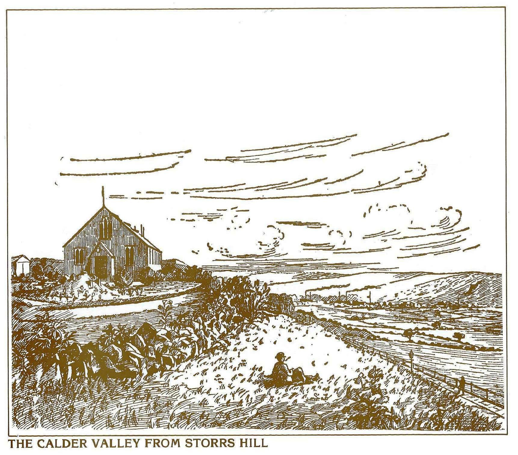
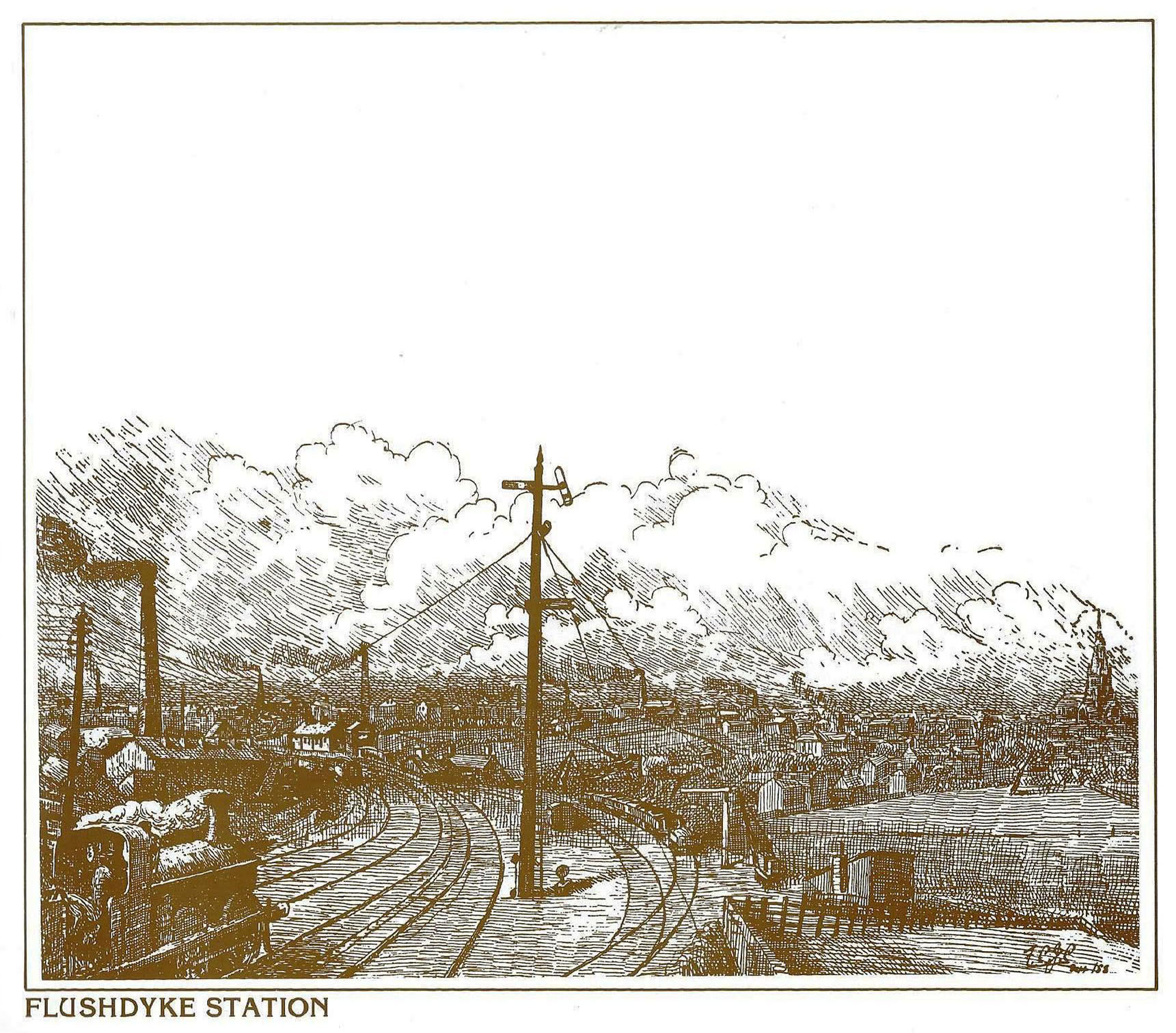
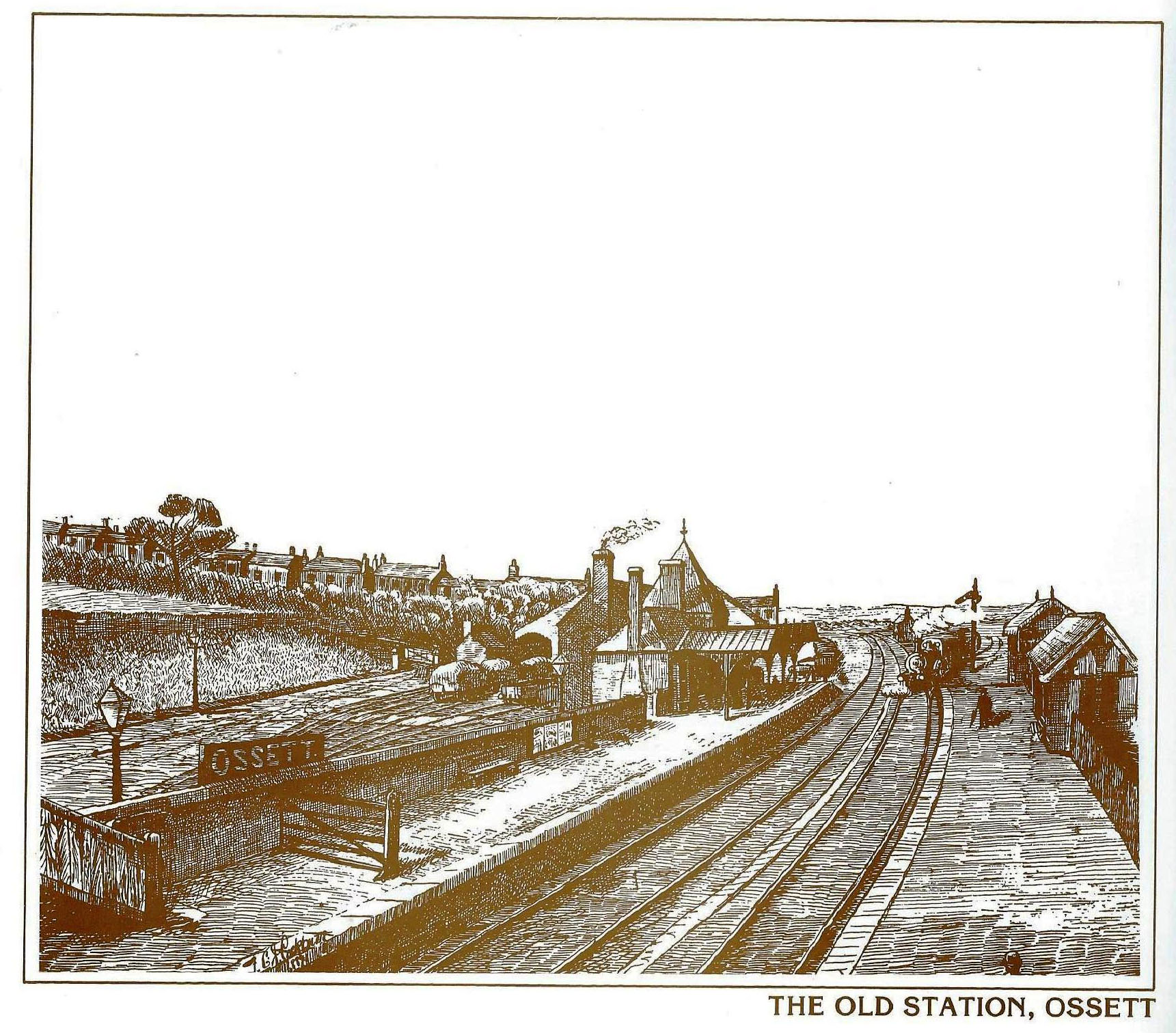
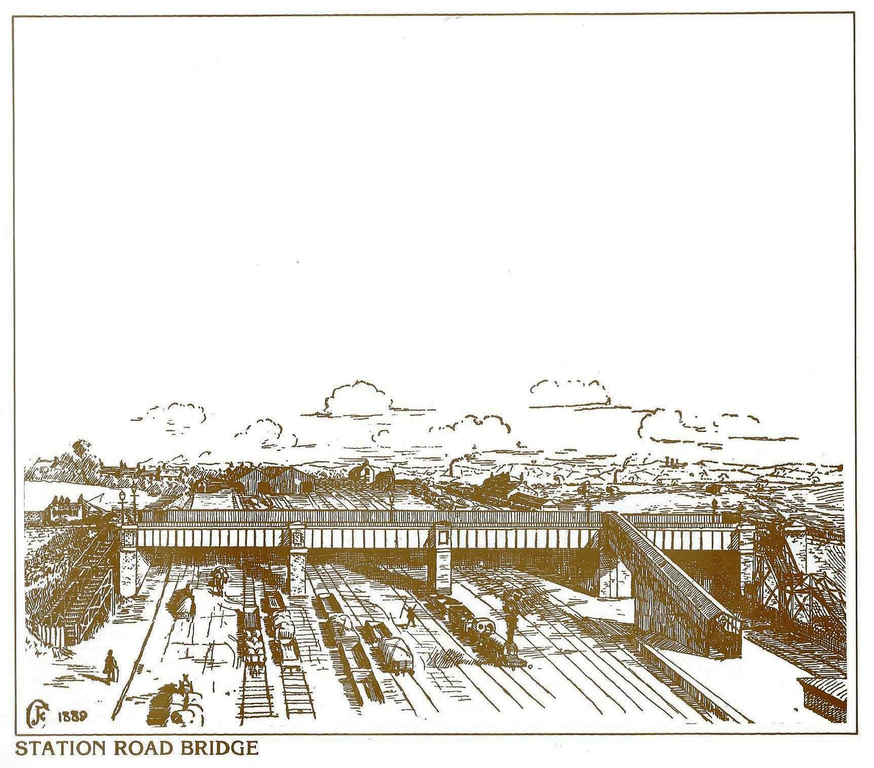
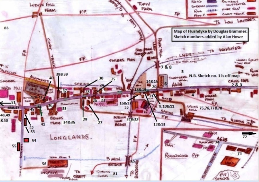
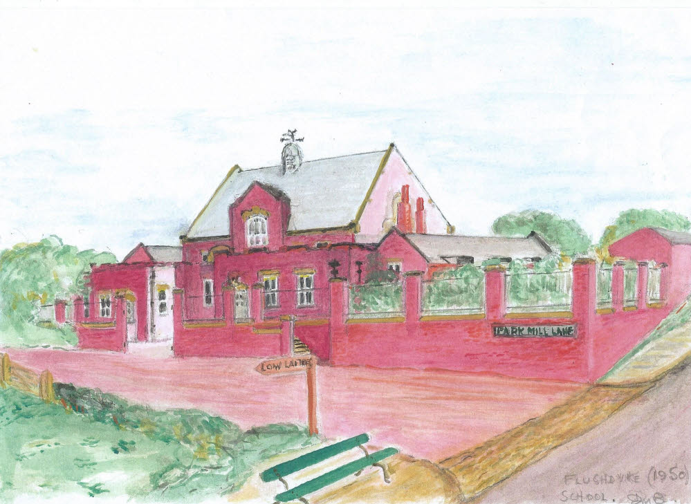
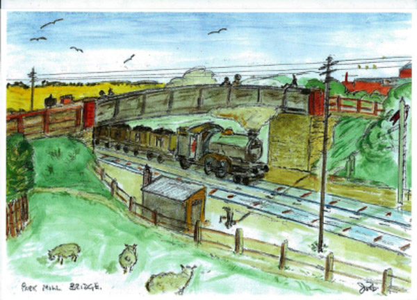
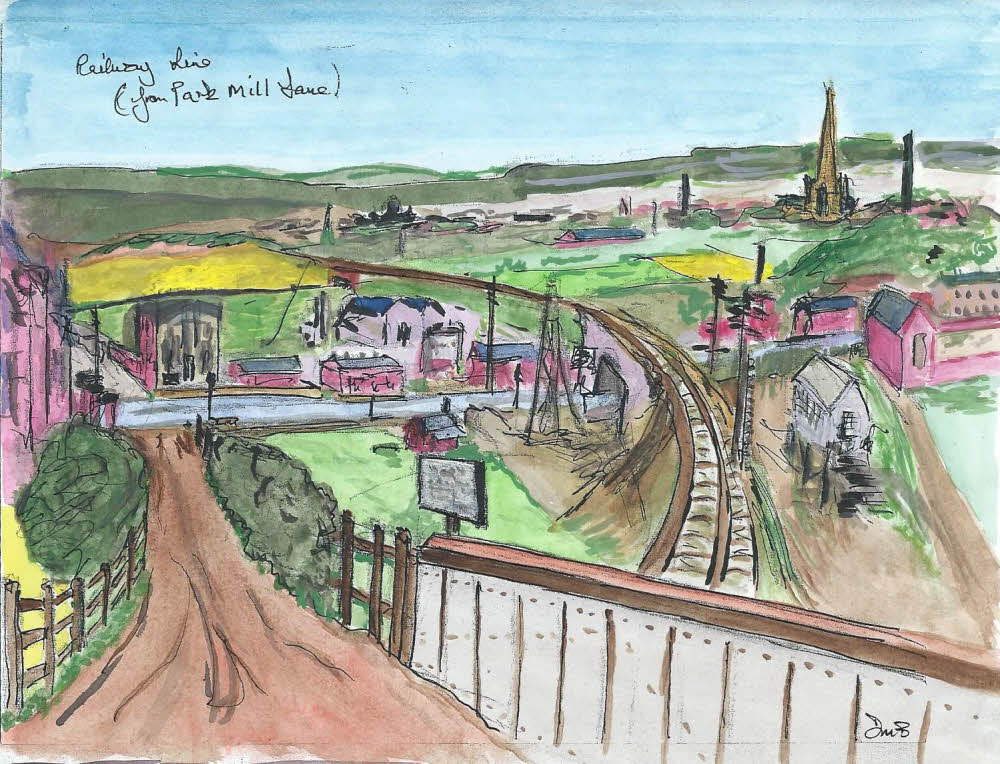
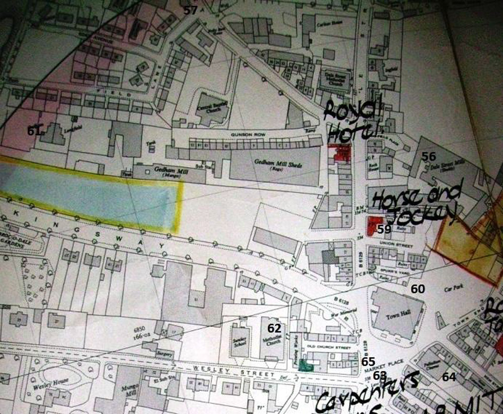
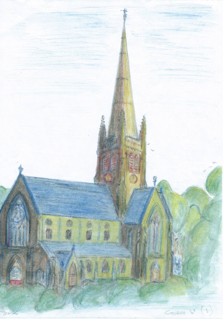
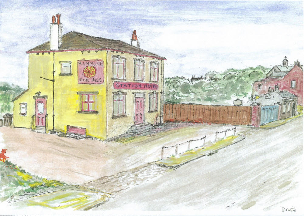
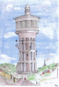
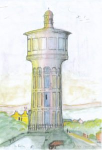
This is a collection of almost 100 sketches of Ossett and Flushdyke by a most remarkable man. Douglas Morton Brammer was born in Flushdyke, once a small village within the small town of Ossett in West Yorkshire. He was the most modest of men with remarkable talents. He had a phenomenal memory, an eye for detail and an ability to recall, draw and recount tales of Flushdyke and Ossett in the 1940’s and 1950’s. These memories and his love of community are reflected in this Douglas Brammer Collection of sketches

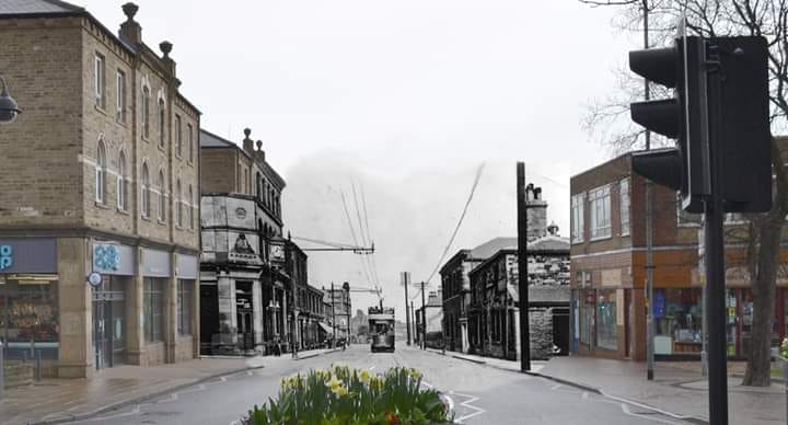
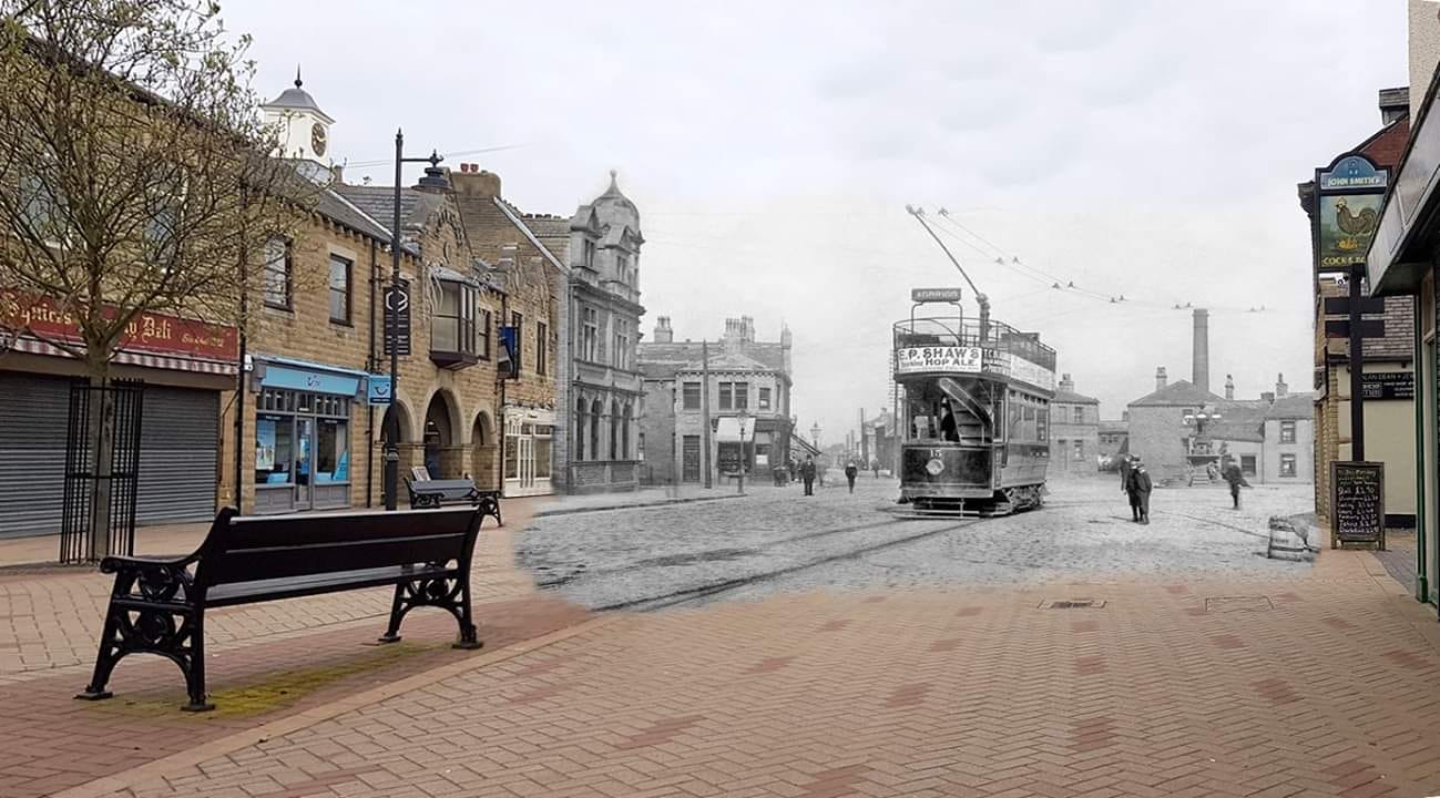
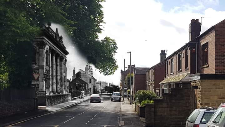
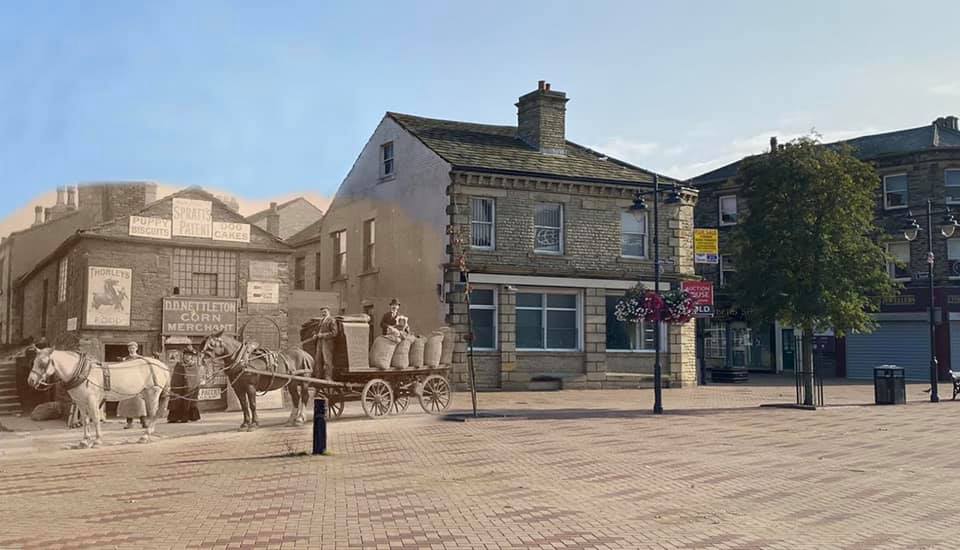
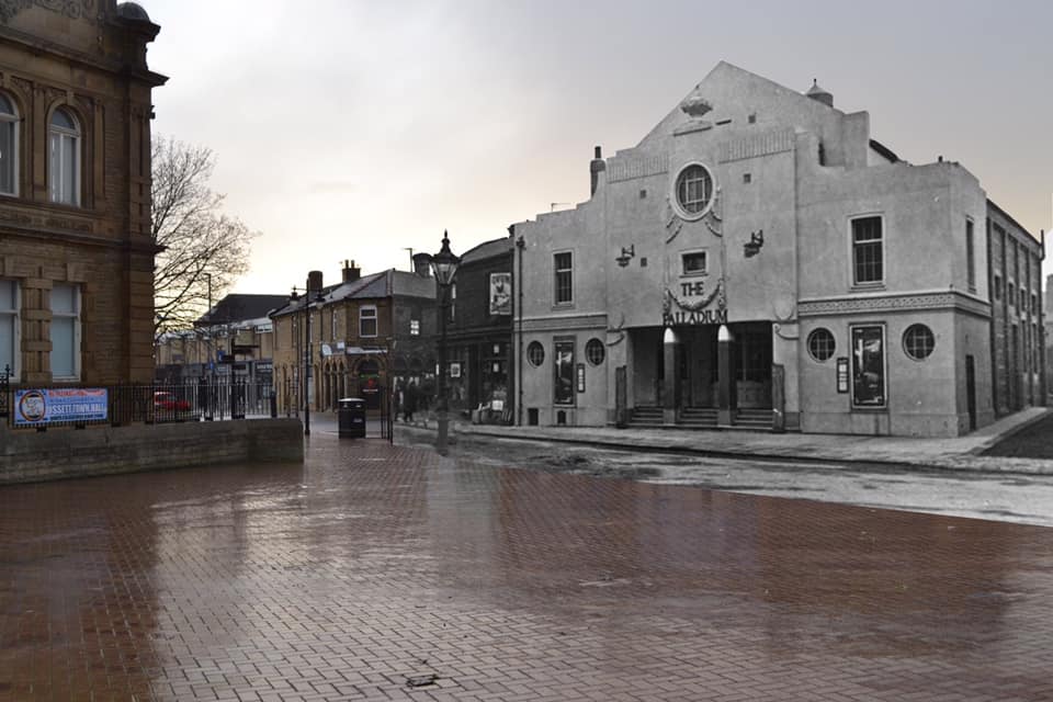
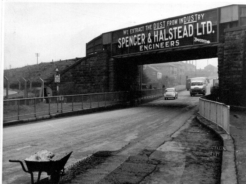
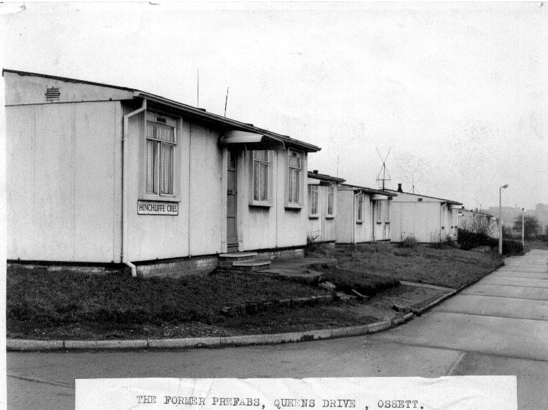
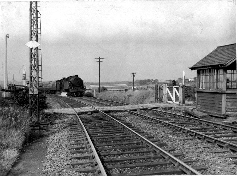
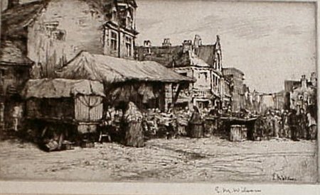
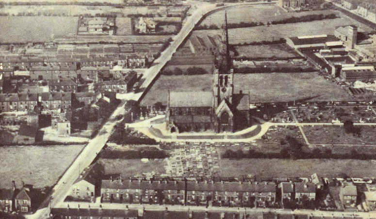
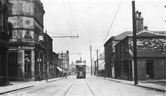
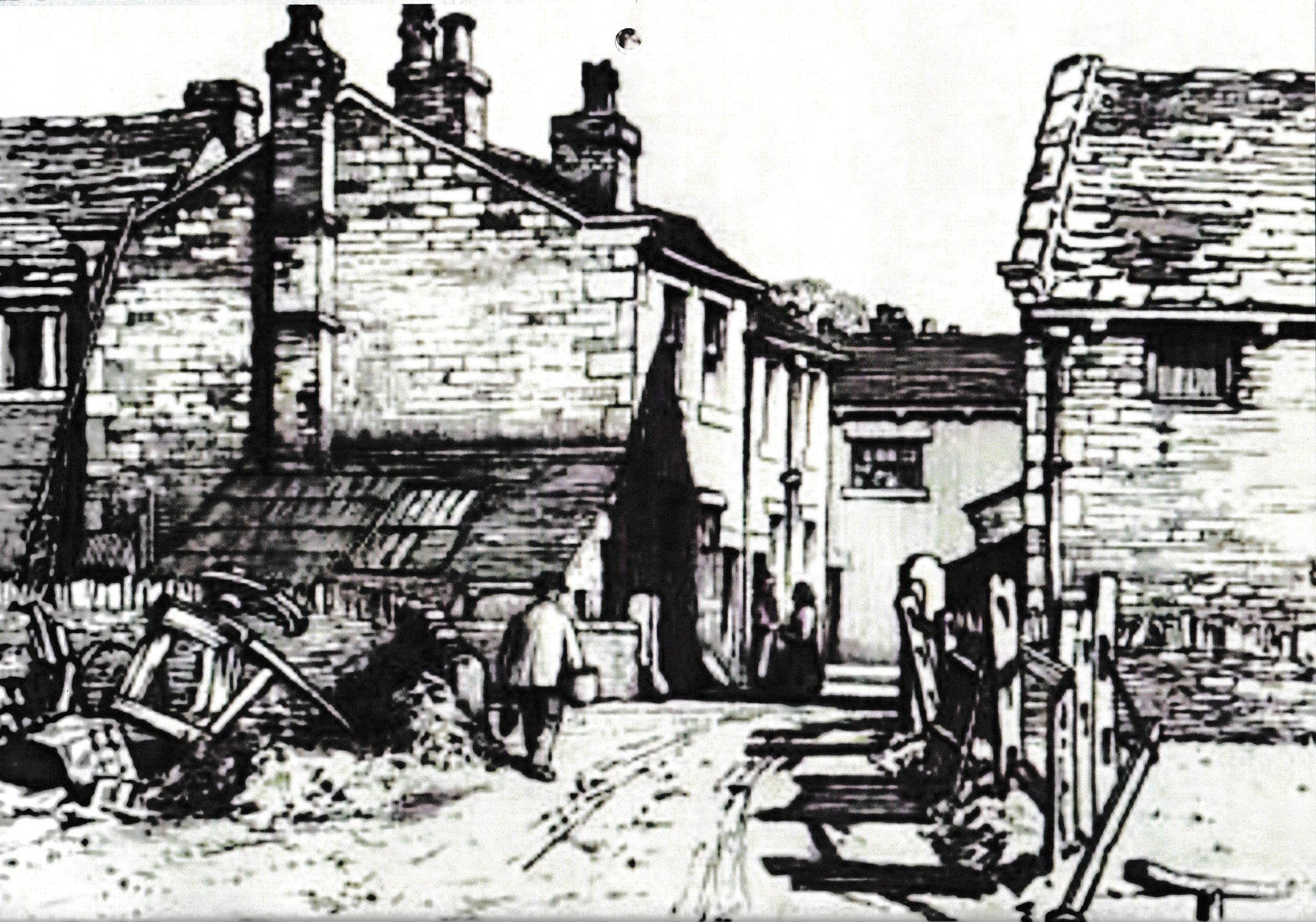
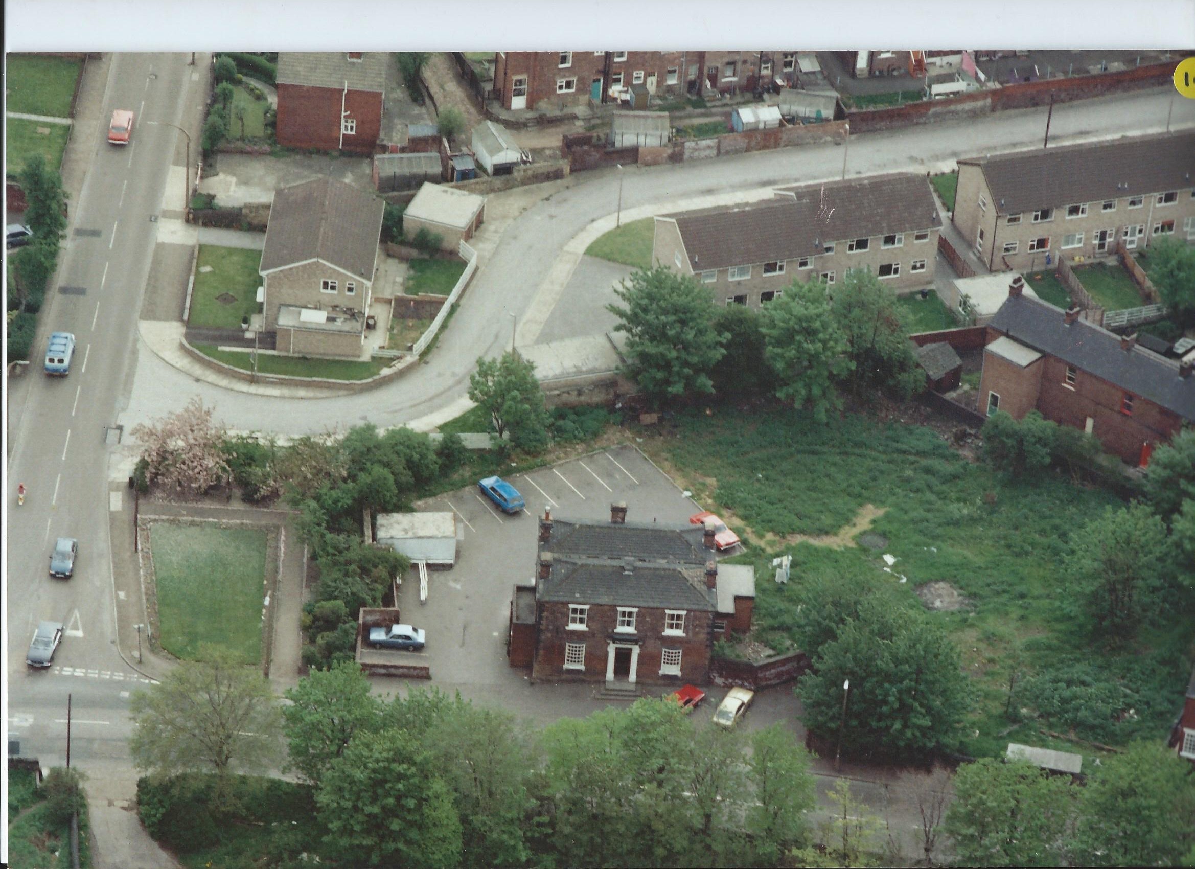
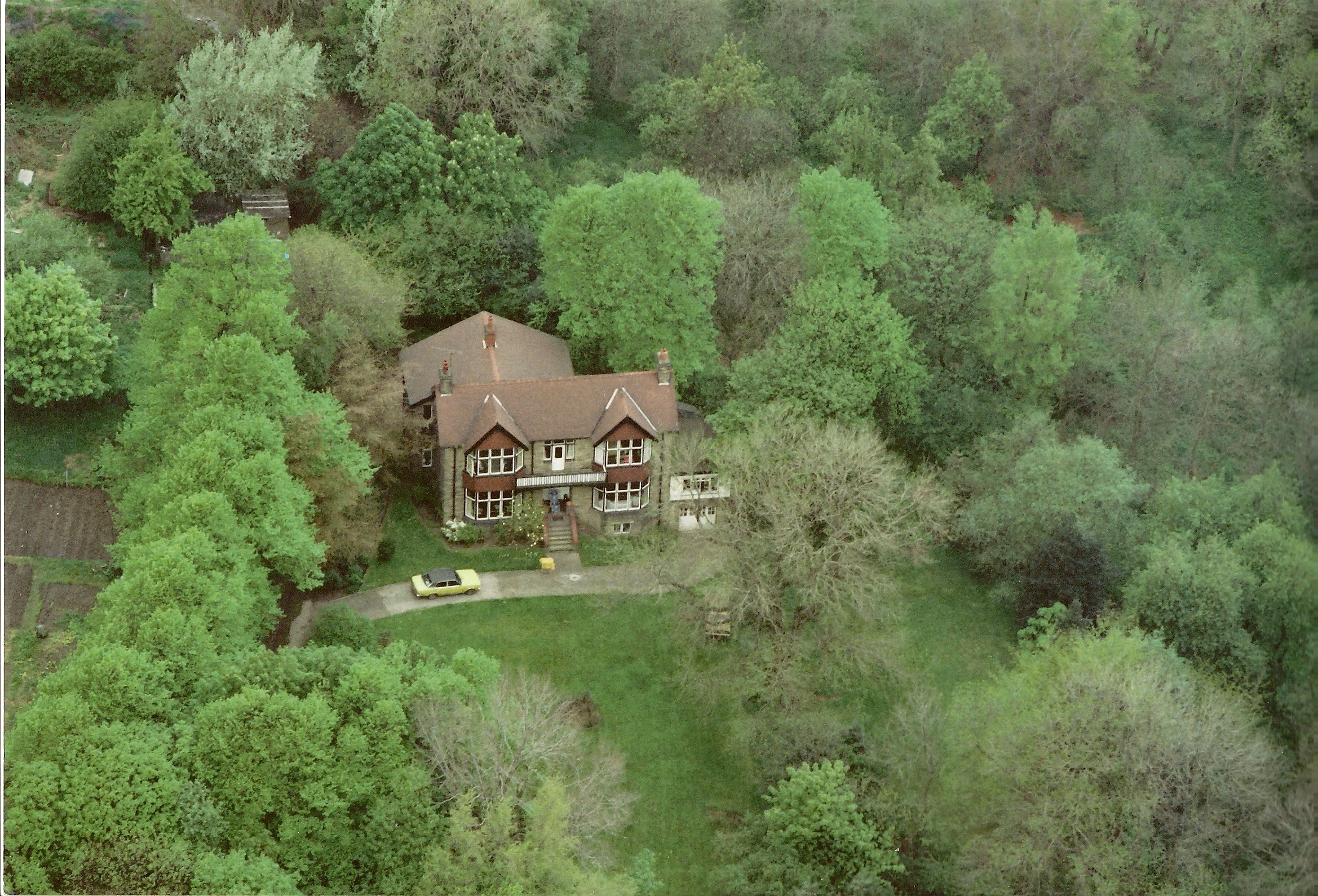
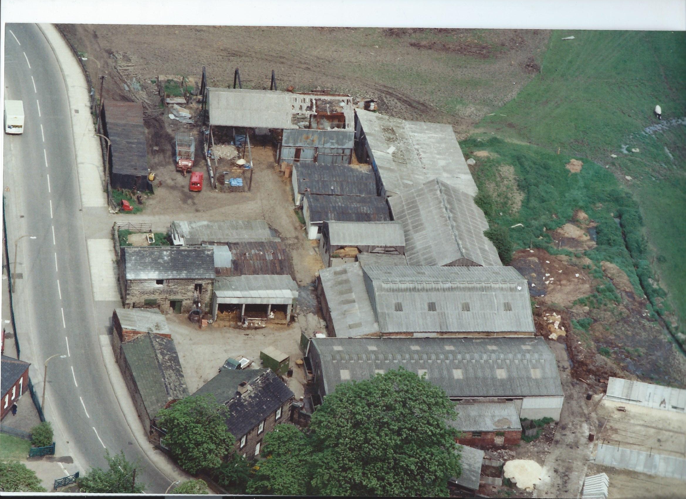
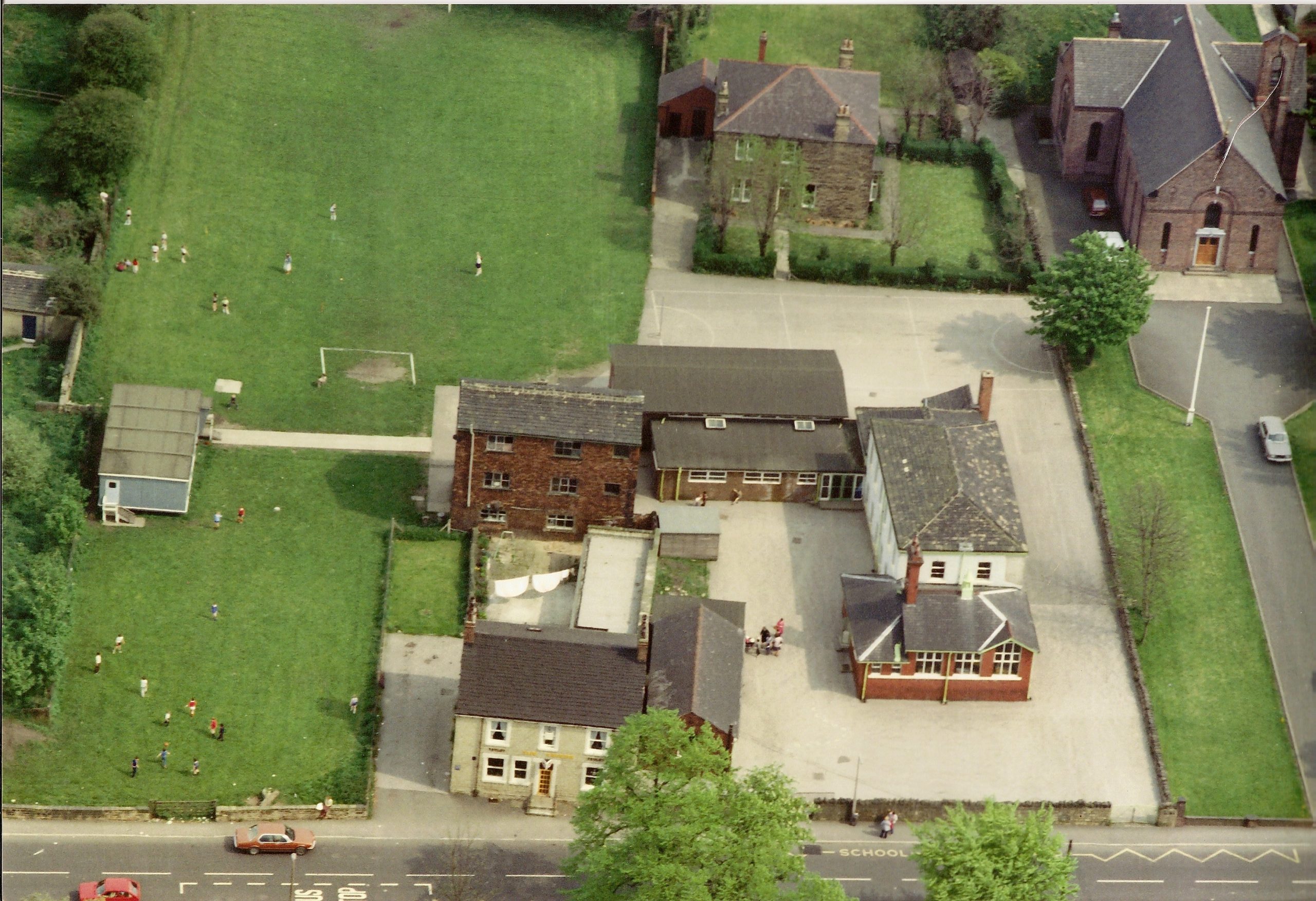
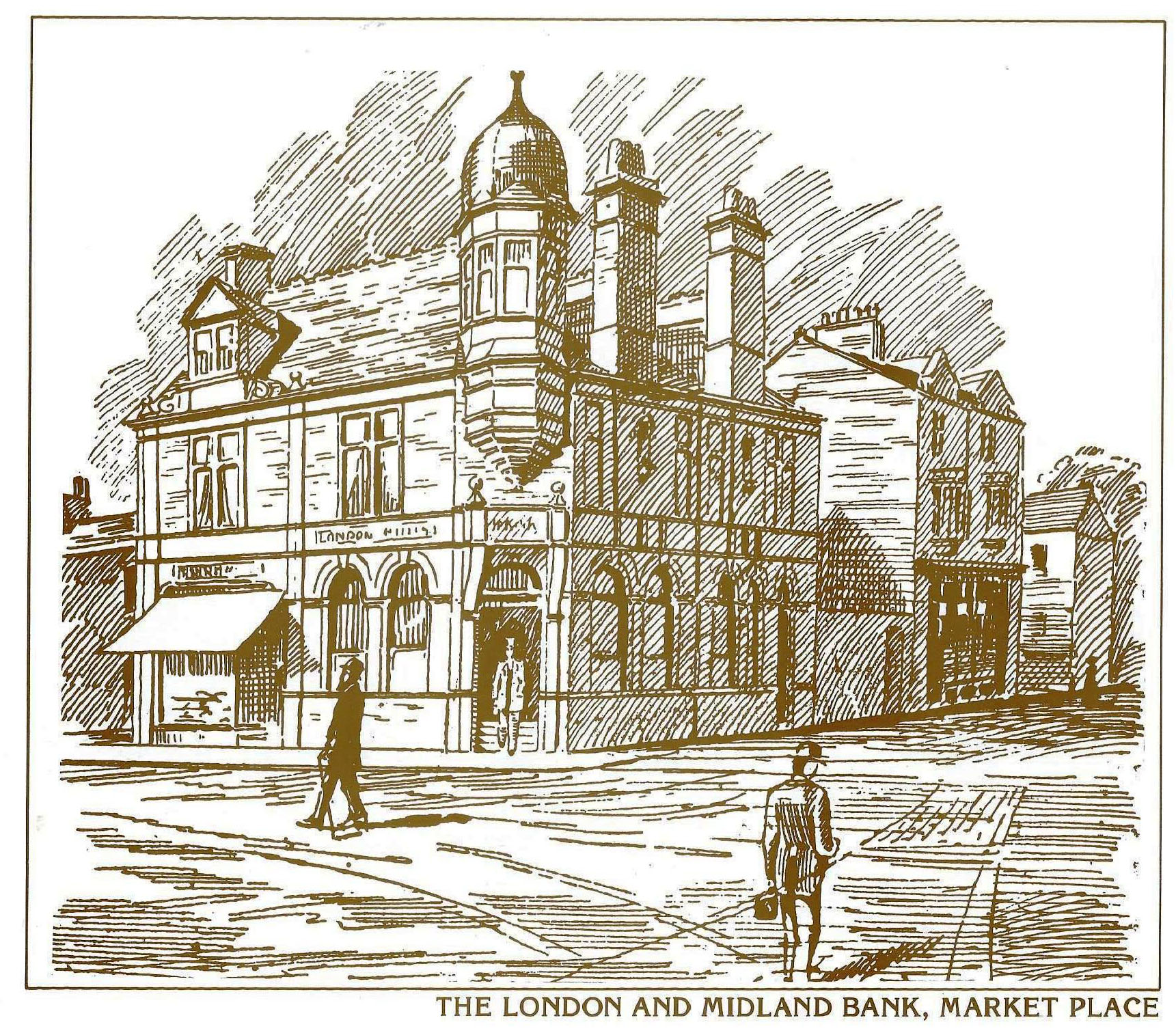
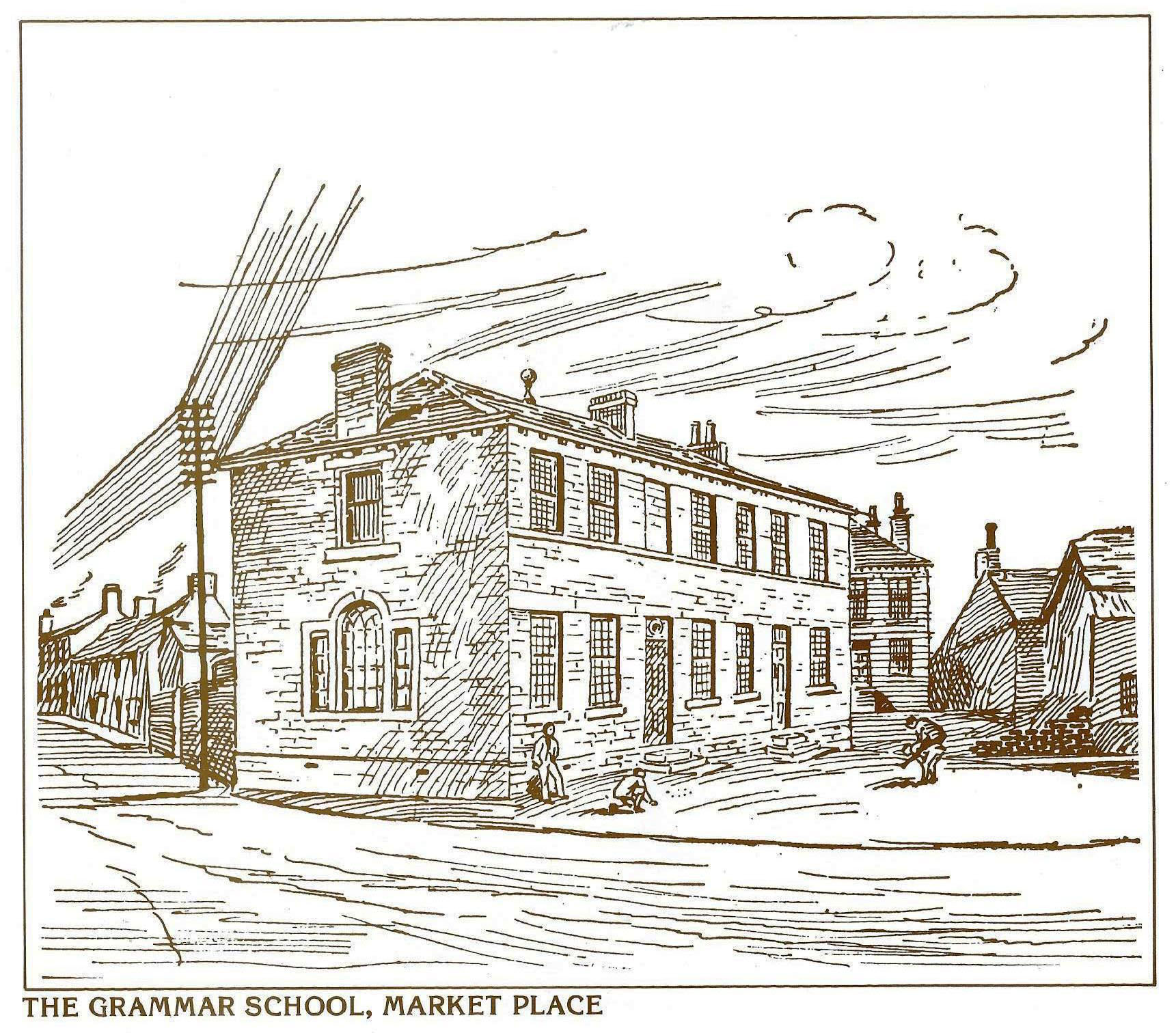
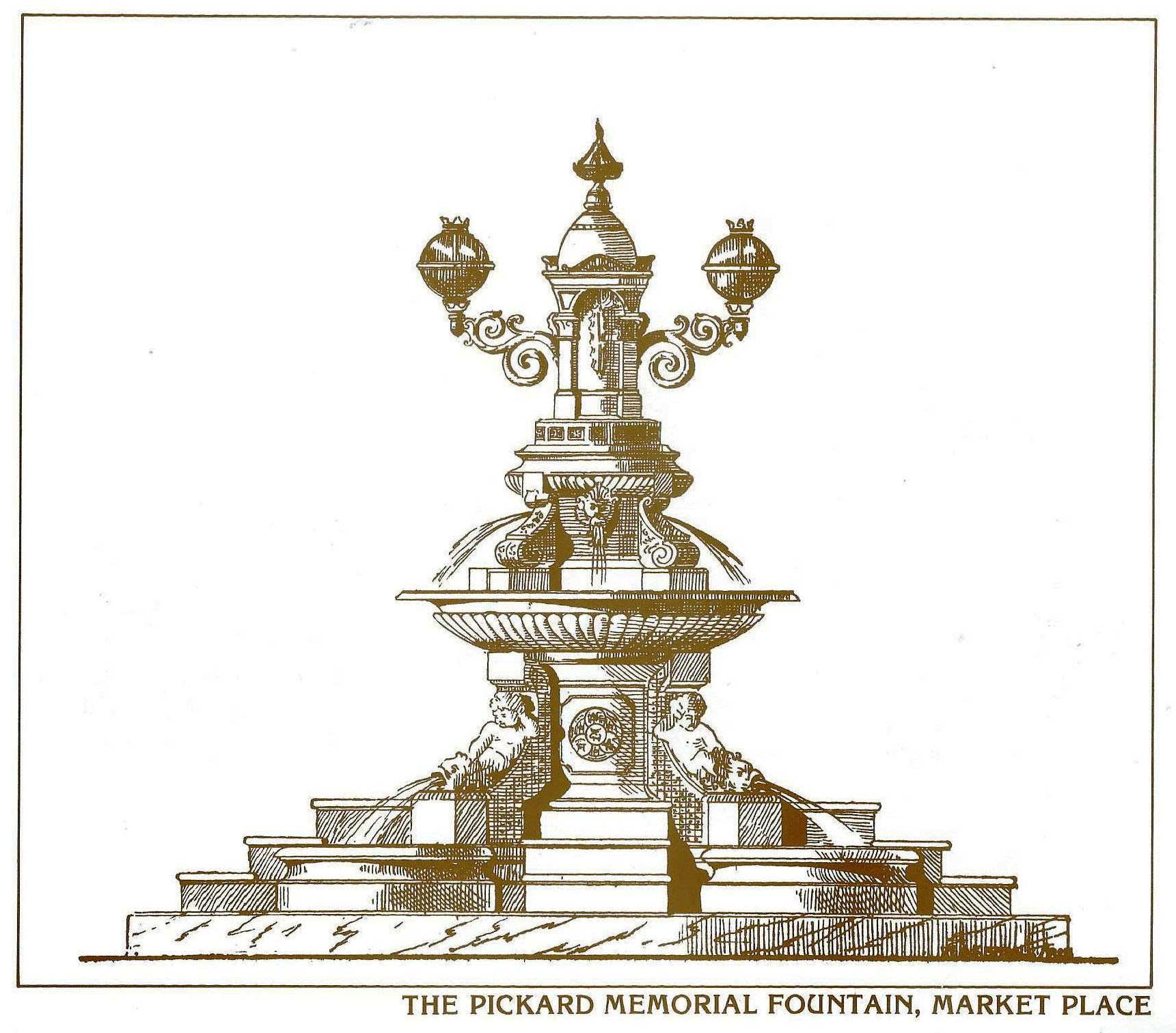
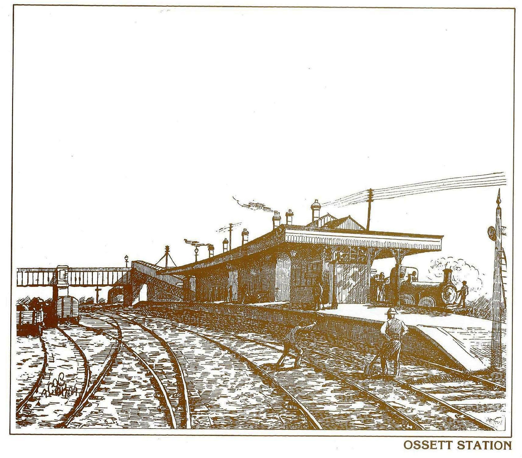
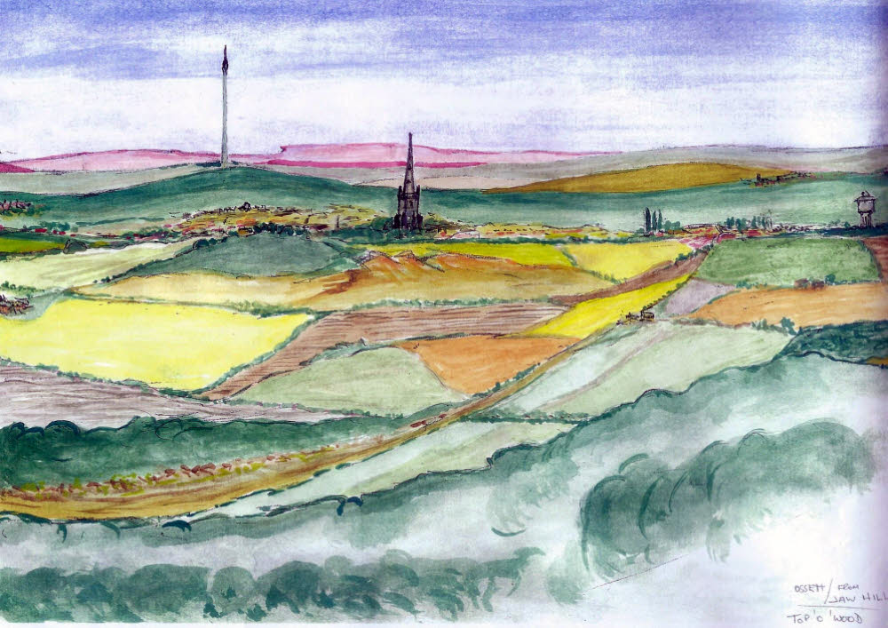
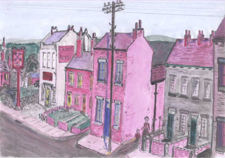
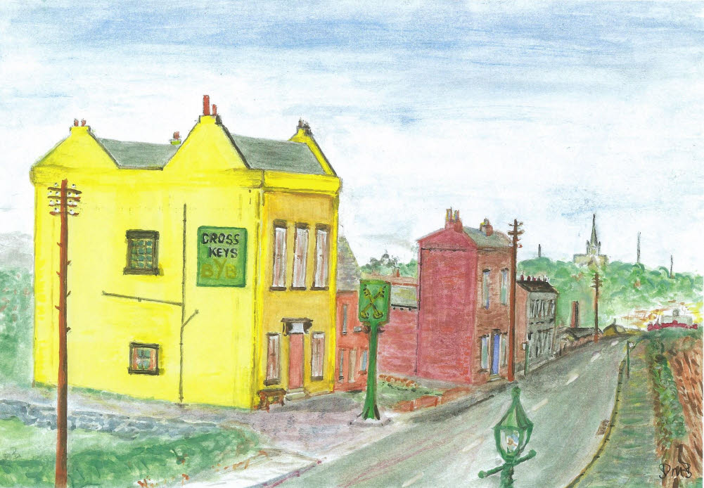
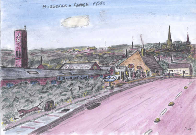
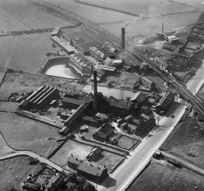
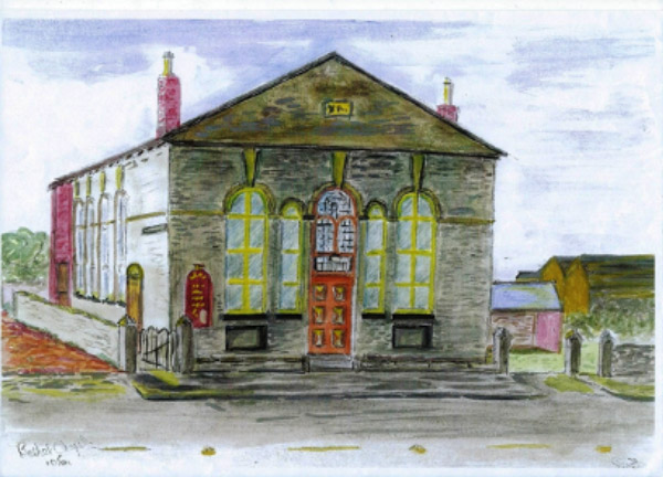
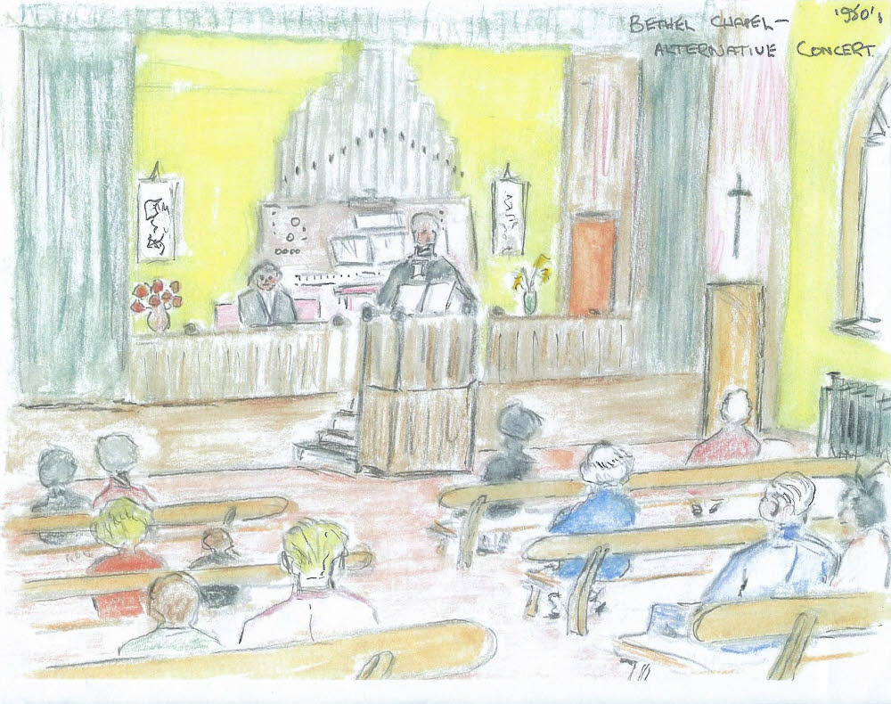
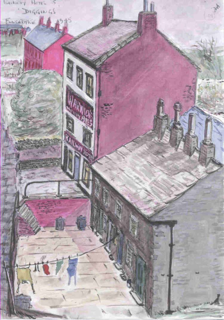
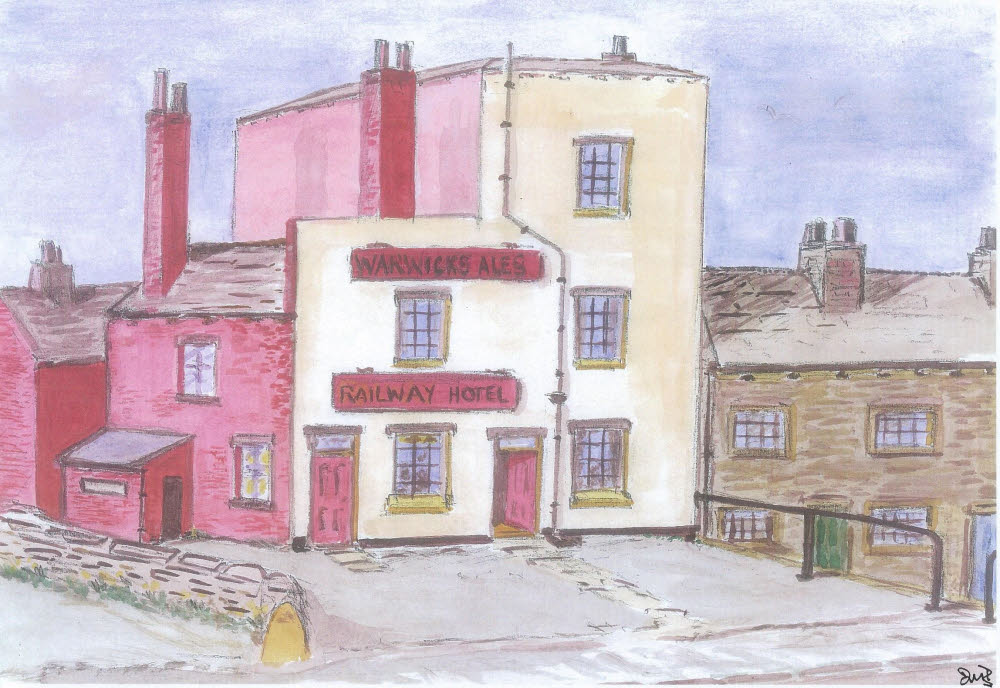
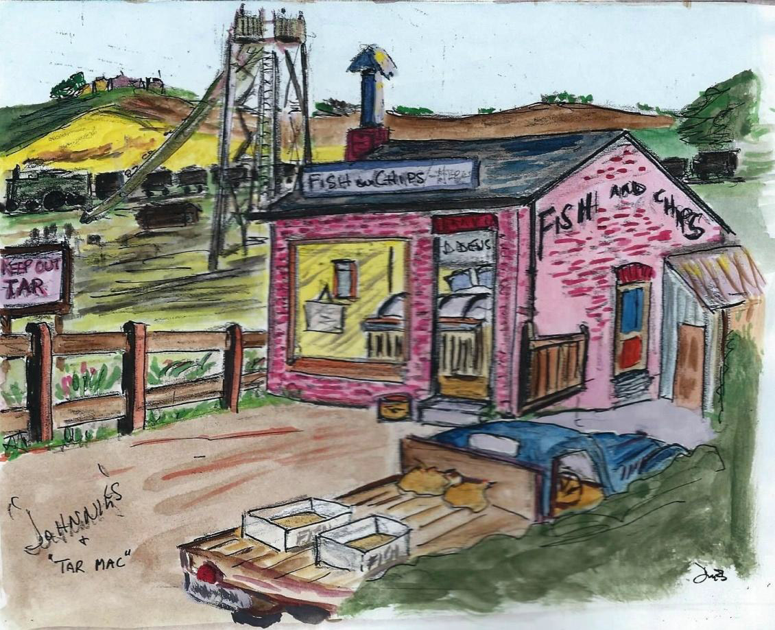
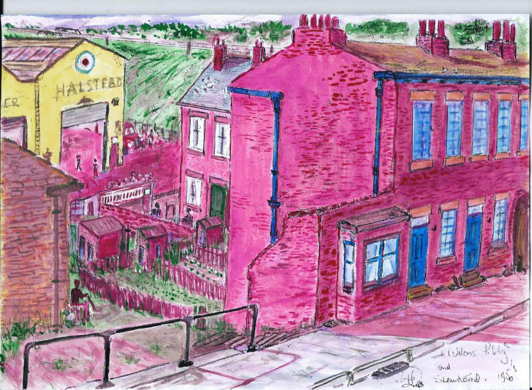
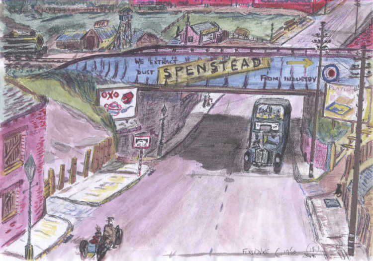
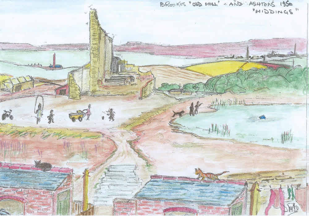
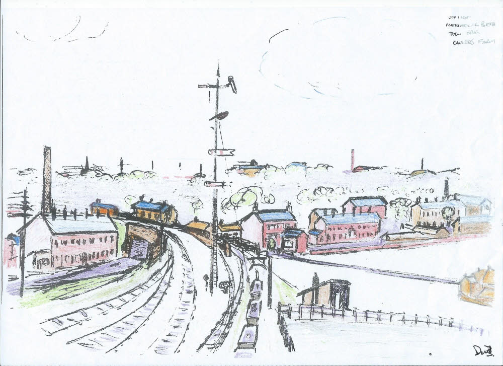
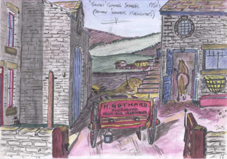
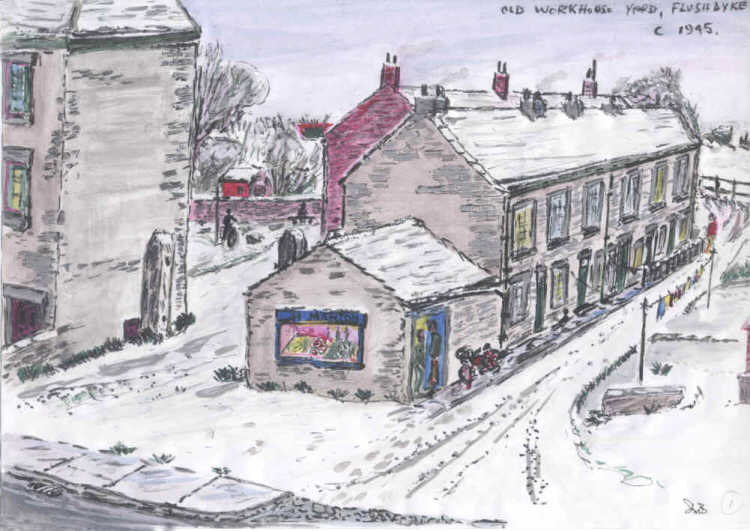
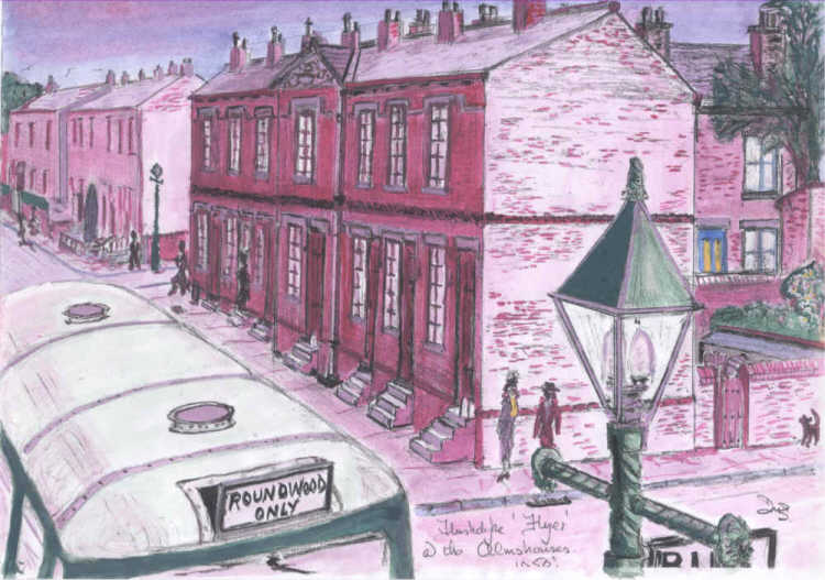
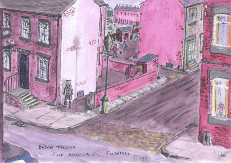
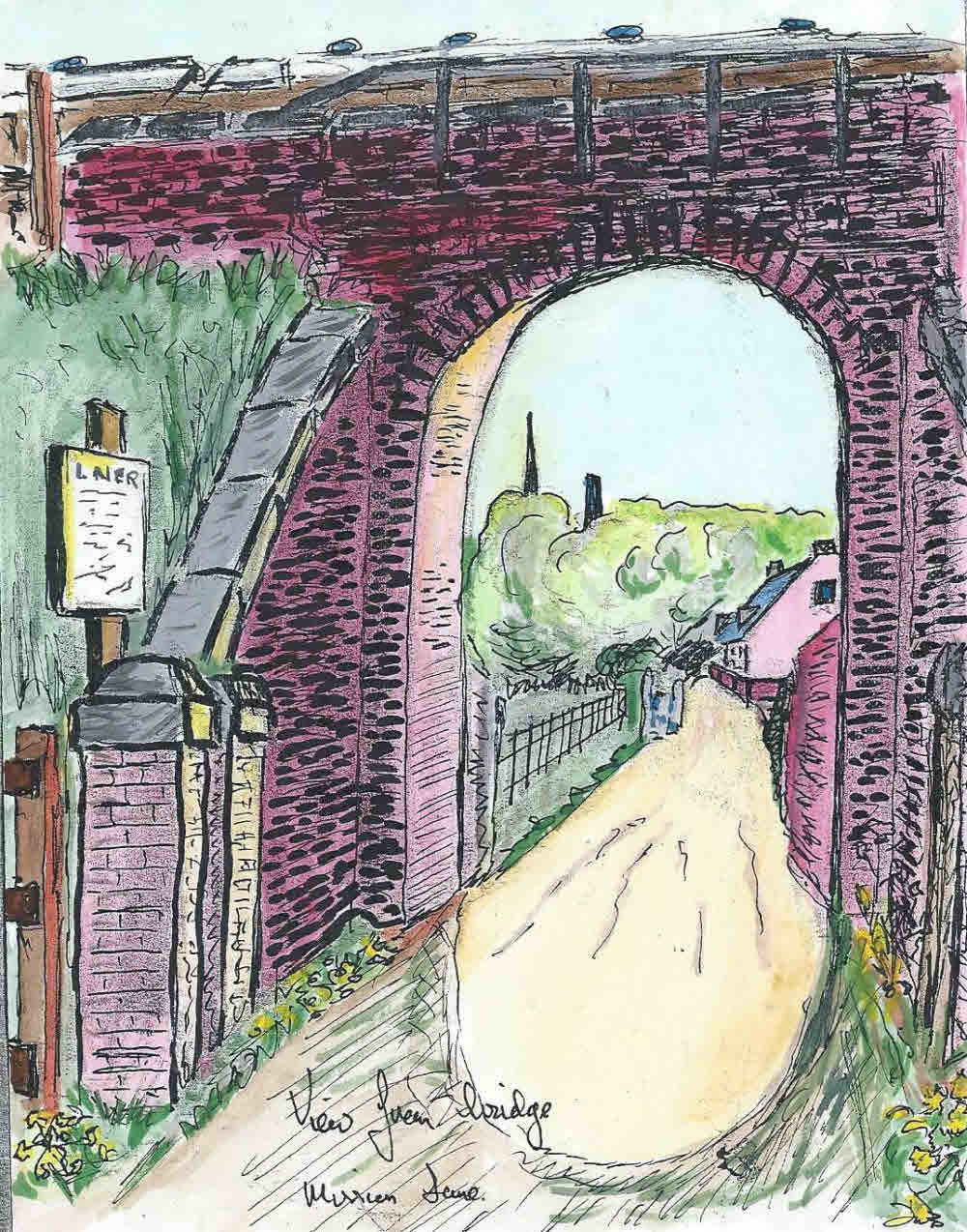
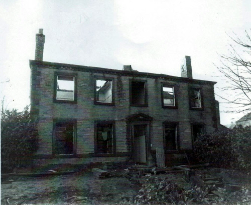
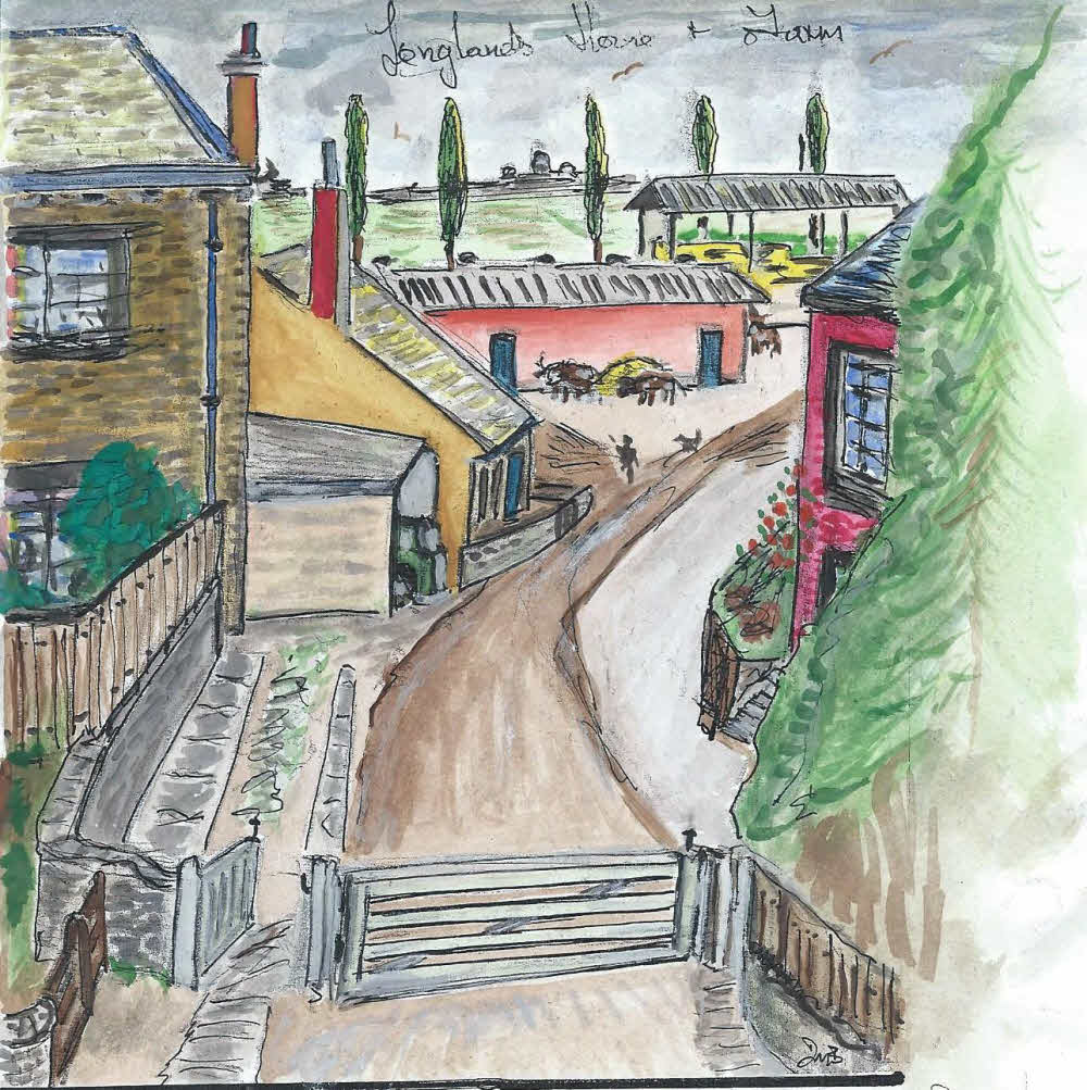
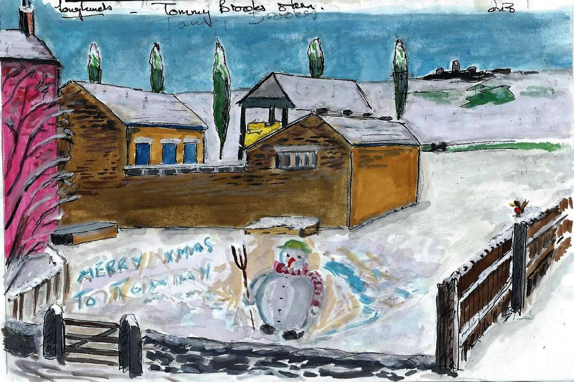
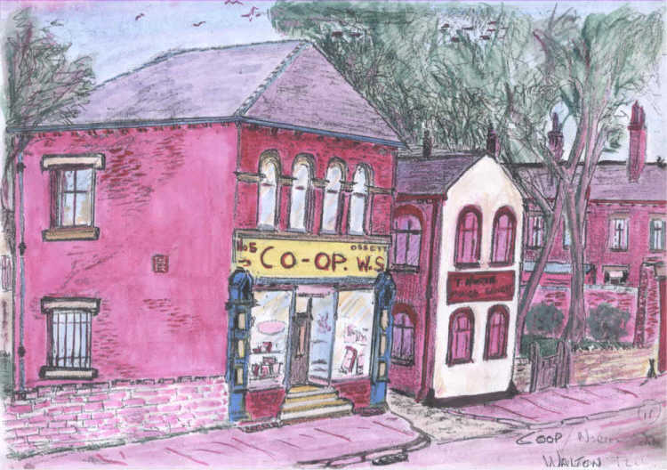
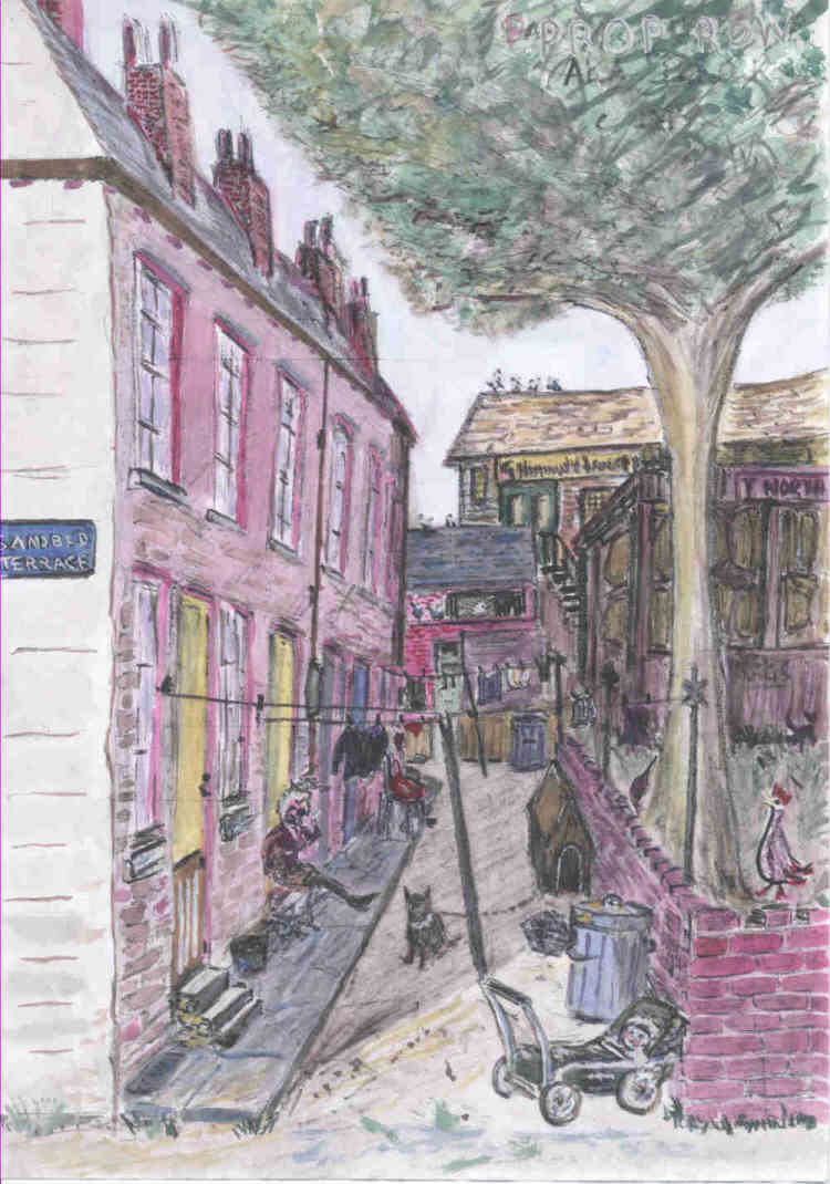
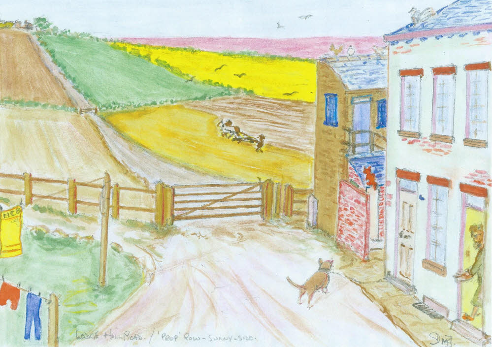
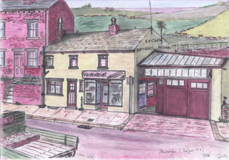
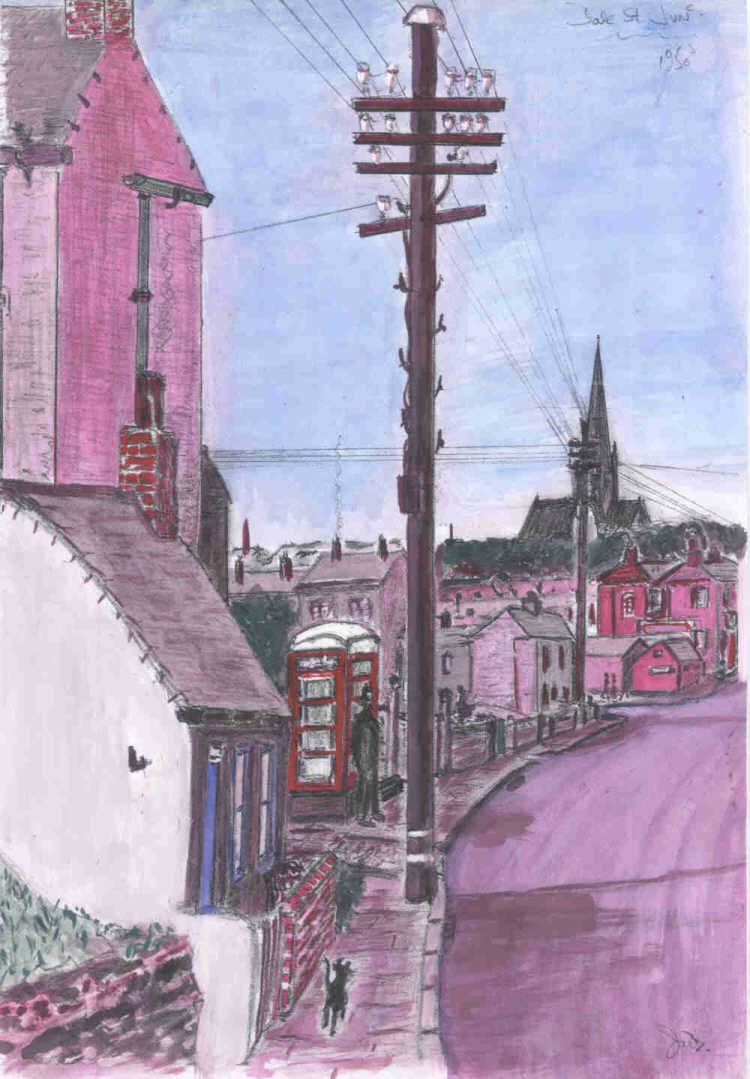
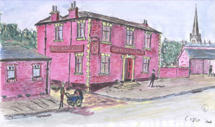
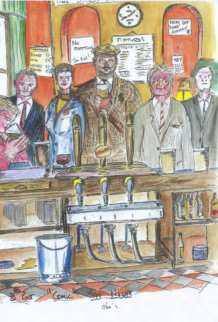
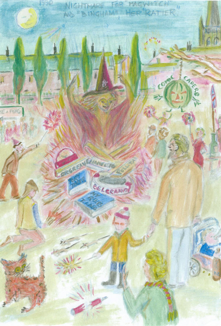
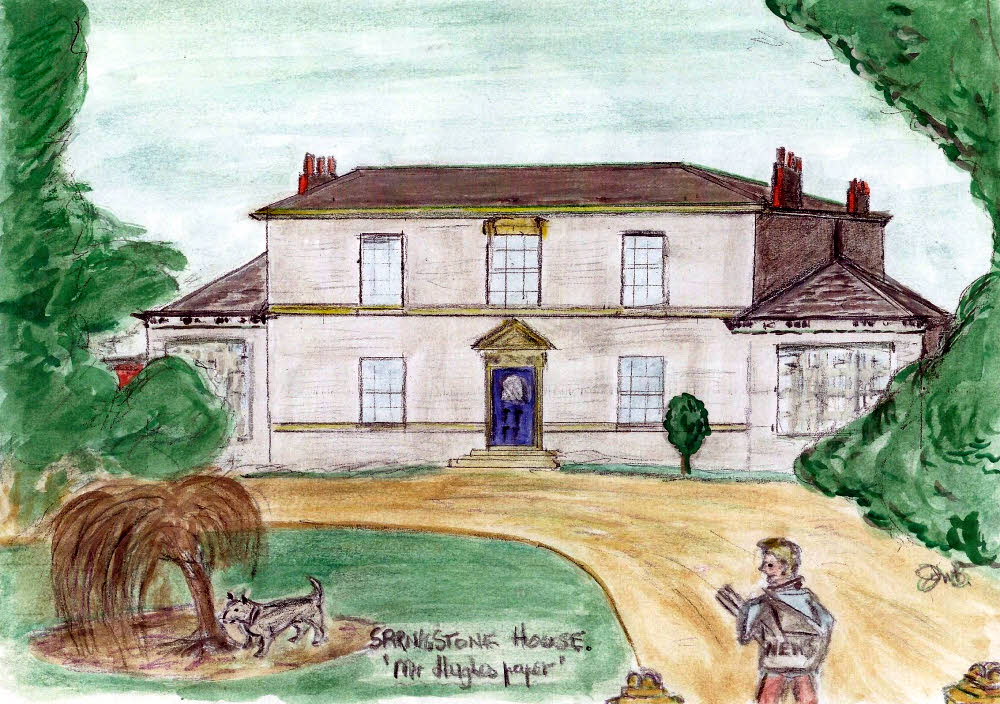
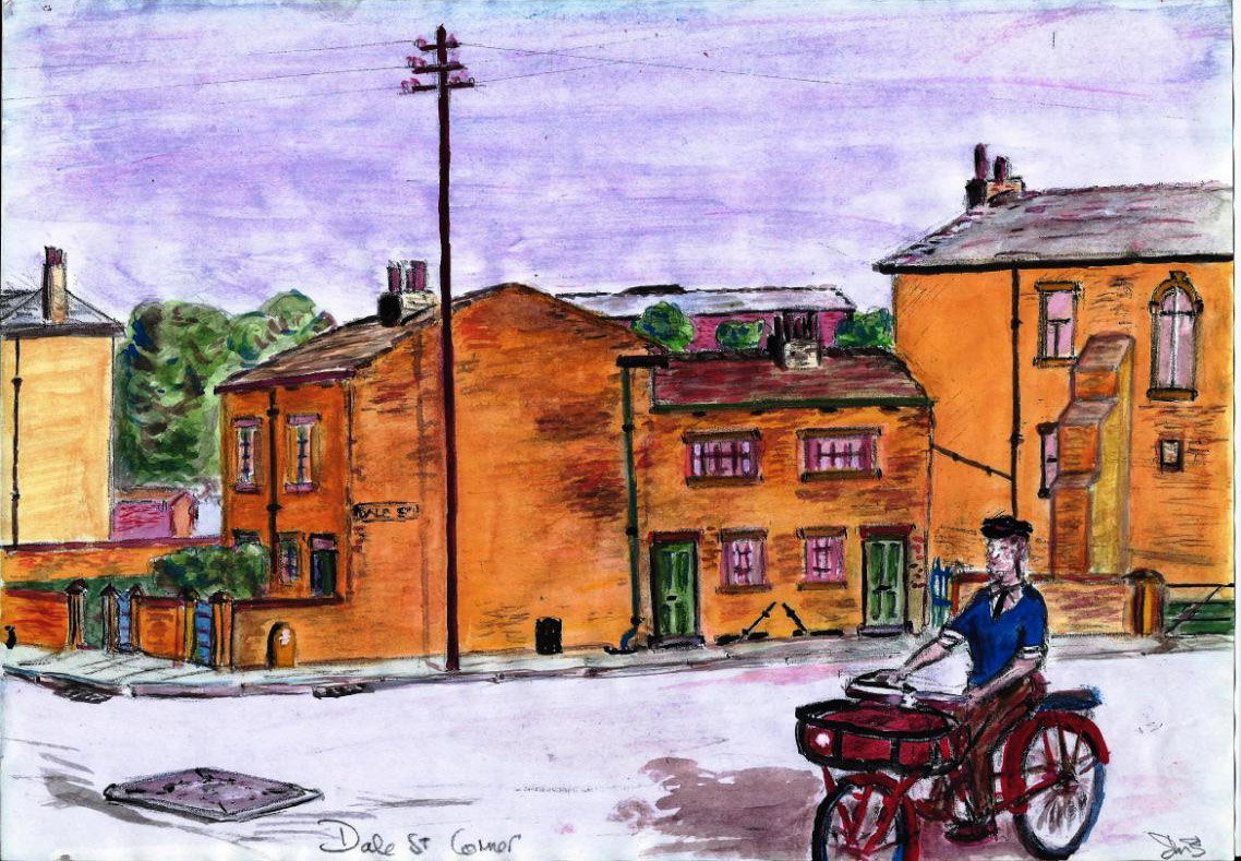
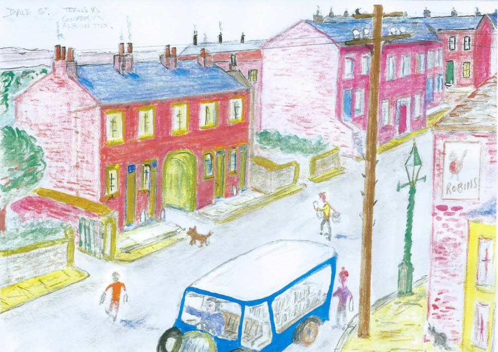
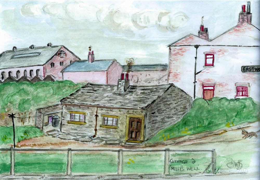
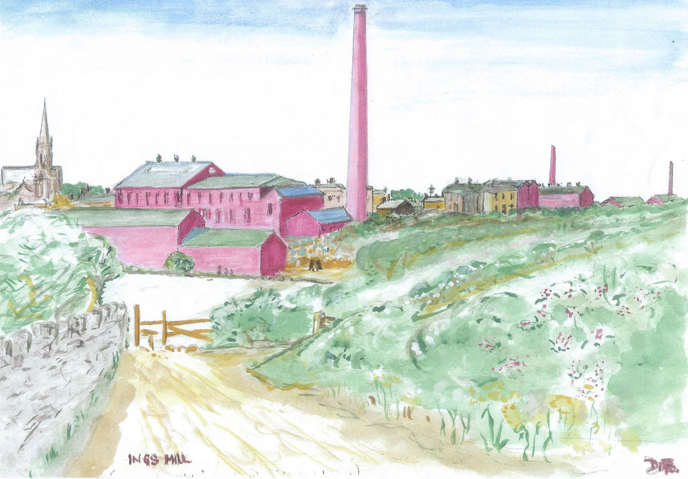
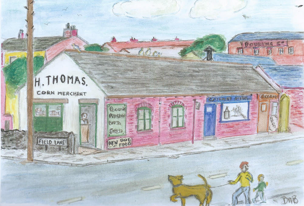
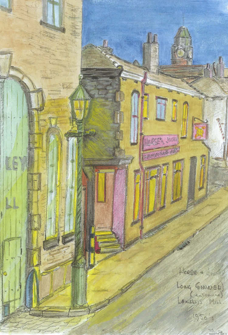
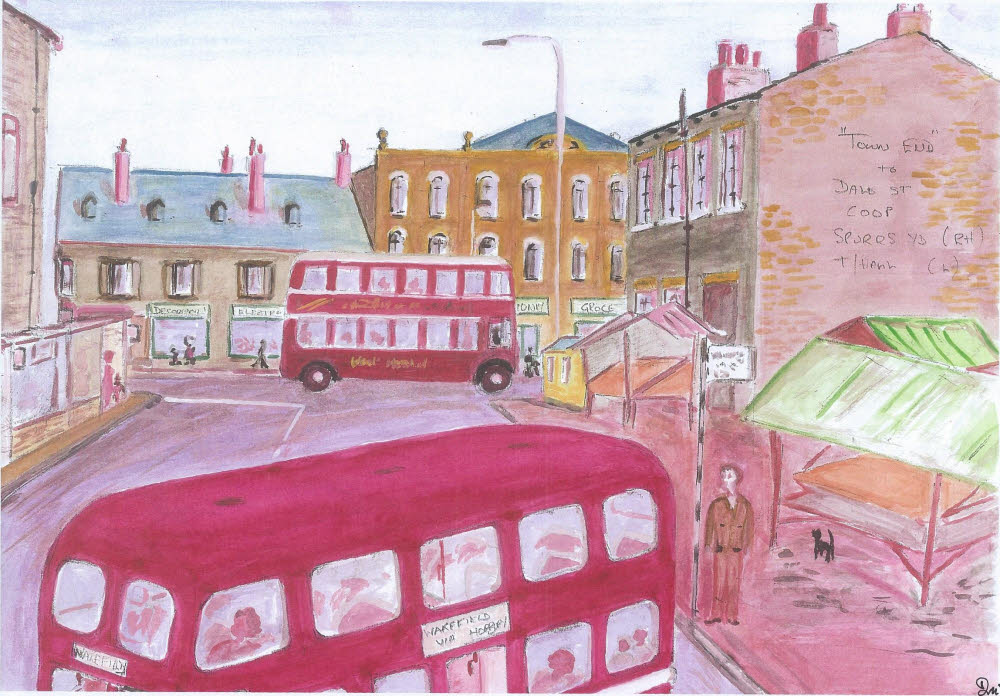
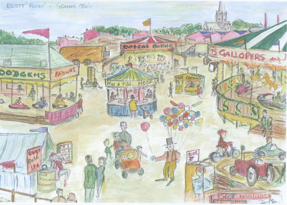
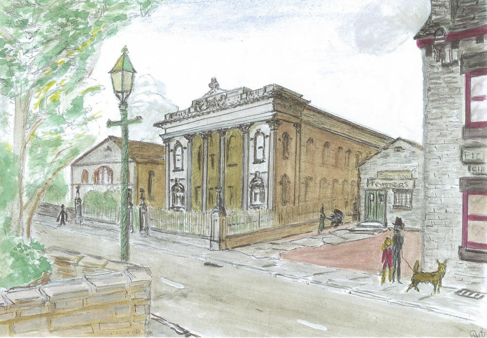
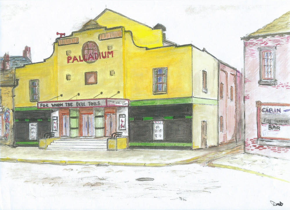
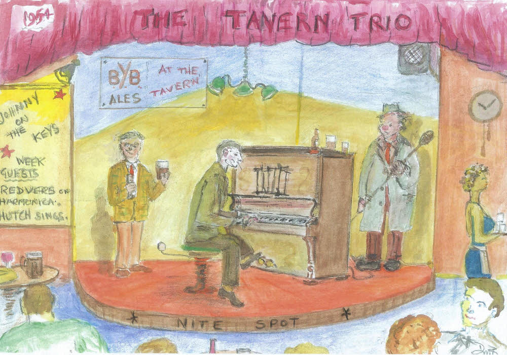
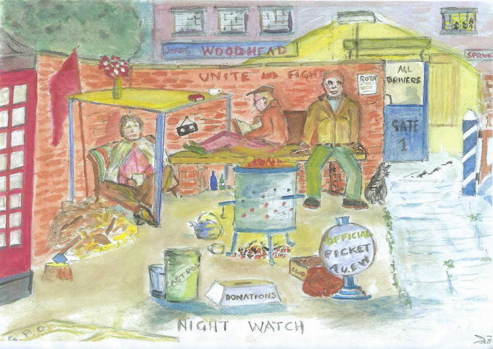
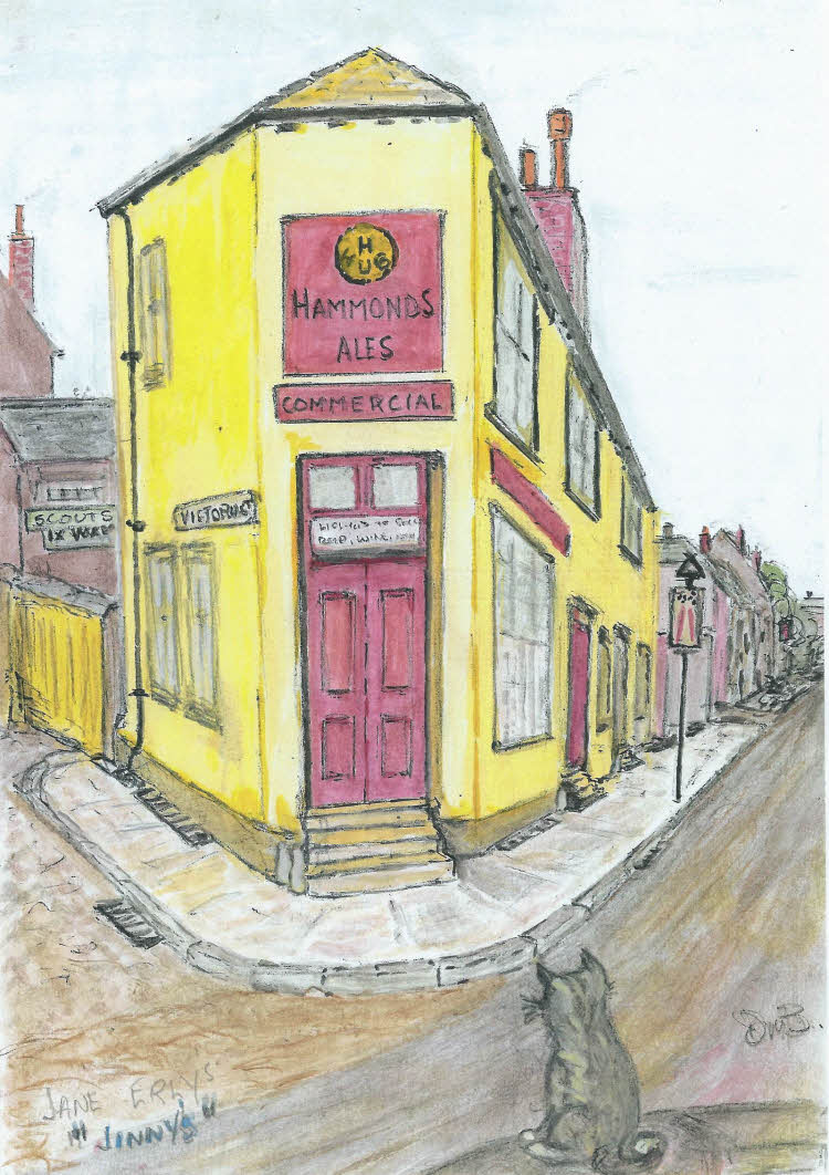
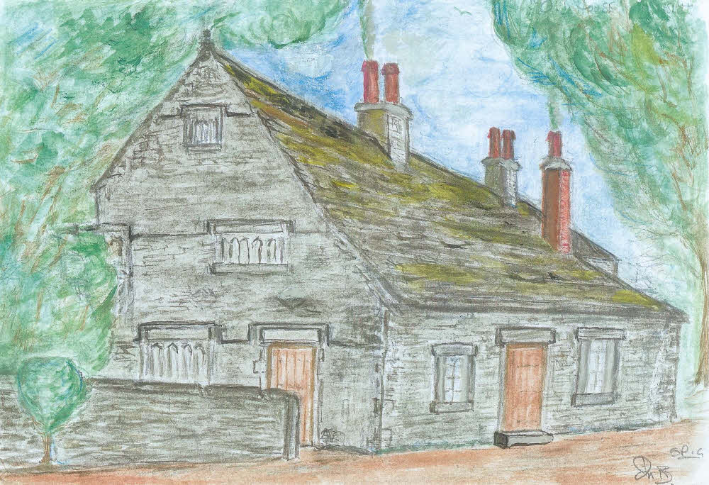
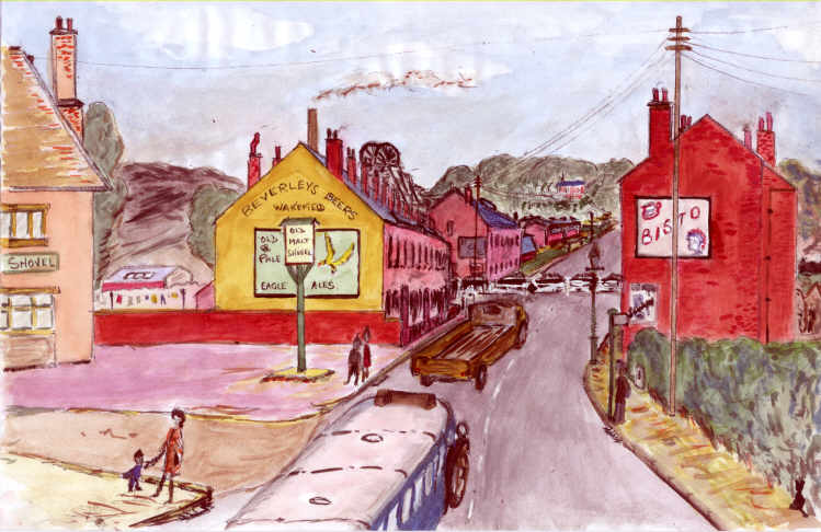
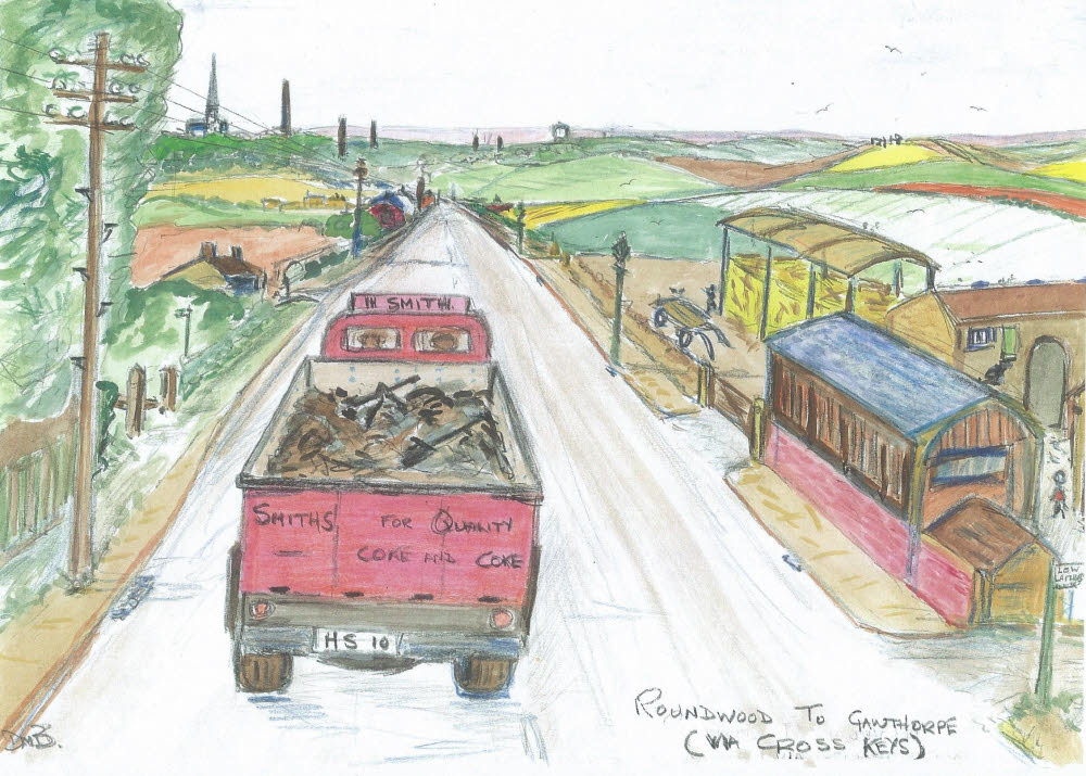
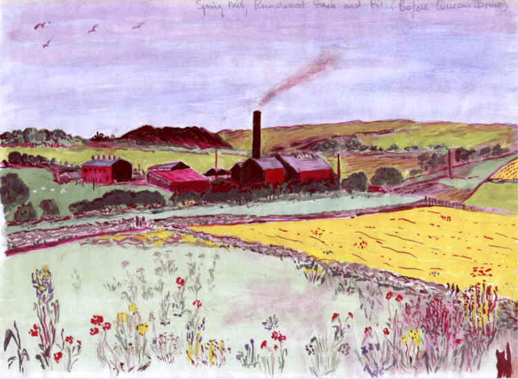
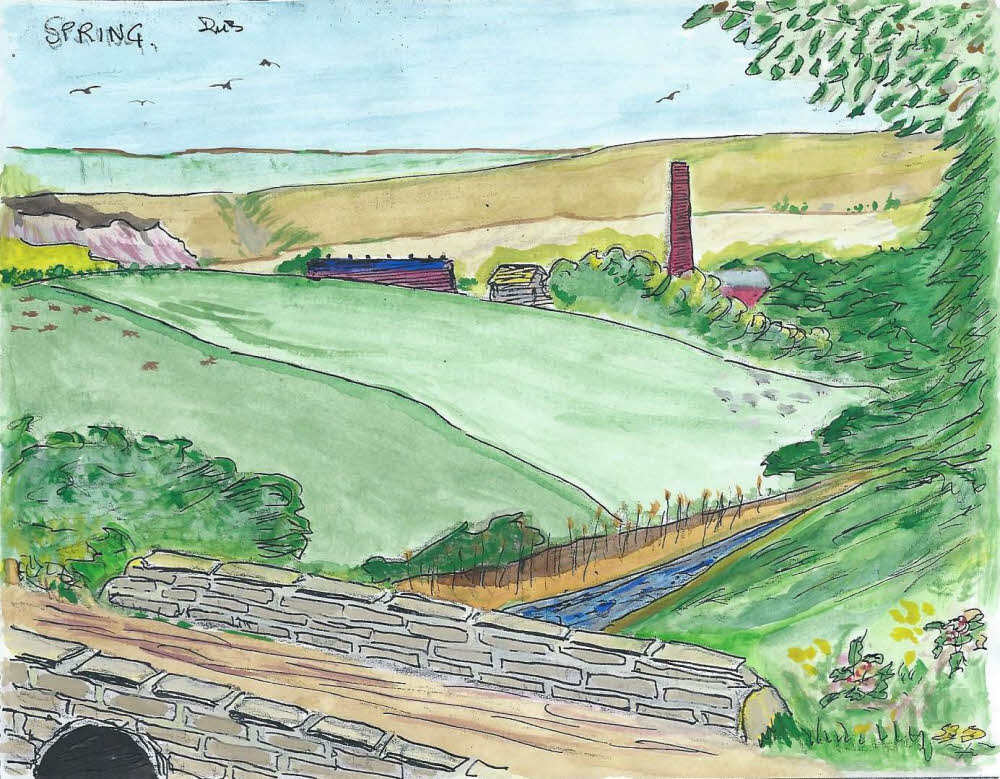
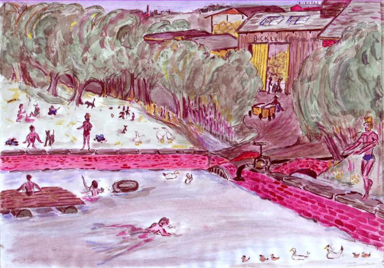
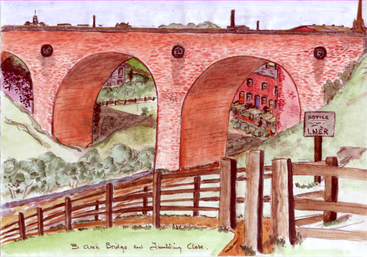
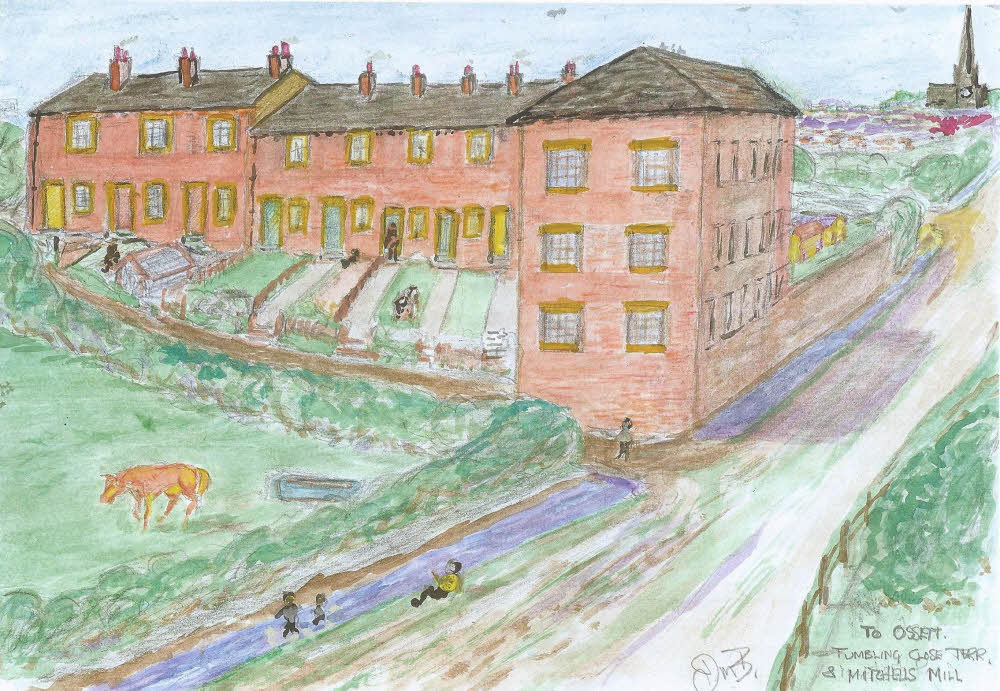
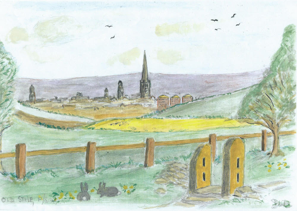
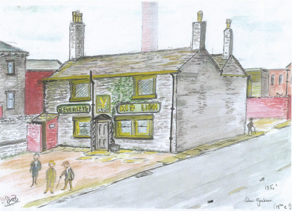
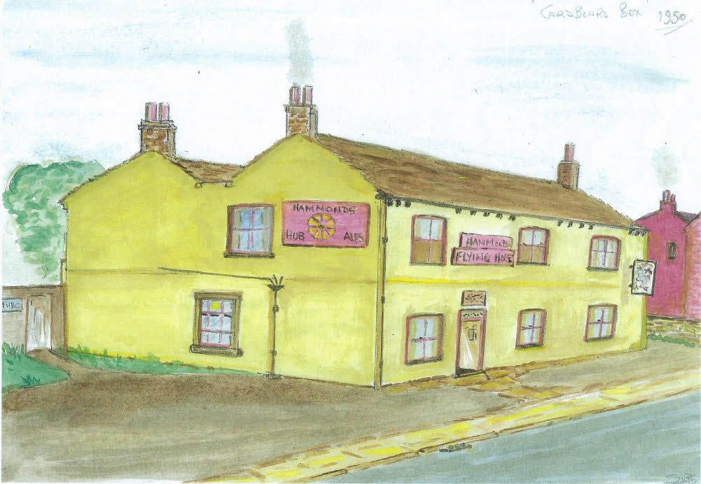
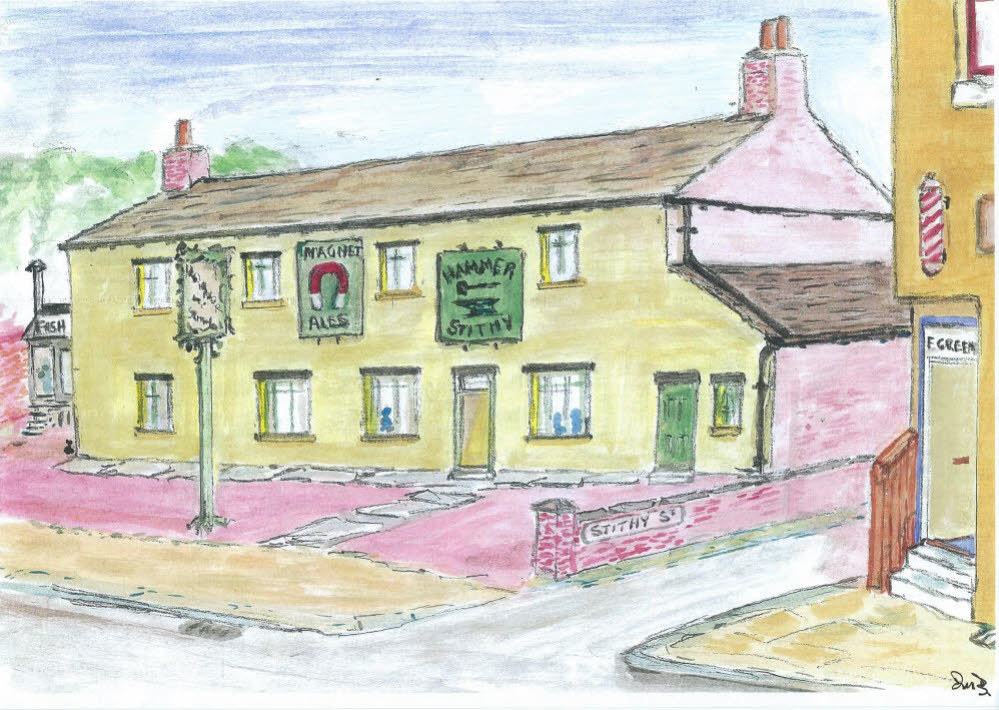
His sketches of Flushdyke capture a community swept away by industrialisation in the early/mid 1970’s. They capture not only the buildings, many of which were lost in the name of progress, but also the people, the character, the spirit, the very essence of that community. The sketches are not copies of photographs for few exist. Instead they are the product of his photographic memory, made from his mind and from his heart. Even more remarkable is that his sketches were penned only for his own use so that he could help to explain to others his memories of times gone by. In truth they are a pictorial biography of the life of Douglas Morton Brammer.

In addition to his skills as an artist, Douglas Brammer had a wonderful way with words. He could recall, in the finest detail, the places and the people of his youth. He turned those memories into remarkable works of art which showed these places as they were in the 1940’s and 1950’s. Outstanding as they are, his sketches represent much more than works of art. They are also a social history emblazoned with stories of those people who lived and worked there.

Sink yourself into these sketches and you will be transported to a Flushdyke and Ossett which was a far different place in a different time. Wonder about these places and the lives of the matchstick men and women and the matchstick cats and dogs which grace many of his sketches. They are the memories of his youth in the 1940’s and 1950’s and they are of immense historic importance. Douglas would have shaken his head at such a thought but they illustrate places which escaped the photographer. Without them we could only wonder about what once was Flushdyke.

The sketches are set out in a way that enables the reader to take a journey through Flushdyke and Ossett in the 1940’s and 1950’s. The journey begins with a view of three major landmarks known to us all as we head home, down the M1. It then proceeds along the Wakefield Road at Flushdyke to the junction with Dale Street (sketch no.52). From here the journey continues into the Market Place, then along the Green to Storrs Hill Road and to the former Ossett Grammar School (sketch 71).

From here on the collection is a composite of sketches of Roundwood, Spring Mill, Gawthorpe and public houses (largely gone). As such it doesn’t lend itself quite so easily to a continuous journey although a wander from Ossett Academy along Manor Road, then Baptist Lane to Broadway will take you to Roundwood (sketch 72). There on to Spring Mill, back into town and on to Gawthorpe . Or, if you prefer, draw up a chair, make a drink, browse and just enjoy. Each sketch is numbered. These are more than just pictures .They recount a social history in a way which could only be voiced by Douglas. He was also an extraordinary teller of stories who could hold the listener spellbound.

This collection of sketches is dedicated to the remarkable man who made them, Douglas Morton Brammer. 

Alan Howe July 2017

1. The Ossett landscape looking south from Jaw Hill, Kirkhamgate. This is a view of Ossett travelling south towards Junction 40 on the M1 Motorway, a sign we are almost home. The 329m. tall Emley Moor Mast is to the left, with the 70m. tall spire of Ossett Holy Trinity Church in the centre and the 35m. Gawthorpe Water Tower on the right. The spire of Holy Trinity features as a landmark in many sketches. This sketch also marks the beginning of our journey through Ossett in the 1940’s and 1950’s.

2.The Cross Keys public house lent its name to this now semi-detached area of Flushdyke. Once a part of the busy Wakefield Road, the M1 and Ossett bypass turned it into a quiet backwater.

3. The Cross Keys public house closed in 1932 and is now divided into two private houses. The Cross Keys dates back to 1821 when it was owned by local farmer John Wilby. The last licensee was Robert Popplewell who took over in 1927.

4. Shepherd Hill 1950’s. Showing Burdekin’s chimney and premises on the site which once also included a garage. Visible in the background are the Holy Trinity church spire and the mill chimneys which once punctuated the Ossett skyline. Burdekin’s basket makers made industrial skips and baskets for the woollen trade and other sundry items for the domestic market such as pigeon baskets, shopping baskets and wicker furniture. The Burdekin family lived in a large house in Flushdyke near to Nettleton & Porter’s works. When Joe Burdekin, the founder of the business, died his two sons carried it on and it was significantly expanded. A garage also operated from what is now the forecourt to J.B’s Cafe Bistro. Later Burdekins moved to the house which now stands behind JB’s Bistro and showroom. The large bungalow nearby was bought and redeveloped by Edwin Guy, nephew of Sam Bickle. Below the bungalow was a rag mill which was demolished and a second bungalow was built on the site. In the background, you can see the plethora of mill chimneys that punctuated the Ossett skyline in the early part of the 20th century. Ossett was a grimy, smoke-stained town before the mills and their chimneys disappeared.

5. A 1950’s view of Flushdyke from Shepherd Hill with Douglas Brammer’s beloved Flushdyke School and Bethel Chapel on the left. Flushdyke then was an eclectic mix of works and homes, a real community for all to see.

This view from Shepherd Hill, Ossett towards the rear of Flushdyke school (see sketch 6) and is now the approach to the M1 motorway. On the left is the front of the Bethel Chapel and behind is Spencer and Halstead (Engineers). The strips of fields above the railway line are the Longlands and the redbrick mill (top left of the sketch) is Mickman and Denton’s old property which is still in existence today. Beyond them is Ossett Town Hall and to the right is Ossett Holy Trinity Church with the chimneys of Sutcliffe’s Moulded Rubber works and Bickle’s Northfield Mill.  To the right of the church is the chimney of Walter Walker’s mill and then Ward’s Bottomfield Mills opposite the junction of Dale Street with the A638 Wakefield Road. The road in the sketch runs down from Dale Street to the railway bridge (since demolished). The old Flushdyke Station was located on and to the left of the bridge. Access to the station platforms was by a long flight of stairs from the other side. The white building at the left of the school is the Railway Hotel which was shored up with buttresses for a few years before being demolished.

Ashton’s Buildings (sketches 16,17 &19) are next to be seen on the left and also have a road frontage to the Wakefield Road. Behind Ashton’s Buildings is the Spencer and Halstead Works with an entrance to the left between Ashton’s Buildings and the Spenstead Railway Bridge (sketches 18 & 19).  Also behind Ashton’s Buildings is Brooke’s Mill (sketch 21) and its reservoir or pond.

Johnnie Dews’ Flushdyke Fisheries (sketches 14 & 15) is shown in the photograph as the only building on the right hand side of the Wakefield Road. There appears to be no evidence at that time of the adjacent Tarmac Plant.

Flushdyke Station (Sketch 22) can just be made out at top right on the Ossett side of the L.N.E.R railway line. A train trundles its way from the direction of Bradford towards Wakefield just before the Spenstead bridge. It would have continued its journey under the Park Mill Lane bridge (sketches 7 & 8)  which is just out of shot on the middle right of the photograph.

The aerial photograph is courtesy of Britain From Above  https://britainfromabove.org.uk/ The website features images from the Aerofilms collection, a unique aerial photographic archive of international importance.

6. Flushdyke School in the 1950’s standing on Park Mill Lane which led to Low Laithes until it became truncated by the Ossett bypass. The Wakefield to Dewsbury (Flushdyke) Road is on the right.

7. Park Mill Lane Bridge. The school at top right and a Roundwood pit train and wagons on its journey. Flushdyke School is shown top right

8. The railway under Park Mill Lane bridge heading towards the Spenstead Bridge over the Flushdyke Road. Bethel Chapel is on the left opposite to Park Mill Lane. The railway line crosses the Wakefield Road and the landmark, Holy Trinity Church, can be seen in the background, top right.

9*. The Bethel Chapel at Flushdyke was built in 1864. During the years 1900-1912 it was used as a day school. In this sketch the chapel is shown facing Wakefield Road near the top of Shepherd Hill and adjacent to the lane to Spring Mill on the left.  In the background is Spencer and Halstead (Spenstead’s) and the Chapel stable which was built to provide protection for those more wealthy patrons who arrived by horse and trap. For some this was the spiritual home of Flushdyke and was the sister chapel to Ossett Green Congregational Church. Many church social events were held there and Bring and Buy sales or Whist Drives were regular fund raisers. Local residents, Sam Bickle and Alec Cartwright, were organists at the chapel with Fanny Nolan supporting their efforts with her piano playing. The Reverend Hutchins was thought to be the last minister before the chapel was closed and demolished to make way for industrial development.

10. The Bethel Chapel

11. Bethel Chapel, Flushdyke and a 1950’s concert with Reverend Hutchings preaching and music by Sam Bickle, Alec Cartwright and Fanny Nolan.

12. The Railway Hotel, & The Diggings  Flushdyke in 1945.

The row of terraced houses shown in the picture was situated about five feet lower than the road on the left and was known as the ‘Diggings’. It may have been that the original road on which the ‘Diggings’ was built was bypassed by the A638 which was lifted in height during construction. The Railway Hotel was owned by Warwick and Company’s Anchor Brewery of Boroughbridge. In the 1830’s it was known as the “Old Half Way House”. Warwick’s Ales and Stout were very uncommon in the local area and only the Elephant & Castle in Westgate, Wakefield is known to have been owned by the same company. The Railway Hotel was auctioned at the Cooper’s Arms in 1882 but withdrawn since only £950 was bid.

13. The Railway Hotel, & The Diggings  Flushdyke in 1945.

In the 1960’s, the Railway Hotel had to be shored up with wooden buttresses after severe subsidence almost caused the building to collapse, probably as a result of ancient coal mine workings. Harvey ‘Cuddy’ Cudworth, Bill Mackie, Minnie Tomlinson and Irvin Littlewood were some of the colourful characters who were landlords at the Railway. Some of the Railway Hotel’s best customers and pub regulars were Horace and Joan Dews, Jim Bulmer and his son Tony, Jeff Hey, Ron Wilby and Jeff Pickersgill. In 1949, Edwin Tomlinson became the licensee. The Railway Hotel struggled on in its rather dilapidated state until June 1962 when licensee Irvin Littlewood finally threw in the towel. The pub closed and was demolished shortly afterwards.

14. Johnnie Dews’ Flushdyke Fisheries..

Situated opposite Ashton’s Buildings (see sketch number 16) this was Johnnie Dews’ Flushdyke Fisheries, in the 1940’s. The building still remains in 2017 but has been extended. The Tarmac plant and the landmark, Lodge Hill, appear in the background.

The Fisheries was situated close to Flushdyke school and was owned by a man called Johnnie Dews, a member of a well-known family in Ossett. This was a popular mainstay for family eating. How much were fish and chips circa 1945 and were they served in old newspapers? Did they taste any better? How big were the portions? Was it haddock or cod or whiting? Were there any other sundry items, for example fishcakes and if so, were they mashed up fish and mashed up potato or slices of potato and pieces of fish. Any sausages, pies, etc? Salt and vinegar provided?

15. A similar sketch of Flushdyke Fisheries. Next door was the old Tarmac Works; a regular playground for younger “Flushdykers” but dirty and dangerous with old star drums, broken conveyors, old rail bogies and a tower to climb. No elf’ n’ safety in those days! There were old star drums, broken conveyors, old rail bogies and a tower to climb which was better than Alton Towers. In the background is Lodge Hill Farm.

16. Ashton’s Buildings in the 1950’s.

Ashton’s Buildings on the Wakefield – Dewsbury Road at Flushdyke. The access to Spencer & Halstead’s is on the right, just before the Railway Bridge. The gable and roof of Brooke’s old mill can also be seen on the right background. Ashton’s Buildings were back to back dwellings and the central “tunnel” to the rear of the block can be seen in the centre of the sketch. To the left a single storey shop can be seen and some of the characters who lived there. These included Mrs. Ashton, known for her “Ha wah” call to young children to go away, and the Henderson, Wilkinson, Silcock and Wilby families who lived here. Claude Wilkinson is shown on his bike in the foreground.

17. Ashton’s Buildings in the 1950’s was a vibrant and lively block of back to back dwellings and home to the Ashton, Henderson, Hey, Wilkinson, Silcock, Booth, Dews and Wilby families. In the background are Horace Longbottom’s pigeon loft and Albert Scholey’s house. The Diggings are just visible on the left with Spencer and Halstead to the rear.

18. Flushdyke Station with Brooke’s Mill on the left and the paddy line rail link to Gawthorpe Pit on the immediate right. The properties along the Flushdyke road and Owlers Farm can also be seen on the right.

Flushdyke Station was the first station to be opened in Ossett in 1862 as a temporary terminus of the Bradford, Wakefield and Leeds railway. The line extended to Ossett and then on to Batley in 1864 when the line was doubled throughout. By 1883, Ossett had three railway stations: at Flushdyke, Ossett and Chickenley Heath, all on the Wakefield, Batley and Bradford branch of the Great Northern railway. Flushdyke station finally closed in 1941.

19. A sketch entitled Trolley Race down Shepherd Hill from the Wakefield side of the Spenstead Bridge. Ashton’s Buildings on the left with spectators Fatty Clark and Jim Wilby watching from the Vironita sign as the Bradford train via Ossett trundles past on the L.N.E.R line. Shepherd Hill is situated at the Wakefield end of the Flushdyke road where Burdekin’s was located and where J.B’s Cafe Bistro stands today. In times when traffic flow was lower and slower this was a well-known route for young lads to try out their home-made buggies, often made from spare bits of wood and boxes with wheels from old prams and push chairs. They somehow held no fear for yesteryear’s youngsters, or their parents, as they thundered down the hill waving frantically to the bus and train drivers. If you didn’t win the race there was always “best of three”.

Photograph (Courtesy WMDC Libraries) of the bridge looking towards Ossett. Ashton’s Buildings is on the left with the entrance to Spencer and Halstead beyond just before the bridge that carried the L.N.E.R. railway.

20.  Flushdyke in 2012 “After The Renaissance”

This sketch of Flushdyke in 2012 is unusual in as much as it shows the recent past. Laced with irony, the sketch is entitled “After The Renaissance” and shows the “slow lane”, through Flushdyke alongside the “faster” Mad Mile, Ossett bypass. Included in the distance is the spire of the landmark Holy Trinity Church. The church features in many of the sketches as a point of reference to assist viewers to get their bearings.

21. Brooke’s Old Mill (ruin) from the rear of Ashton’s Buildings. The cats in the sketch are sitting on the roofs of the middings (privies) of Ashton’s Buildings. On the right is the pond, popular with children and dogs. Spring Mill and its terrace of cottages can be seen on the left in the distance. This derelict mill was also called Whitley Spring Mill? I don’t believe so .

22. Flushdyke Station in the 1930s-1940s

With Brooke’s Mill on the left and the paddy line rail link to Gawthorpe Pit on the immediate right. The properties along the Wakefield Road at Flushdyke and Owlers Farm can also be seen on the right.

Flushdyke Station was the first station to be opened in Ossett in 1862 as a temporary terminus of the Bradford, Wakefield and Leeds railway. The line extended to Ossett and then on to Batley in 1864 when the line was doubled throughout. By 1883, Ossett had three railway stations: at Flushdyke, Ossett and Chickenley Heath, all on the Wakefield, Batley and Bradford branch of the Great Northern railway. Flushdyke station finally closed in 1941.

23. John Kidger Shoe Shop

John Kidger set up his shoe repair shop after having served in the Forces in WWII. Camber Terrace can be seen to the left of his premises. Shown behind the shop is the “Pit Hill” and the “Skin’Oil” or Nettleton and Porter’s, fellmongers.

John Kidger was renowned locally for his skills and his cobbling was immaculate. In the 1970s, he moved house and business premises to Streetside near the Flying Horse public house. Behind Kidger’s shop was the hen run of one “Mather” Shires, one of many that he rented in various parts of Flushdyke over the years. Behind the hen run is the old pit hill and the “skin ‘oil’ of Nettleton and Porter’s fellmongers. A fellmonger is someone who removes hair from animal hides in preparation for tanning. The process of fellmongering used to be done manually but had to be done quickly after the animal was slaughtered to prevent the hides from decaying before tanning could begin. Nevertheless there was always the smell of decaying flesh and it could be quite unpleasant for the people who lived close to the business. The house on the left is part of Camber Terrace.

24. “Sandy” Harold Gothard, ran his fruit and vegetable business from here in the 1940’s and 1950’s. He delivered his produce all around north and west Ossett and beyond in his horse-drawn cart. The same buildings had previously housed a manufacturing business making Walker’s “Blaze-Away” firelighters which paradoxically all came to a sudden end after a fire in the 1930’s. Behind the stable block is Owlers Farm which is still in existence and was owned by Mr. Norman Stead in the 1950’s. This area is now used by Bridge Garage and the stable premises, although still recognisable, have been reduced to a single-storey building.

1940/50’s aerial photograph including Camber Terrace in the foreground with John Kidger’s Shoe Repairers (sketch 23) to the left and Sandy Gothard’s (sketch 24) opposite. To the far left of Gothard’s, just off picture, was Joe Bickle’s Post Office (Sketch 25). Photograph courtesy of Mike Blamire.

25. Bickle’s Post Office

This was Joe Bickle’s known to everyone as “Joe Bick’s” and was a grocer’s shop as well as being a local post office branch for the Flushdyke area. Joe Bickle was the cousin of Sam Bickle, a former Ossett mayor and the owner of Northfield and Spring Mills. The huge, delivery bike was ridden by two aspiring youths, Harry Hemingway and Keith Ward, who took full orders of family groceries up and down the main street of Flushdyke. The bottom house was occupied by Mick Green and family; another house belonged to the Welburn family and the left-hand house was occupied by Lawrence Bickle, the nephew of shop-owner Joe. The Bickle family originated from Devon and came to Ossett in the late 18th or early 19th century. Lodge Hill Farm can be seen in the distance.

26. COAL FOR THE BRAMMERS

This sketch shows coal being delivered from Roundwood Colliery to the Hartley’s house. The terrace is on the Flushdyke road next to the Toffee Factory (now “Bags for Everything”).In the 1940’s Herbert Hartley and his wife Maud lived next door to the Brammer family on Wakefield Road in Flushdyke. Herbert was a banksman at nearby Roundwood Colliery. As such he was entitled to a supply of free coal which was delivered by horse and cart, owned by the Ossett Co- operative Society. This picture shows the Roundwood coal being delivered at the Hartley’s house, with an irate Mrs. Brammer remonstrating with the delivery man because the horse is eating her prize roses after ploughing up the back lawn. Access to the rear of these terraced houses involved the horse and cart being backed up a very narrow passage between the houses and the Johnson & Sowerby toffee shop next door.

A 1940’s/1950’s photograph of Sandy Gothard’s (sketch 24). His horse was kept in the building parallel to the road. These buildings were located opposite Camber Terrace and are visible in the earlier aerial image. Photograph courtesy of Mike Blamire.

27. Workhouse Yard.
This old block of buildings used to be Ossett’s Workhouse. In existence before 1780, in 1834 the workhouse housed 80 inmates and was one of the largest in the district. Long since demolished, it stood on land which is now a small, green space adjacent to St. Oswald’s Mission (see sketch 29).

This old block of buildings, some dating back to the 18th century, used to be Ossett Workhouse which was in existence before 1780 but is likely to date from even earlier. Joseph Townend of The Green, Ossett was master of the workhouse between 1780 and 1786. To offset costs and help pay for their upkeep, workhouse inmates were hired out at low wages to local tradespeople to do a variety of tasks. Attached to the workhouse was some land which was farmed to provide food and some of the paupers were engaged in spinning yarn. Eventually, after the formation of the Dewsbury Poor Law Union in 1837 (which had two representatives from Ossett), the workhouse at Flushdyke closed. From 1853 the Ossett inmates were housed instead at the new Dewsbury Union Workhouse which had been built at a cost of £8,000 at Healds Road with another £2,000 spent on a separate block for children.

The stone cottages in the row were traditional “one-up-one-down” houses and behind were two larger brick cottages. Inside some of the cottages, screwed to the wooden roof beams were metal hooks and other remnants from the time when it was a place where people both lived and worked. The larger house on the left, possibly the workhouse master’s dwelling, was a three-storey building and there was evidence of gates having hung across the yard entrance. This house was also known as the “Mortuary House” and part of it, perhaps the cellar, may have served as a mortuary when the workhouse was in existence.

In the late 1940’s the one-storey building at the end of the row of houses was used for making ice cream and was later developed into a shop by Harry Manton, selling fish, fruit and vegetables. A family called Pickersgill lived in the first stone cottage after the death of Bob Akeroyd. Sarah Pickersgill lived next door. A relative of the Brammers, Jack Hinchcliffe, lived in one of the brick cottage and the Watson family lived in the other. Austin Scott lived in the larger three-storey “mortuary house”. 

28. The Flushdyke Almshouses shown here were situated opposite the workhouse. The local bus, the Flushdyke Flyer, is in the foreground. Douglas Brammer was born in 1937 in the terrace shown to the rear of the almshouses.

Almshouses were provided by charities to accommodate the elderly. Often targeted at the poor of a locality, at those from certain forms of previous employment or their widows, they were generally maintained by a charity or the trustees of a bequest. The Flushdyke almshouses were a row of terraced houses for elderly ladies and were comfortable and self contained. The bus is the famous Ossett/Flushdyke Flyer that travelled down from Ossett town centre at twenty minutes past the each hour. It turned around at Roundwood and returned at thirty minutes past the hour, going into Ossett and then on to Wakefield. People would shout around the village, “Flyer’s gone down”, a signal to get out if you wanted a lift. Douglas Brammer noted that he was born in the end house of the terrace shown behind the almshouses. Ward’s house is on the far left up Wakefield Road and below there lived the Tomlinson and Mackie families.

29. St. Oswald’s Mission belonged to Ossett Parish Church and was used as a Sunday school and community hall for Flushdyke residents who also worshipped at the main church. Sketched here from Eldon Terrace, the mission still stands and is now a hair and beauty salon. This particular view is from across the road at the bottom of Eldon Terrace. To the immediate left of the Mission and behind the telegraph pole was Workhouse Yard. Later on, St. Oswald’s was used by a private company as a nursery and schoolroom. Gordon Rosario owned the social care business that ran the agency. The vehicle shown in the foreground was operated by H. Smith, Coal Merchant who operated from Cross Keys where he lived at ‘Red Lodge’ which is still standing.

30. Eldon Terrace in 1945. All of the dwellings which once stood here have gone. This street is now the entrance to the roadway which leads to Lodge Hill Farm and Owlers Farm. Behind the picture of Eldon Terrace is Southview Terrace. The almshouses (sketch 28) are shown on the right. Eldon Terrace is now known as Eldon Street and is the entrance to the roadway which leads to Lodge Hill Farm and Owlers Farm. Behind Eldon Terrace is Southview Terrace. At the front right of the picture are the almshouses described elsewhere. The house on the left was occupied by the Lumb family. The house with the yard in the centre of the picture was owned by Jock MacKeeman who worked on the demolition of many of the houses when Flushdyke village was being cleared for industrialisation. Douglas Morton Brammer was born at Eldon Terrace in 1937.

31. Mission Lane Bridge (now demolished) crossed the lane that ran from the Flushdyke road at St. Oswald’s Mission to Spring Mill and Ossett Common. The terrace of houses at Spring Mill can be seen in this view together with Spring Mill itself and the old chimney stack. Further in the distance are the coal slag heaps at Roundwood with Lupset beyond. As you walked through the bridge, the paths diverged; the left hand path went back to Shepherd Hill, forward went over the old golf course to Ossett Common and the right hand path went to the Three Arch Bridge, Tumbling Close and Ossett.

32. The view from Mission Lane Bridge. This sketch is a variation on the earlier one (sketch 31).This is a view looking westwards from the bridge. The spire of Holy Trinity Church can be seen in the distance.

33. Longlands House In its prime the 12-roomed house was the home of the Haigh family, the largest land owners and the richest family in Ossett. The House stood in grounds extending to 16 acres, with a further 5 acres nearby. Its location, with convenient east to west and north to south routes, was perfect for its owners’ business as wool staplers and land owners.

Tommy Brook’s Farm, on land adjacent to and owned by the Haigh family, can be seen on the right of the sketch so well recalled by Douglas Brammer who recalls delivering papers to the house in the 1940s.

Once upon a time Flushdyke was home to many working class families going about their business, earning a living and bringing up their children in a small community of mainly back to back houses where everyone knew everyone. There was however one significant exception to this rule. A family called Haigh and a house called Longlands known, it seems, to hardly anyone. With 12 rooms and its own “plantation” Longlands House was the largest in Ossett, owned and occupied for 100 years or so by Ossett’s richest family, the Haighs of Longlands Hall .The last of the Longlands’ Haighs died in the late 1850s but Longlands survived for another 110 years or so until it was demolished in the 1970s to make way for the Longlands Trading Estate.

Douglas Brammer delivered newspapers here as a young boy and this sketch was drawn from his memory in 2013. Subsequent to his sketch the following photograph of the House was discovered.

Longlands Hall just before demolition in the early 1970s.Photograph courtesy Ruth Nettleton

34. Known as Tommy Brook’s Farm, this was rented from and part of the Longlands Estate (see sketch 33). Longlands House is shown here on the left and red brick cottages on the right, which were occupied by the

Chapman family. Like the farm these cottages were also part of the Longlands House estate. The access road led from the Wakefield Road between the house and the cottages into the farmyard. Tommy Brook’s farm was located close to the site once occupied by the software company Team 17 and is now home to the Concorde Group. Tommy Brook rented the farm from Colin Crook who lived next door at Longlands House. Tommy’s sister, Gladys Brook, was married to Frank North who had the rag warehouse in Flushdyke next to the Co- operative store.

In this sketch Tommy Brook’s farm is shown with the edge of Longlands House on the left and the red brick cottages on the right, which were occupied by the Chapman family. Like the farm these cottages were also part of the Longlands House estate which was bought in the late 1920’s by Colin Rowland Crook, a Flanshaw brickworks owner and car enthusiast. The access road led from the Wakefield Road between the house and the cottages into the farmyard. Tommy Brook’s house, on the left, was attached to Longlands House and may once have been the coachman’s home.

35. Tommy Brook’s Farm in winter. Another sketch of Tommy Brook’s farm with the rear of the red brick cottages shown on the left and the mistals and barn in the centre behind the seasonal snowman.

In the sketch on the left is a garage that housed some of Mr Crook’s motor cars. The other sketch shows Tommy Brook’s Farm with the rear of the red brick cottages on the left and the mistals and barn in the centre behind the seasonal snowman. More can be seen of the history of Longlands House and the Farm on Alan Howe’s History website https://ossettheritage.co.uk/local-history/locations/houses/

36. Another view of Tommy Brook’s farm(sketch34). In a field adjoining the farm was thel ocal air-raid shelter and during WWII, if an air raid warning was sounded and you didn’t have a cellar, then this was the place to go. Ossett’s only air raid occurred on the evening of 16th September 1940 when ten, high explosive bombs landed in the south of the town and approximately another twenty, incendiary bombs landed in Gawthorpe and Flushdyke. Luckily no-one was killed and only a few people were injured. It was thought that Ossett wasn’t being specifically targeted by the German Luftwafffe and the bombs were jettisoned by German bombers returning from a raid.

The air-raid shelter was eventually dismantled by local joiner, George Hemingway, who bought the land on which to build a detached house. 

37. The Flushdyke Co-op of which Sydney Brammer, the father of Douglas Brammer, was manager for around ten years in the 1940’s and 1950’s. The rag warehouse next door was owned by Frank North, whose father Thompson “Tossy” North originally started the business. Behind the rag warehouse is Walton Place, a terrace of six houses.

Aerial photograph from the early 1980’s showing the Co-op and North’s rag warehouse. To the rear are 18th century buildings still in use by local businesses (2017). The two-storey building at rear left is that shown in sketches 38 and 39.

38. Sandbed Terrace one side of which was also known as Prop Row. There were approximately thirteen, back- to-back terraced houses with a lavatory block at the top of the yard. The “Van Field” was immediately adjacent to Prop Row. The allotments and local football field were also very close by. At any one time as many as thirty children lived in this row of small houses and the washing lines were always out, hence the name “Prop Row”. Prop Row was adjacent to the Co-op and Tossy North’s rag warehouse and yard. At the top end of the terrace was George Hemingway’s joinery and undertaking business, in a building which is still there today. Pigeons were kept at the top of the row, above the lavatories and hens were kept in “Tossy” North’s field. Dogs and cats were also plentiful.

39. Sandbed Terrace. The “other side” of the back-to-back terrace. This was known as the Sunny Side or Posh side compared with the Prop Row side (sketch 38). The old track road through to Lodge Hill Farm in the rear ground was subsequently truncated when the Ossett bypass was constructed. The Ossett bypass or “Mad Mile” bisects the track, which still exists in part and can be accessed by going along what was Eldon Terrace, under the bypass and turning left, then right to rejoin the original path shown in the sketch. George Hemingway’s joiner’s shop is shown on the right rear and an N.C.B. towel dries on the washing line to the left. Arthur has opened his door early morning to empty his chamber pot on a friendly dog whilst George Sutton of Lodge Hill Farm is busy tending his land in the rear ground fields.

40. Wainwright’s electrical shop was a thriving Flushdyke business supplying accumulators, batteries for domestic radios, in the pre-TV and pre-mains electricity era of the 1930’s and 1940’s. Radios were powered from large batteries and since there was no mains electricity, these had to be changed every two or three weeks and returned to the shop for recharging. Radios were a popular form of entertainment in the 1950’s before television came on the scene and although mains electricity was becoming available in parts of Ossett, many houses in Flushdyke did not yet have electricity. The shop also sold bicycles and gramophones and everything needed to make them work. In the late 1950’s the Wainwrights moved away to live in Blackpool and a man called Swift bought the shop. He turned the premises into a garage and paint-spraying shop. At the left hand side of the premises was Arthur Mitchell’s house. To the rear of Wainwright’s was Ossett Town’s football field behind Fern House (sketch 42) before Town’s move to Ingfield. In the distance is Lodge Hill Farm, once home to the Steward to the Lord of The Manor of Wakefield.

41. The view across the road from the front steps of Fern House (sketch 42). The building on the left, once owned by Riley’s Fireworks, became the Vironita health drinks factory in the 1940’s & 1950’s. The Gospel Hall on the right was built in the 1950’s.

In the 1920’s and 1930’s, the factory building on the left of the picture belonged to Riley’s Fireworks which was closed after a huge explosion in 1927.The Riley’s firework factory later became the Vironita Works making a ‘health’ drink that became popular in the 1940’s and 1950’s. It is thought that Dentons (Rag Merchants) of Ossett had a financial, part share in the Vironita Works. The Gospel Hall (Gozzy Hall) on the right was built in the 1950’s after premises at the bottom of Dale Street were vacated. Some thirty years later the Gospel Hall moved to Dale Street where it is located today. At the gateway is Arthur Mitchell’s pig and hen run. Arthur lived on the opposite side of the road, two doors down from Fern House WMC. The field was used for grazing tethered horses owned by Spurr family of Dale Street and ‘Sandy’ Gothard who ran a fruit and vegetables business in Flushdyke.

42 Fern House Working Men’s Club in 1950. Behind was a large ex-railway goods van which was used as the dressing room for Ossett Town Football Club whose ground was just behind the railway coach. The team later moved up to Ingfield.

43. Fern House Snooker Hut adjacent to the main building on concert night in the 1950’s. This shows the last game of snooker before “the turns” entertained for the rest of the evening.

44. This was the view looking along the Flushdyke road towards Ossett whilst standing more or less opposite Fern House. The spire of the Holy Trinity Church provides the landmark. The Commercial Inn is visible just beyond the Dale Street junction with the Flushdyke road.

The featured telephone box was located immediately in front of Mitchell’s house (now the vet’s – see sketch 45). This is where the well known Ossett policeman, Sergeant Godwin, used to stand when meeting with the local beat constable.

The little, white cottage on the left of the picture was located at the present entrance to a motor trader’s premises. Between the telegraph pole and the telephone kiosk was the access road to Jackson’s Transport.

45. This house, once owned by the Mitchell family, is close to the Wakefield Road & Dale Street junction and is now Palmer & Duncan’s Veterinary Surgery. In the background are now-demolished terraced houses known as Mitchell’s Row.

46. Lodge Hill from Wakefield Road. Sketch (number 46) of Wakefield Road, Flushdyke is viewed from Knoll Close and shows the landmark, Lodge Hill Farm, in the distance. The high wall is now much lower, the cottages no longer there. Fern House and its green hut concert/snooker room are beyond.

In the 1950’s this was under the tenancy of George Sutton. By the 13th Century much of the uncultivated land of Ossett township became the hunting park of the Lord of the Manor of Wakefield. Known as the New Park it totalled about 1100 acres and the perimeter stretched to approximately 6 miles with 757 acres being in Ossett, nearly a quarter of the whole area of Ossett township. Situated on a hill top with a commanding view over the park was the Lodge used by the keeper and the foresters. In 1305 the foresters were Adam le Hunte(r) and his son John le Hunte(r).

This lodge, not surprisingly, was situated at Lodge Hill shown in the above sketch and a little of the remains of that building still exist. In the 1950’s the farm was approached through a stile (to the left of the letter box shown in the picture) and then through the “bottom field”. Part of the building on the left is the current AHED property. The high wall which previously ran down to the two roadside cottages has now been reduced to 18″.Beyond the cottages is Fern House WMC with the green shed which served as a concert room and a snooker room. The red building to the right of Fern House WMC was a house belonging to the Flesher family.

47. Lodge Hill from Wakefield Road. This sketch (number 47) looking north from the Wakefield Road junction with Dale Street is a slight variation of sketch 46.

It also shows Lodge Hill Farm in the distance with the stile (shown at the left of the letter box shown in the picture) and the footpath which went through the “bottom field” to Lodge Hill. The footpath still exists albeit in two parts having been cut through by the Ossett bypass. Behind the trees and Fern House was Ossett Town’s football field. The building on the left still exists and was once part of the Ward’s Mill complex which stood there. Old maps show the presence of a smithy in the vicinity of the cottages.

48. The Commercial Inn aka The Comic. Sketches 48 & 49 show the Commercial Hotel or the “Comic” as it was known locally. In the 1830’s, the Commercial was known as the Travellers’ Rest or just the ‘Travellers’’ because of its position on the Wakefield -Halifax turnpike road. Although the public house isn’t technically in Flushdyke being located at the bottom of Dale Street, it was very well patronised by Flushdyke folk. In the 1950’s, a coach house was standing to the left of the Commercial and was used by passengers when waiting for a bus – a superior bus shelter! On the right- hand side of the pub was part of a stabling block for harnesses and saddles. The actual stables were across the yard. The Commercial Hotel served Hammond’s Ales and the cellar was considered to be the best beer cellar in Ossett even though it flooded regularly. Albert Vause and Wilf Grogan were the landlords in the 1950’s.

49. Drinking mates at The Comic. Sketch 49 shows some of the regular drinkers at “The Comic”. From left to right-Brian Oldroyd, Louis Ruzicka, “Timmy” Eileen Mitchell, Jack Hiendley, Herbert Fozard and Tommy O’Connell. In late December 2011 planning consent was granted for nine dwellings on land to the rear of The Commercial. Dwellings have now been built and the Public House/Hotel itself has been redeveloped as apartments.

50. Comic Capers’ Bonfire at the Commercial Inn. The Bonfire was to mark the resignation of Mrs. Thatcher as Prime Minister and Leader of the Conservative Party in November 1990.

51. Springstone House. This sketch entitled “Springstone House -Mr Hughes’ paper” shows the grand house at the junction of the Dewsbury to Wakefield Road and Springstone Avenue. Flushdyke.  The sketch records a young Douglas Brammer on his early morning paper round. He is about to deliver a newspaper to a resident of Springstone House, Mr Hughes, who was also a teacher of history at Ossett Grammar School. He taught Douglas and they knew each other rather well.

Douglas is looking warily at the terrier dog that regularly followed him on his rounds. His name was Chippy and he accompanied Douglas almost every day and to almost every address.  Mr Hughes became convinced that Douglas was Chippy’s owner but in reality they were just good friends. On occasion not even that.

 Chippy would follow Douglas on his paper round and even to Ossett Grammar School once Douglas had rushed home, changed and found his way there following his morning paper round. One day, Douglas was in class, when there was huge commotion outside.  Mr Axford, who was the headmaster, and his wife, had two hounds which they kept at the School. For some reason Chippy took exception to the Axford’s dogs.

As terriers do, Chippy made his presence felt. Crisis ensued and with the three dogs being beyond control the only call to be made was to Douglas to take control of ‘his’ dog Chippy. Mr Hughes rose to the challenge and called Douglas from class. True to form, Douglas, came to the rescue, ensuring of course that everyone knew that Chippy wasn’t his dog. Few believed him but nonetheless the Axfords became fans of Douglas Brammer much to the delight of Douglas’ fellow pupils!

Springstone House was built by John Sanderson Archer in about 1830 and is now a Grade II listed building. Between the early 1850’s and 1885 it was home and a General Practice for Dr. William Wood Wiseman. The dwelling was sold by the Wiseman family in the early 20th Century and is currently the business premises of Carclo plc, a technology-led plastics business with global, integrated capabilities and operations. Click here for a more detailed history

52. A 1940’s look at the junction of Dale Street with Wakefield Road, Flushdyke. The buildings in the foreground are long-gone and were replaced in the 1960’s with old folks’ bungalows. The house on the far right remains and that on the far left, once owned by the Mitchell family, is now a veterinary surgery (see sketch 45).

53. Dale Street. This sketch depicts an early morning scene on Dale Street close to the junction with the Flushdyke road. In the left background Teall’s Yard, Conyer’s Yard and, at the rear left, Albion Terrace. Every detail is captured including, not least, the old gaslamp at the bottom right.

54. Nelly’s Well. This single storey cottage, once home to a Gosney family, was situated on Dale Street. It is now the site of a row of domestic garages. Eastwood Terrace can be seen at right rear.

Nelly’s Well itself, can be seen on the 1851 Ordnance Survey map of Ossett, and stood closer to Dale Street than the cottage. In more recent times (1950s) the disused well was covered by Yorkshire flagstones. Most of the other buildings seen here in one of Douglas Brammer’s most recent sketches still stand today.

The mill building (Denton’s) to the left rear was used as a barracks in WWII and had targets painted on the external walls for firing practice.

55. Tomlinson’s Yard Illustrating what was once Tomlinson’s Yard, this sketch demonstrates that nothing is forever.

The yard was situated on the west side of Dale Street in the position recently occupied as Ossett Fire Station, abandoned in 2017 and currently occupied by the company Speedy Hire.

The sketch shows a young Douglas Brammer delivering his morning papers to those customers who lived at the terraced yard. On the right, stood at her open door is Mary Knaggs who, every morning, would call out to Douglas and demand a morning paper even though she wasn’t a customer. She was often disappointed.

On the left is George Rawden’s “Emporium” with his goods and bargains stacked outside.

56. Ings Mill and Dale Street from Tumbling Close and the Three Arch Bridge. The Mill was also known as Denton’s Mill. The lane with the stone wall on the left was known as Blue Clay Lane and Holy Trinity Church stands in the left background.

Ings Mill located in Dale Street was built in the second half of the 19th century, probably around 1870 for the Ossett Mitchell family, later there were early 20th century structural alterations. In 1881, the failure of the woollen cloth making business, operated by Seth Mitchell, at Ings Mill was reported in the local press. In December 1881, the situation was made worse when fifty or sixty power loom weavers at Ings Mill went out on strike because of a reduction in their wages. However, a week later the dispute was settled when the weavers returned to work.

The mill was occupied in 1882 by J.J. Mitchell and in the same year, Mitchell & Co., Ings Mill, Ossett were fined for employing three women who worked through their dinner hour against the regulations laid down in the Factories Act. Ings Mill was extended in 1887 with new buildings and J.J. Mitchell also took over Healey Old Mills. Mitchell & Co. were still in business in 1901 and were listed as woollen cloth manufacturers.

Sketches numbered 1 to 56 are shown on the earlier map drawn by Douglas. The above 1930’s map of Ossett Town centre shows the location of the sketches numbered 56 – 68 excluding sketch 58 which is of Ossett Holy Trinity Church.

57. H. Thomas’ Corn Merchants. This sketch shows H. Thomas’ Corn Merchants which is now Giles and Ward pharmacy located on Church Street. The sketch illustrates the building as once it was at the junction of Church Street and Field Lane.

58. Holy Trinity Church, North Ossett from Moorcroft after the demolition of Woodheads (2005-06.) Holy Trinity Church was built between 1862-65, consisting of a chancel, nave, aisles, southwest porch and a 110ft high tower with a spire 116 feet high, rising from the intersection of the nave and transept, and containing a clock and 8 bells cast in 1865. The style of the architecture is English Gothic of the early second or geometric period. The building, made from Yorkshire stone, is in the shape of a Roman cross measuring 145 feet in length and 56 feet in width internally, with transepts 11 feet in depth. The height of the nave from floor to roof ridge is 67 feet. The nave arcade shafts are of alternate red and blue polished Aberdeen granite surmounted by richly carved capitals.

The East Window (gifted by Benjamin Ingham of Palermo) and the West Window (funded by the Whitaker family of Ossett) are fine examples of stained glass. There are sittings for 1,000 persons. The Parish Register dates from the year 1792. The contractors responsible for the construction of the church were Messrs. Hampshire, masons, Huddersfield; J.W. Sykes, joiner; Snowdon Brothers, plumbers, Ossett, and Joseph Snowden, painter.

59. The Horse & Jockey Public House on Dale Street with its entrance off Long Ginnel which led to Town End and the Police Station. The adjacent Langley’s Mill is shown on the left and Union Street in the background. The Town Hall clock can be seen at top centre.

Now a Sam Smith’s house, in the 1950s, it was owned by Hammond United Breweries Limited as the sign in the sketch shows. The earliest recorded date of the Horse and Jockey was 1870 when it was owned, as a beerhouse, by Joseph Whittaker Ellis with William Smith the licencee.

The Beerhouse realised £1200 in 1879 and in 1890 Nathan Elis applied for a bagatelle licence, stating that he had a suitable room, that the house was his own property, and that he had lived in it for twenty years.

On the left, next to the Horse & Jockey is Dale Street Mill (later Langley’s Mill).. The Langley family ran the mungo and shoddy business at the mill in Ossett and also another one in Batley until October 1869. The company was described as rag merchants, merino and mungo manufacturers in 1901 and the Langleys still owned and occupied the mill in 1915. When the Langley Brothers ceased trading, the premises were taken over for a short while by the firm of Jack Stross Ltd. of Batley who were rag merchants and shoddy manufacturers.

60. Town End, Ossett in the 1950s. “Ossett In Transit” or the “Metro Centre” with the bus stop at the rear of Ossett Town Hall looking towards Co-Operative stores on Dale Street. Spurr’s Yard and the market stalls on the right.

61. Ossett Feast at Gedham Field, which was located close to Gedham Mill at the bottom of Kingsway, opposite the Lidl Supermarket. All the fun of the Fair with ice cream, lollies and candy floss. Feast weeks or wakes weeks were an annual feature of life in cities, towns and villages especially in the north of England. Originating as a religious celebration or feast it developed into a week when factories and schools closed and the workforce took a week off, usually unpaid, to take their families away for their annual holiday. The week often began with a fair which itself became known as the feast.

The expansion of the railways made for ease of travel to seaside resorts on the east and west coasts but the decline in manufacturing industries and other technological advances saw the tradition steadily disappear in the second half of the 20th century.

In Ossett’s case the feast was held at Gedham, the area behind the Cooperative Store and the sketch displays the variety of stalls and entertainments which catered for Mums, Dads and children. How many romances began, and perhaps ended, at Ossett Feast?

62. The Wesleyan Chapel on Wesley Street was built between 1866-68 at the height of religious fervour in Ossett. It was said to be the third largest Methodist chapel in England. The chapel had a fine classical facade, which faced out on to Wesley Street with the other three sides having a rather plain appearance. The Wesleyan Sunday School built in 1825 can be seen beyond the Chapel. The chapel was demolished in 1961.

On the left of the sketch is the wall of Jagger’s Croft and on the near right the building, known today as Rhythm & Booze, was then Pickard’s Chemist’s (later run by a Pickard descendant, Ian Rigg). Between the Wesleyan Chapel and Pickard’s Chemist is the Shaw Peace printing works, which was located in the old Church of England Sunday School building which was built in 1814 at the end of Old Church Street. The old Back Lane (now, at this point, Ventnor Way), marked by the position of the lamppost, ran along the front of the Jagger’s Croft wall and between Shaw Peace and Pickard’s Chemist.

63. Ossett Market Place in the 1940s and 1950s in a sketch entitled “Sunday Morning” or “At your Convenience.” Bainbridge’s and The Cooperative shops are shown in the left background with the Ossett War Memorial before its subsequent move to a new location in the Market Square. Hannah Pickard’s Fountain takes centre stage in the Market Place and with the nearby underground Public Conveniences provides the foreground for the Town Hall to the rear. The tiled conveniences were lovingly and spotlessly maintained by Harry Sugden.

64. The Palladium, Ossett showing Gary Cooper and Ingrid Bergman in “For Whom The Bell Tolls.” The Palladium cinema opened on the 22nd December 1913 with the silent film “Greater Love Hath No Man” and closed on the 29th April 1961, the last film shown was “The Miracle.” The Cinema, once a favourite venue for many Ossett people now of a certain age was demolished later in the 1960s and replaced with shops. To finish off an ideal evening, or afternoon, out the Cabin Fish Bar was conveniently situated on the right.

65. Ossett “Nitelife” 1955, this group of likely-lads, known as Fly By Nites at the end of Wesley Street outside of Pie Bents (Bentleys Pie & Peas) and Laycock’s Newsagents. From left to right Harry Clayton, assuming his usual position commonly known as the collier’s cronk, Floyd Curtis and Cliff Glover, formerly of Dewsbury R.L.F.C. It is said that Harry Clayton was hardly ever seen elsewhere and usually took up the position, geographically and physically, shown in the sketch.

Flushdyke folklore has it that a friend of Douglas Brammer’s was once stopped in Flushdyke by a driver seeking directions to Station Road. The route was explained to the driver and he was advised to take the next left on to Dale Street and then carry on and turn left at Harry Clayton. The truth of the story has not been corroborated.

Bent’s Pie & Peas shop was a popular haunt following an evening at Ossett’s Palladium Cinema situated on the opposite side of the Market Square. It was either Bent’s for Pie & Peas or the Cabin for Fish & Chips.

66. The Tavern Trio in 1954. The Tavern Trio with Johnny Barras, older brother of Geoff Barras, on piano, Len Hutchinson on the right and Redvers Terry on the left. The Trio are seen here performing at The Tavern, formerly the Railway Tavern which changed its name to the Tavern in 1976 and again to “Over The Top” in August 2000. The property fell into disrepair and was fully refurbished, extended and its use changed to comprise a bakery, two shops and the Cafe Vie in 2014. The complex is a very creditable conversion now known as Thompson’s Yard.

The Tavern Trio were never short of a gig venue and played regularly at the Horse and Jockey, The Commercial and many other Ossett Pubs in addition to The Black Rock on Wakefield Westgate top.

67. A piece of Ossett’s fairly recent industrial history Picket Line Night Watch at Woodheads factory at Moorcroft, top of Springstone Avenue, Church Street.

68. The Mason’s Arms on Queen Street, The Green now known as The Taps. The sketch shows the entrance to Ossett Railway Station platforms and the railway bridge to the left. The earliest licensee of The Mason’s was recorded in 1853 when John Boothroyd, a beer retailer and stone mason, was awarded the first license. No doubt it was John’s trade that lent itself to the name of the Public House. At the time of this sketch, in the late 1950s, William “Billy” Seckar was the licensee.

69. The Commercial on the corner of Horbury Road and Victoria Street was, from 1952, a Hammond Ales Public House, which was “small but popular locally.” The earliest recording of The Commercial was in 1870 and it was home, and work, for the Erly family between 1918 and February 1966, when it closed. At the time of this sketch the Pub was also known as “Jinnies”, after Jinny Erly. In June 1967 the licence was transferred to The Two Brewers (now The Malagor Thai Restaurant) on Queens Drive.

70. Sowood Manor House. Drawn largely from memory in 2015, the house was demolished in the late 1950’s when it stood alongside the Park Lane entrance to Ossett Grammar School. Recorded on the 1850 O.S. map as Manor House, it had a datestone of 1684 and is believed to have been the Manor House of the Lord of Sowood Manor.

This very old building was shown as a Manor House on early OS maps and it is believed to be the original Sowood Manor House. Located just to the right of the long driveway leading to Ossett Academy, Douglas Brammer has produced this sketch showing what the old Manor House looked like before it was demolished in the late 1950s. The old Manor House had a datestone of 1684, making it older than Sowood farm by 5 years.

There are no other pictures anywhere, but the building appears on some aerials photograohs. This side of the house is shown facing Victoria Mills. Douglas recalls nipping over the wall to escape one of the school prefects when he didn’t have his school cap with him. In those days, it was part of the school rules that you had to wear the school cap up to a certain age or suffer a detention if you were caught without a cap.

It is understood that a high wall was built on the lane to Park House, close enough to the Manor House to entirely block the south facing view across the Calder Valley which had been enjoyed by the occupants of the Manor House for almost 200 years. The south facing entrance of the Manor House was thereafter used as the rear entrance and the new front entrance enjoyed a view of Victoria Mills.

Dating back to the 13th Century, Sowood, or South Wood, appears first in 1277 as Soutwode in the Manor of Wakefield Court Roll. About this time Sowood was a Manor in its own right and became known as The Manor of Southwood or Southwood Green and because there was a Manor there must have been a Manor House. 14th Century references to Sowood indicate the presence of a manor house with120-180 acres of park land and farming activity but none of those references specify the location, within Sowood, of the manor house, the park or the farm.

There are two possible locations for the Sowood Manor House, originally timber framed but subsequently replaced or re-built. One is the site of Sowood Farm (with datestone 1689 & the initials F.M. of the builder, Francis Marsden). The other possibility is that it was the above house, (built in 1684 with the initials E.G.) located on the road, Park Lane, leading to Ossett Academy. Moreover in 1775 some121 acres of land, to the west of the Academy, towards Healey Road and the river Calder was owned by William Oates. His grandfather, also William, was Lord of South wood green in 1709. Several of the field names in that land holding ( e.g. Warren Close, Peacock Close, Laithe Close, Far Park & Pale Close) suggest the presence of a parkland used, at one time, for rearing and keeping animals for the Lord’s table.

71. Ossett Grammar School now Ossett Academy. This is Park House in 1950-52 with the stable block on the right and the old army huts in the distance on the left. Park House in those days was home to the School Library to the right of the Main Entrance and Form Room 10 to the left. The first floor provided accommodation for the Staff Room, Biology Lab and the VI Form Block.

In 1904, the old Grammar School had to move from the centre of Ossett, to make way for the construction of the new Town Hall. For a while, the school was housed in the Central Baptist schoolroom in old Church Street. Eventually, Ossett Corporation purchased Park House for £2,500, the value no doubt reduced because it had been used for the convalescence of victims of a smallpox epidemic. Meantime, the school continued at the Central Baptist schoolroom with 60 scholars until the end of the school year 1906-1907, whilst alterations at Park House were completed.

Set in three acres of land, Park House was built in 1867 for Philip Ellis, a partner in Ellis Brothers, cloth manufacturers, then the owners of the adjacent Victoria Mills (Burmatex). The Ellis brothers made their fortune by selling cloth for uniforms to both sides during the Franco-Prussian war (1870-1871). Philip Ellis died in 1877 and then there was a major slump in the cloth weaving trade in 1880. The Ellis family had to put Park House up for sale.

With its ornate staircase and beautiful stained-glass windows with representative designs of Art, Science, Literature and Music, Park House was formally opened by Alderman T.W. Bentley, Chairman of the Education Committee and of the newly-constituted Governors, for the commencement of the Autumn term, on the 24th September 1906, with a largely increased roll of 95 scholars and an augmented staff of 7. The new premises provided accommodation for 135 scholars, with Headmaster’s and Governors’ room, common rooms for male and female staff, six classrooms, and art room, dining room, chemistry laboratory, which was also arranged for tuition in physics, and a manual instruction and cookery room.

72. Roundwood Malt Shovel Inn. The original Old Malt Shovel Inn dates back to the early 1800’s but the one sketched here looking toward Ossett originated in 1937. This sketch shows the level crossing that used to bridge the A638 Dewsbury-Wakefield road when Roundwood pit was a working concern. This picture shows the level crossing that used to bridge the A638 Dewsbury-Wakefield road when Roundwood Pit was a working concern.
The pit tubs were filled with coal and then transported on a link line to join up with the main Bradford to Wakefield LNER railway at Low Laithes. The original “Old Malt Shovel Inn”, located on Haggs Lane, Ossett dated to the early 1800’s and was frequented by the coal miners who worked at nearby Roundwood colliery. Originally, it was a dwelling house with gardens of over one acre, stable and other outbuildings.
The new “Malt Shovel Inn” originates from 1937 after Broadway was built and, at that time, was just within the Ossett boundary. Around 1970 the name was changed to the “Sports” and changed again to the “Frog & Firkin” about 1985. The pub reverted to its present name late 1997 or early 1998. In 2021 the renovated building is occupied by Chantry Vets.

73. Old Roundwood Pit was built on the site which is now an industrial estate on the Wakefield side of Queen’s Drive. The pit baths shown here were situated where the petrol station now stands on the Ossett-bound side of the Wakefield Road.
Railway trucks were filled with between 8 and 12 tons coal and the railway ran across the main A638 road on a mineral railway link line from the L.N.E.R. Bradford-Wakefield main line at Low Laithes. Trucks would have to pass over a weighbridge which was on the opposite side of the road to the pit to check their tare weight. From there they would go across into the pit yard to be filled from hoppers. The little pit railway engine would then take them back across to the weighbridge to calculate the load being carried. From here the trucks would be taken to the nearby main railway line for onward despatch or into the yard adjoining where they were allocated to coal merchants. It was good, hard-burning coal called “Silkstone Best”.
After WWII, coal was still rationed and local coal merchants had their allocation. One local coal merchant was S.H. Longbottom, who lived in nearby Dale Street and every fortnight he could go to Roundwood for his allocation of coal. The house shown beyond the railway line is still there today and is the end house of a terraced row. In the 1940’s, this house was occupied by a senior employee of the colliery.

74. The coal merchant’s truck is heading from Roundwood to Gawthorpe via Cross Keys on the stretch of the old Wakefield to Dewsbury road, which was truncated by the construction of the M1 motorway. The sketch shows the truck at the current site of the traffic lights at the junction of Queen’s Drive and the Wakefield Road.
Smith’s Coal Merchant’s truck at Roundwood heading towards Gawthorpe with Clegg’s Farm on the right and Gladstone Cottage and Red Lodge (at Cross Keys) on the left, with Holy Trinity Church in the distance. A signpost signals the track to Low Laithes on the near right of the sketch. The coal merchant’s truck is heading towards Ossett on the stretch of the old Wakefield to Dewsbury Road, which was truncated by the construction of the M1 motorway.
Clegg’s Farm was in the position currently occupied by the Days Inn and the farm and Gladstone Cottage were demolished at the time that the M1 was being constructed.

Photograph of Spring Mill in decline. The mill stood close to the position of the present Golf clubhouse, now (2021) unused for that purpose. Spring Mill no longer provides pitch and put golfing facilities and its future is uncertain.

75. Spring Mill, In the background is Roundwood pit and stack before the construction of Queen’s Drive. In the 1950s, the mill was owned by the Bickle Brothers, rag merchants, mungo manufacturers, carbonisers and dyers. Spring Mill itself was located where the golf course is now. There are relics of the mill and the mill dam in the area which is now a local beauty spot. In 1848 the site of the mill, formerly the property of the late Richard Raywood, was sold to Ossett clothier and farmer Mark Stephenson. In 1853 there was a fire at a workshop belonging to Mark Stephenson and the uninsured building with looms and a quantity of cloth was destroyed. Over the next 50 years the mill was operated by four owners or lessees and was seriously damaged by fire on three occasions. The main mill building consisted of three storeys and an attic and contained scribbling, spinning and milling machinery. The ground floor was used for milling, the second floor for scribbling and the top floor and attic for spinning with an engine room at one end of the building. The weaving sheds were detached from the main building.

76. Spring Mill from the small bridge over Spring Beck at the north end of Spring Mill Recreation area. The mill chimney and a terrace of houses can be seen in the distance. These stood close to the present golf clubhouse.

77. Spring Mill Dam During the summer months, the dam at Spring Mill became an open-air lido. A health and safety nightmare today, nobody questioned the quality of the water that was pumped from the mill. Spring Mill Yard and terrace of cottages close to the dam which was a favourite haunt for children swimming in the warmer months.

The Spring Mill area was very popular as a walk and leisure area, although at the time of the picture above in the 1940s, it was quite unofficial. Spring Mill is now a designated leisure area owned by Wakefield Metropolitan District Council off Queen’s Drive. Where the current small lake is situated was the old mill dam, fed by a spring which flows down from Palesides and Lodge Hill.

There was a rich and varied selection of wildlife in the area with kingfishers, finches, pigeons and cuckoos regularly seen around Spring Mill.

78. Spring Mill Yard and terrace of houses close to the dam which was a favourite haunt for children swimming in the warmer months.

Spring Mill was located where the golf course is now. There are relics of the mill and the mill dam in the area, which is now a local beauty spot. In 1848, the site of the mill, formerly the property of the late Richard Raywood was sold to Ossett clothier and farmer Mark Stephenson. In 1853, there was a fire at a workshop belonging to Mark Stephenson, Ossett manufacturer where the uninsured building with looms and a quantity of cloth was destroyed.

Over the next 50 years the Mill was operated by four owners or lessees and was seriously damaged by fire on three occasions. The main mill building consisted three storeys and an attic, containing scribbling, spinning and milling machinery. The ground floor was used for milling, the second floor for scribbling and the top floor and attic for spinning, with an engine room at one end of the building. The weaving sheds were detached from the main building.

79. Three-Way and Cattle Gate. This view, entitled “Three-Way and Cattle Gate, Spring Mill”, is from a Spring Mill of years gone by looking north towards Flushdyke, Shepherd Hill and Cross Keys. The sketch shows Burdekins and the works chimney on the horizon with a lane leading towards Queens Drive and Haggs Hill.  This old lane,  now merely a footpath, can still be walked, and leads to and from Burdekins on the Flushdyke Road (formerly the Wakefield –Halifax Turnpike Road). It was once the way to Wheatley’s Colliery and beyond to a coal pit on the eastern edge of what is now Spring Mill Golf Course.

 Spring Mill Lane itself is on the left of the sketch, and winds its way towards Bethel Chapel and  Flushdyke School on the Flushdyke Road.

The wooden post at centre of the sketch was crucial.  It prevented cattle choosing a route which had not been approved by the herder as he went about his work herding cattle to and from the field gate shown in the sketch.  The lane in between, running right to left in the sketch, led  under the Mission Lane Bridge  to St Oswald’s Mission. The three stone posts  in the centre foreground led off to the Three Arch Bridge (now approximately where Towngate Petrol Station stands) and to  Tumbling Close Terrace and Mitchell’s Mill.

80. Entitled the Three Arch Bridge and Tumbling Close, the railway bridge was accessible by footpath from Flushdyke. The middle archway is where Towngate petrol station is now located. The bridge was demolished in the 1960’s to make way for the Towngate housing development, as was Tumbling Close, a row of terraced houses, which can be seen under the right-hand arch of the bridge.

81. Tumbling Close Terrace on the left of the sketch with Mitchell’s Mill on the right. Littlefield Road ran between allotments to join Tumbling Close just off to the left. A stream runs alongside the mill and lane. Both stream and lane ran from the back of Denton’s Mill on Dale Street (Sketch no. 56) down into Spring Mill dam (sketch no. 77).

Tumbling Close terrace was situated near to the railway bridge, known as the Three Arch Bridge, which stood close to where the Towngate Petrol Station stands today. The bridge carried the LNER railway line from Ossett Station to Wakefield Westgate Station. The bridge and the terrace of house was demolished in the 1960s to make way for the Towngate housing development.


The Tumbling Close terrace of eight dwellings was still occupied in 1961 by the likes of Raymond Parker, James Bilton, Fred Scholes, Colin Oldroyd, Michael J. Noonan, Derek Skevington and Leonard Fenton.

The sketch shows Tumbling Close Terrace on the left of the sketch with Mitchell’s Mill on the right. Littlefield Road ran between allotments to join Tumbling Close just off the sketch to the left.  Ossett Holy Trinity Church can be seen in the right background. A stream can be seen running alongside the mill and aside the lane which, like the stream, ran from the back of Denton’s Mill on Dale Street down into the dam at Spring Mill.

82. Up Littlefield from Tumbling Close Terrace. Tumbling Close is behind us in this sketch which is a view along Littlefield Road towards Ossett Town End from Tattersfield Street. The white building in the middle distance is what was then the Cooper’s Arms.

83. Old Stile, Palesides. A view of Wakefield from Lodge Hill/ Palesides. Lodge Hill was part of the Lord of The Manor of Wakefield’s hunting park, known as New Park. So too was the area still known today as Palesides. This place name derives from the fences or pales which bordered the New Park to keep animals in and poachers out .

84. The Red Lion Public House. Allegedly haunted by the ghost of a highwayman The Red Lion Public House on the old Wakefield to Halifax Turnpike Road with Walter Walker’s Mill chimney in the rear. The chimney was “toppled” in the 1990s. The sketch shows the outcome of a liquid lunch with Alfie Crowther and Herbi Fozard chatting as Jack Crabtree wanders off with his walking stick on his way home, but, unknowingly, heading in the wrong direction.

The Red Lion probably dates from the 18th century but licensing records are rare before 1821, when it is believed that the Inn was owned by Joseph Shepherd, who was also the licensee. By 1891, the Beverly Brothers Ltd, Eagle Brewery, Wakefield acquired the premises and the 1950s sketch carries the same name. Ann Jackson was the licensee at this time, having taken over in 1926, and she held the license until 1960. Ann held the license for longer than any other licensee in the Inn’s history.

The Inn is also said to have a ghost of an 18th Century highwayman whose name was Robert Chappell and who was born in Ossett in 1795. He became notorious as a thief and highwayman and it was said that his crimes were more numerous than those of Dick Turpin, but not as serious. Unlike Turpin, Chappell didn’t murder anyone, but it was said that in local Petty and Quarter Sessions, his name was as familiar as a household word and that conviction had followed conviction almost as soon as he had been released from the prison gates. In 1835, he was saved from transportation to Australia and instead given six months hard labour in Wakefield’s House of Correction. Robert Chappell died in 1864.

85. This 1950’s sketch entitled Cardboard Box is of the The Flying Horse Public House, from time to time also referred to as the Old Flying Horse, ceased to exist in 2014 when it was demolished to make way for new housing development. The Public House once stood on the old Wakefield to Halifax Turnpike Road at its junction with Church Street. Its position made it an ideal calling place for drivers of pack horses between the two towns.

Hammond United Breweries Ltd acquired the House in 1949 and their name is displayed in the 1950s sketch. During this period the Public House saw three licensees with David Hunt, who took the license in 1929, handing over to Harold Robinson in 1954 and Lily Robinson in 1958. The sketch shows the entrance to the bowling green which stood behind the Flying Horse and it, at least, has survived the housing development.

86. The Hammer and Stithy Public House, Wakefield Road, Streetside proudly displaying its John Smith’s Magnet Ales sign in the 1950s. Reddick’s fish shop is on the left and Frank Green’s barber’s on the right of the sketch, at the other side of Stithy Street. The Hammer and Stithy, recently re-opened after a period of inactivity, was also previously known as the Hammer and Anvil, presumably in case anyone didn’t know what a stithy was.

Recorded in 1821, when James Naylor was the licensee in 1829, the public house was advertised to let in the Leeds Mercury. It was then described as an old, established and well accustomed Public House with stables, other outbuildings, twelve horses and three acres of land adjoining thereto, situate at Ossett Street Side.

87. The Station Hotel, situated on the A638 Wakefield to Dewsbury road on Chickenley Hill at Chickenley Heath was a Hammond’s house in the 1950s, as depicted in this sketch. Chickenley Heath railway station was located nearby, hence the name of the licensed premises. The Station Hotel is believed to have started in 1875 as a beerhouse and is shown with St Mary’s Church and the roofline of Owl House on the right.

During the 1950s the public house had three different landlords starting with William Reginald Blackburn, known as “Reg”, from 1946, followed by Fred Thornes in 1955 and finally by Joseph Edward Harrison in 1958. The House was closed for trading in September 1969 and the license was transferred first to Frank Cyril Mays and then to Richard Stephens Smith in 1970 subsequent to the closing of the premises.

88. The Royal Oak on Owl Lane was also known as “the Barracks” due to it being end of a terrace of 24 back-to-back dwellings, known by the same name. More than likely the terrace got its name from its appearance and, with the exception of the Royal Oak, the row was subsequently demolished, leaving only the Public house standing.

The sketch shows the three storey dwellings in the 1950s when The Royal Oak, first licensed as a beerhouse in the 1870s, was owned by Beverley Beers. It was only in 1964 that The Royal Oak was eventually granted a publican’s full license and this may have coincided with the time of demolition of the remainder of the Barracks dwellings.

In 1954, a petition was raised by the miners at the nearby Shaw Cross colliery who requested an extension of closing time to 4 p.m. so that the they could obtain a drink at the end of their day shift. The extension was granted to the then licensee, Francis Joseph Graham.

In the sketch, the Gawthorpe Water Tower stands in the left background, while Talbot Coal Dealers of Gawthorpe get on with their coal deliveries.

89. Gawthorpe St Mary’s Church and the end of Pickersgill Street on the right. A growth of population in Gawthorpe led to the creation in 1901 of a third parish in Ossett (although it was technically designated a consolidated chapelry) bearing the name Gawthorpe with Chickenley Heath, combining portions taken from the older parishes of Ossett, Earlsheaton and Hanging Heaton. The church of Gawthorpe St Mary the Virgin was built in 1899 to serve the new parish.

St. Mary’s Church, Gawthorpe closed in 2001 because of a declining congregation caused by road building and recent housing developments. The Gawthorpe parishioners were transferred to Holy Trinity Church, Ossett whilst Chickenley parishioners were transferred to a new church in Dewsbury. In 2007 planning permission was granted to convert the old church into a modern apartment block, but the church was demolished and has been replaced by new housing..

90 & 91. Two sketches of the landmark Gawthorpe Water Tower close this collection of Douglas Brammer sketches. To many born in the 1940’s the imposing Water Tower was known as “The Iron Teacher” after the Hotspur Comic robot character which appeared in the Hotspur for the first time in August 1954.The first sketch looks toward Ossett whilst the second features Johnny Shepherd’s farm and John Cannings’ house (now The Huntsman) in the near distance.
By about 2006 Gawthorpe Water Tower had ceased active use for water storage, but it remains in use in 2020 as a host for telecommunications equipment and, of course, as a sign of arriving home. The Water Tower was granted Grade II status in December 2020.